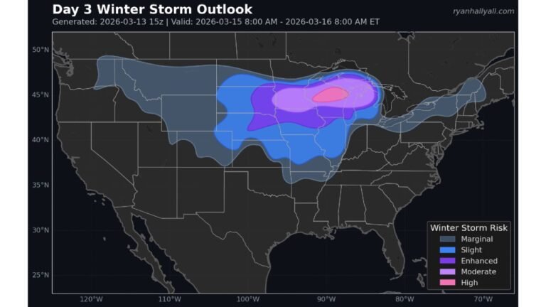
Powerful Atlantic Storm Rapidly Intensifies Near 40°N / 70°W — Pressure Falling Toward Mid-960s as Eye Clears and Blizzard Conditions Expand
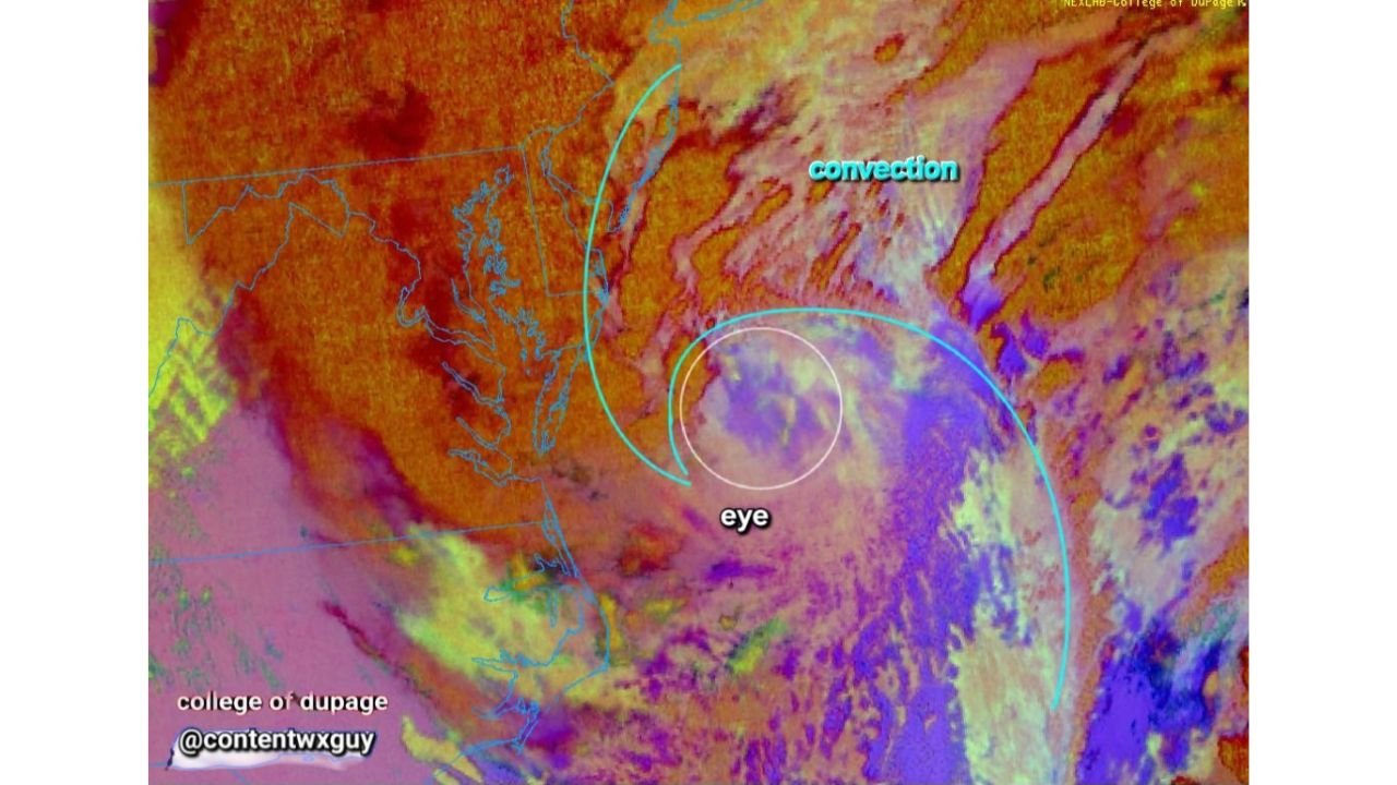
ATLANTIC OCEAN — A rapidly strengthening coastal storm is entering its most intense phase this morning, with satellite imagery showing a clearing eye structure and explosive convective banding wrapping tightly around the center. Meteorologists report the system’s central pressure has already fallen below 968 millibars — and is still dropping — with projections suggesting it could bottom out in the mid-960s near 40°N / 70°W over the next 12 to 18 hours.
That level of pressure would place the storm among the more powerful non-tropical cyclones to impact the Northeast in recent years.
Eye Structure Becoming More Defined
Infrared satellite imagery from the College of DuPage shows a noticeable clearing in the storm’s center — a feature more commonly associated with hurricanes than winter storms. While this system is not tropical, its structure is becoming increasingly organized.
Meteorologists note:
- The storm’s eye is becoming increasingly visible.
- Convective banding is rapidly intensifying around the core.
- Deep convection is firing along the eastern and northern quadrants.
This structural evolution suggests the system is entering its peak strengthening window rather than winding down.
Pressure Falling Into Rare Territory
Surface analysis via the Weather Prediction Center indicates the storm is already below 968 mb, an unusually deep reading for a winter cyclone in this region.
For context:
- Typical strong winter storms range between 980–990 mb.
- A drop into the mid-960s signals extreme pressure gradients.
- Stronger pressure gradients translate directly into more intense wind speeds.
If projections verify, sustained gale-force winds and damaging gusts will continue across coastal sections of New Jersey, Long Island, Rhode Island, Massachusetts, and coastal Maine, with the strongest winds focused offshore.
Blizzard Conditions Continue Across the Northeast
Earlier mesoscale discussions highlighted:
- Snowfall rates of 2–3 inches per hour in parts of eastern Massachusetts and Rhode Island.
- Blizzard conditions continuing through the morning hours.
- Power outages climbing past 250,000 customers.
Heavy wet snow combined with strengthening winds significantly increases the risk of:
- Tree damage
- Power line failures
- Hazardous travel conditions
- Coastal flooding concerns
Why This Matters for North Carolina
While this storm is centered well offshore of the Mid-Atlantic and Northeast, powerful Atlantic cyclones can influence downstream weather patterns.
As this system intensifies and pulls northward:
- It may help reinforce cold air across parts of the eastern United States.
- It could contribute to temperature swings in the Southeast later this week.
- Strong high pressure building in behind the storm may lead to breezy, cooler conditions across the Carolinas.
For Cabarrus County, no direct impacts are expected from this Atlantic storm. However, shifts in jet stream patterns and cold air positioning behind major Northeast systems can sometimes affect North Carolina’s late-winter temperature trends.
Peak Intensity Still Ahead
Meteorologists emphasize this system has not yet peaked. The most intense phase is likely over the next 12 to 18 hours as the pressure potentially drops into the mid-960 mb range near 40°N / 70°W — a benchmark that signals an exceptionally powerful ocean storm.
Residents along the Northeast coastline should remain alert for worsening wind, heavy snow, and continued power disruptions.
Cabarrus Weekly will continue monitoring how this large-scale pattern influences regional weather trends.
Stay with CabarrusWeekly.com for ongoing weather updates and local forecast coverage.