Prolonged Wet Pattern Targets Ohio and Tennessee Valleys as Active Spring-Like Setup Emerges Into Late February
TENNESSEE VALLEY AND LOWER OHIO VALLEY — A developing late-winter weather pattern is showing early spring characteristics, with repeated storm systems expected to track through the Lower Ohio Valley and Tennessee Valley over the next seven days, producing widespread rainfall and locally heavy totals.
Active Storm Track Sets Up Across the Central U.S.
Forecast guidance shows a persistent storm corridor stretching from eastern Arkansas and southern Missouri through Tennessee and northern Alabama, with repeated disturbances moving through the region. This setup is consistent with a more energetic southern jet stream, a pattern often seen as the seasonal transition toward spring begins.
Rainfall coverage is expected to be broad, with few prolonged dry breaks as each system reinforces the active pattern already in place.
Heavy Rainfall Totals Highlighted in Tennessee and Surrounding States
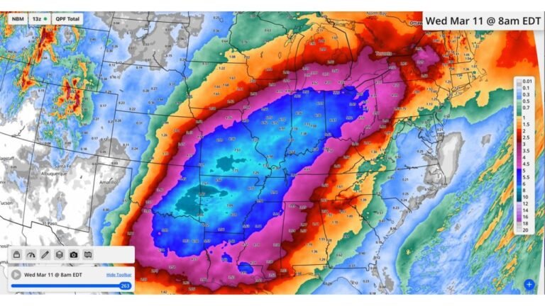
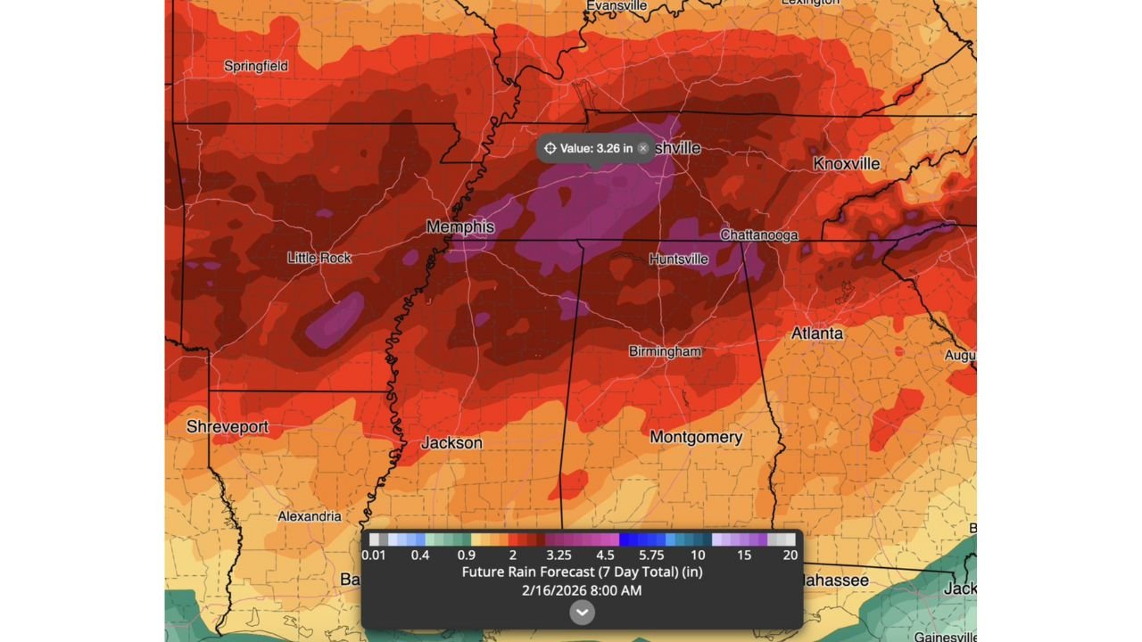
Seven-day rainfall projections indicate widespread totals of 2 to 4 inches, with locally higher amounts possible where storms repeatedly track over the same areas. The highest concentrations appear centered over western and central Tennessee, including areas near Memphis and Nashville, where totals approach or exceed 3 inches.
Surrounding regions across northern Mississippi, northern Alabama, eastern Arkansas, and southern Kentucky are also included within this higher-precipitation zone, suggesting a prolonged period of wet conditions rather than a single event.
Pattern Signals Early Spring Influence
Meteorological analogs referenced with this setup suggest this active storm pattern may persist beyond the immediate forecast window, potentially extending deeper into late February and early March. Such patterns often coincide with increased atmospheric energy, which can support stronger storm systems as temperatures gradually moderate.
While this outlook is focused on rainfall totals, the broader pattern bears monitoring as seasonal transitions historically increase the variability and intensity of weather systems across the region.
Flooding and Saturated Ground Concerns Increase
With rainfall expected over multiple days, soil saturation levels will rise, particularly in areas that have already received recent precipitation. This raises the potential for localized flooding, especially in low-lying areas, near creeks, and in poor drainage locations across the Tennessee Valley and Lower Ohio Valley.
Residents in flood-prone areas should remain aware of forecast updates as this pattern continues to evolve.
As this wet and active weather pattern unfolds, CabarrusWeekly.com will continue tracking how broader regional trends may eventually influence weather conditions farther east. Readers are encouraged to share local rainfall reports or impacts from their area with the Cabarrus Weekly Weather Desk.