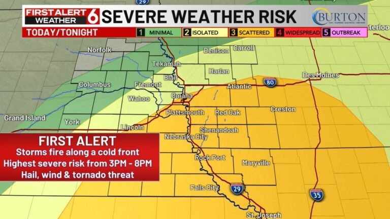
Severe Storms Target Texas to Illinois Monday, Then Intensify Tuesday as Chicago, Peoria and Indianapolis Face Elevated Tornado Risk
UNITED STATES — A new week of severe weather is unfolding across the central U.S., beginning Monday in the southern Plains and Mid-South before expanding northeast into the Midwest on Tuesday.
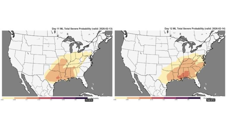
Forecast maps show a broad corridor of strong to severe thunderstorms stretching from Texas through Oklahoma, Missouri, Illinois, Indiana and into parts of Michigan, with tornado potential increasing as the system shifts east.
Monday: Mid-South and Southern Plains in Focus
On Monday, the primary severe storm zone extends from:
- San Antonio and San Angelo, TX
- Dallas and Abilene, TX
- Oklahoma City, OK
- Wichita, KS
- Little Rock, AR
- St. Louis, MO
Storms are labeled as “likely” across parts of Missouri and Illinois, with “possible” severe weather farther southwest into Texas and Oklahoma.
A higher tornado concentration area appears across:
- Abilene and San Angelo, TX
- Del Rio, TX
- Portions of western Texas
These areas show a heightened tornado concern compared to surrounding regions.
Tuesday: Tornado Risk Increases in the Midwest
By Tuesday, the threat shifts and intensifies farther north and east.
The elevated tornado concern zone includes:
- Peoria, IL
- Chicago, IL
- Indianapolis, IN
- St. Louis, MO
- Kirksville, MO
- Fort Wayne, IN
The highest concentration of tornado potential is centered across central and northern Illinois into Indiana.
The tornado impact scale highlights:
- Level 5 concern near Peoria and Chicago
- Level 4 near Kirksville and Kansas City
- Level 3 around St. Louis and Indianapolis
These values indicate an increasing likelihood of tornado development in that corridor.
What the Tornado Signal Means
The forecast discussion notes:
- A few tornadoes appear likely
- Tornado watches will likely be issued
- Strong (EF2+) tornadoes are possible
- Close monitoring of forecasts is advised
This suggests that the environment across Illinois and Indiana may support not just isolated tornadoes, but potentially stronger, more organized storms.
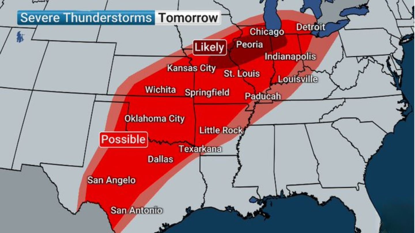
Widespread Severe Corridor
The broader severe thunderstorm zone Tuesday stretches from:
- San Antonio, TX
- Dallas, TX
- Oklahoma City, OK
- Kansas City, MO
- Springfield, IL
- Chicago, IL
- Indianapolis, IN
- Detroit, MI
This represents a multi-state event with impacts possible from the southern Plains into the Great Lakes.
Two-Day Severe Pattern
The pattern unfolding this week features:
- Monday: Clustered storms across Texas, Oklahoma, Arkansas and Missouri
- Tuesday: Expanded and intensified severe risk into Illinois, Indiana and Michigan
Storms developing Monday may lay the groundwork for Tuesday’s more widespread event.
Bottom Line
Severe thunderstorms will impact parts of Texas, Oklahoma and Missouri Monday before the threat expands Tuesday into Illinois and Indiana, where tornado potential increases — especially near Peoria, Chicago and Indianapolis. Strong tornadoes are possible in the most favored zones.
Residents across the central U.S. should monitor forecast updates closely as this multi-day severe weather pattern continues to evolve. CabarrusWeekly.com will provide additional updates as conditions develop.