Severe Weather Outlook Shifts Early Next Week as Risk Expands North Monday, Refocuses West Tuesday and Pushes East Into Midwest by Wednesday
UNITED STATES — The severe weather outlook for early next week continues to evolve, with notable shifts in storm risk areas from Monday through Wednesday across the Plains and Midwest.
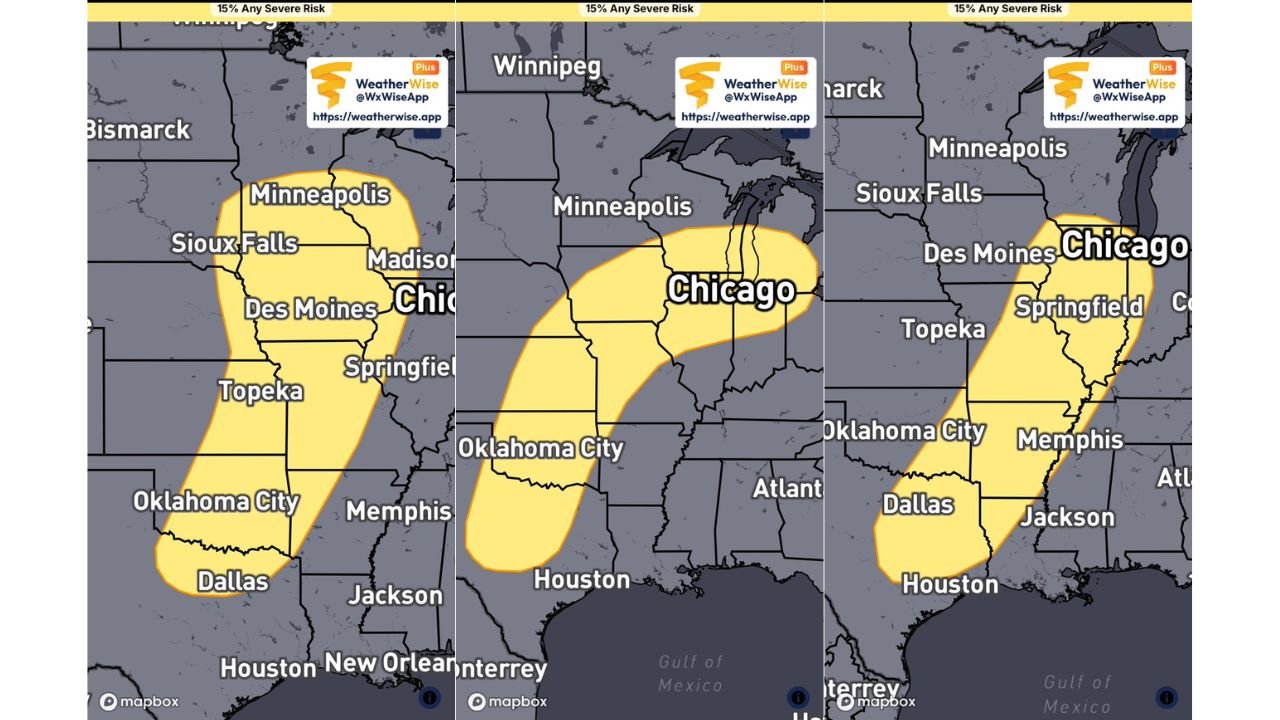
Monday: Risk Expands Farther North Into Upper Midwest
The latest update shows that Monday’s severe weather risk has expanded northward, now covering a broader area from north Texas and Oklahoma through Kansas, Iowa, and into parts of Minnesota and Wisconsin.
This northward expansion indicates a strengthening system capable of pushing storms deeper into the Upper Midwest, increasing the number of areas that could see severe weather impacts.
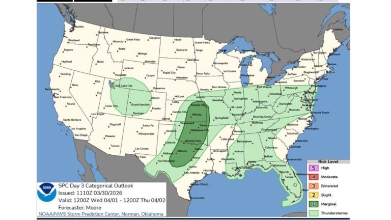
Tuesday: Storm Focus Shifts West and North
By Tuesday, the severe weather risk zone becomes more refined, shifting farther west and north compared to earlier outlooks.
The corridor of concern now stretches from Oklahoma and Kansas through Missouri, Iowa, and into Wisconsin and parts of the Great Lakes region, including areas near Chicago and Milwaukee.
This adjustment suggests a more focused setup where storm development may become more organized along a defined corridor, increasing the potential for impactful weather within that zone.
Wednesday: New Risk Area Emerges Farther East
A new risk area has been introduced for Wednesday, shifting the severe weather threat farther east into the Mississippi Valley and Midwest.
This includes regions from Texas and Arkansas through Missouri, Illinois, Indiana, and surrounding areas, marking a continued eastward progression of the overall system.
The addition of this risk highlights how the pattern is expected to evolve over multiple days, with storm impacts spreading across different regions sequentially.
Evolving Multi-Day Severe Weather Pattern
The changing outlook from Monday through Wednesday reflects a dynamic and shifting storm pattern, where the position of key weather features will determine where the most intense storms develop each day.
Rather than a single-day event, this setup represents a multi-day severe weather sequence, with each day bringing a new focus area as the system moves eastward.
Key Takeaways for Impacted Regions
Residents across the Southern Plains, Central Plains, and Midwest should stay alert as the forecast continues to adjust.
The shifting nature of the risk areas means that locations not initially in the highest threat zone could still be impacted as the system evolves.
With multiple days of potential severe weather, the focus should remain on changing conditions, updated forecasts, and readiness for rapidly developing storms.
Stay with CabarrusWeekly.com for continued updates as this evolving severe weather pattern unfolds, and share what conditions you are seeing in your area.