Severe Weather Threat Expands Across Southern Illinois, Indiana, and Kentucky Thursday as Tornado Risk and Damaging Winds Target the Ohio Valley
OHIO VALLEY — A developing storm system is expected to bring severe weather potential Thursday, with southern Illinois, Indiana, and much of Kentucky outlined for possible strong to severe storms.
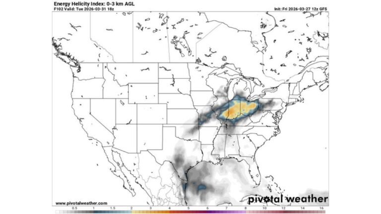
Forecasters indicate that as the next system rapidly organizes, unseasonably high moisture will surge northward into the region. Combined with strengthening wind shear, the setup supports the risk for organized thunderstorms across the Lower Ohio Valley.
Southern Illinois, Indiana, and Kentucky in the Risk Zone
The outlined severe area includes southern Illinois near St. Louis, much of southern Indiana including Louisville, and large portions of Kentucky, extending toward areas near Cincinnati.
This region will sit in a corridor where moisture and instability overlap with strong upper-level winds. That combination can support storm organization and rotation during the initial development phase.
Residents in these areas should closely monitor updates as details regarding timing and storm mode become clearer.
Initial Supercells Could Produce Tornadoes
Forecasters highlight that strong wind shear will be in place, supportive of initial supercells before storms potentially consolidate into a larger line.
If discrete supercells form early in the event, they may be capable of producing a tornado before storms merge into a more dominant wind-producing squall line.
This early phase of storm development is often the most concerning for tornado potential, especially where surface-based instability becomes sufficient.
Transition Toward Damaging Wind Mode
As the system evolves, storms are expected to line out into a more organized band. When this happens, the primary threat typically shifts toward damaging straight-line winds, though embedded rotation can still occur.
Given the strength of the wind fields forecast for Thursday, damaging gusts could become the predominant hazard across parts of Illinois, Indiana, and Kentucky.
The severity and exact coverage of impacts will depend on how quickly instability builds and how storms evolve during the afternoon and evening hours.
Worth Monitoring Ahead of Thursday
The combination of strong shear, increasing moisture, and a rapidly organizing system makes this setup one to watch closely. Even in late winter, these types of patterns can support severe weather when moisture returns northward.
While confidence in exact storm placement will refine over time, residents across southern Illinois, southern Indiana, and much of Kentucky should remain alert to forecast updates heading into Thursday.
If you live in the Ohio Valley and are in the highlighted areas, now is the time to review your severe weather safety plans. Stay connected for the latest forecast updates, and share your local conditions with CabarrusWeekly.com as this potential severe weather event develops.