Slight Risk for West Alabama as Storm Line Pushes In After 3 PM: Tuscaloosa, Florence and Birmingham Face Gusty Winds and Hail Threat
ALABAMA — A developing batch of rain and thunderstorms is expected to move into Northwest Alabama after 3:00 p.m., gradually sliding southward through the evening and into tonight.
The Storm Prediction Center has placed parts of West Alabama under a Slight Risk (Level 2 of 5) for severe weather, while the remainder of the state sits in a Marginal Risk (Level 1 of 5).
Areas Under the Slight Risk
The higher-end risk zone covers much of western portions of the state, including:
- Florence
- Decatur
- Tuscaloosa
- Western sections near the Mississippi border
Cities such as Birmingham, Montgomery, Auburn, Troy, Dothan, and Mobile remain in the broader marginal risk area.
This indicates storms could still become strong in those locations, but the more organized severe potential appears focused farther west.
Timing: Late Afternoon Through Evening
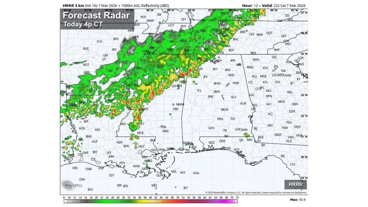
High-resolution forecast radar guidance shows a line of storms advancing eastward into Northwest Alabama late this afternoon. By early evening, the storms are expected to:
- Spread into West Alabama
- Track slowly southward
- Gradually weaken overnight as the atmosphere becomes more stable
The most active window will likely occur between late afternoon and mid-evening, especially across western counties.
Primary Threat: Gusty Winds
The main concern with this system is strong, gusty winds. Some storms could produce locally damaging wind gusts as they move through.
Hail Potential
Small hail is also possible, particularly within stronger cells embedded in the line.
Tornado Risk
The tornado threat is described as very low, and widespread tornadic activity is not expected with this setup.
What Residents Should Expect
While this does not appear to be a major severe outbreak, residents in western Alabama should prepare for:
- Periods of heavy rain
- Strong wind gusts
- Occasional lightning
- Brief hail in stronger storms
Storm intensity should gradually diminish overnight as instability decreases.
Bottom Line
A Slight Risk for West Alabama means scattered severe storms are possible, mainly producing gusty winds and some hail. The rest of the state remains in a lower-end marginal category, with isolated stronger storms possible.
Residents, particularly in and west of Tuscaloosa and Florence, should monitor weather updates this afternoon as the line of storms moves in.
CabarrusWeekly.com will continue following storm development across Alabama as the system tracks southward this evening.