Slight Risk Severe Weather Targets West Texas Saturday Afternoon And Evening With Scattered Thunderstorms Rapidly Becoming Severe Bringing Large Hail And Damaging Winds Across Midland Odessa San Angelo And Abilene Along I-20 Corridor With Brief Tornado Possible
UNITED STATES — Severe weather is developing this afternoon and evening across the Southern High Plains, with the most organized and dangerous activity expected over West Texas, where the Storm Prediction Center has issued a Slight Risk (Level 2) for severe thunderstorms. Residents across Midland, Odessa, San Angelo, Abilene, and surrounding communities need to remain weather aware through tonight as conditions deteriorate.
What Is Driving Severe Weather Today Across West Texas
Two key atmospheric ingredients are fueling today’s severe weather threat across the Southern High Plains:
- A strengthening upper-level jet stream is increasing wind shear across the region, providing the energy needed to organize and sustain severe thunderstorms
- Increasing moisture flowing into the area is rapidly building instability, creating a volatile atmosphere primed for explosive storm development
Together, these factors will support scattered thunderstorms that are expected to quickly become severe as the afternoon heating cycle peaks across West Texas.
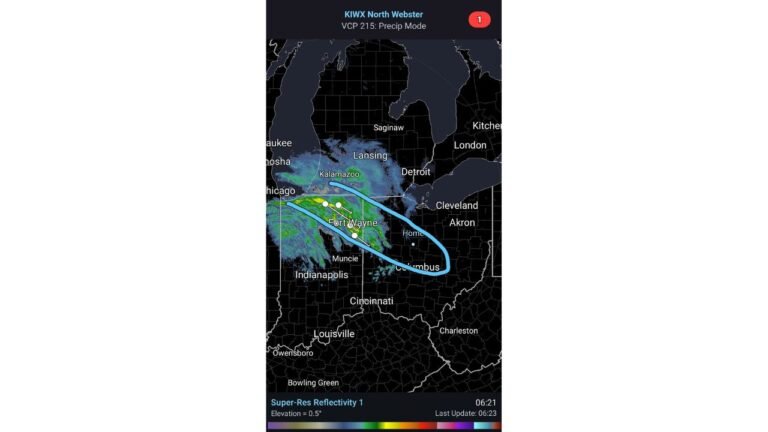
Storm Mode: Discrete Cells First, Then Clusters And Lines
Forecasters note that storm mode will likely evolve throughout the afternoon and evening in a two-stage process:
- Early afternoon and evening — Storm activity will initially favor discrete supercell thunderstorms, the most dangerous storm type capable of producing large hail, damaging winds, and tornadoes simultaneously
- Later in the evening — Storms are expected to evolve into clusters or short squall lines, which shift the primary threat more toward widespread damaging wind gusts
This evolution means the tornado and large hail threat will be highest during the earlier discrete cell phase, while damaging winds become more widespread as storms organize into lines later tonight.
Primary Hazards And Greatest Risk Areas
The Slight Risk zone centered over West Texas includes some of the region’s most populated communities. Areas at the greatest risk today include:
- Midland — directly within the Slight Risk zone
- Odessa — elevated severe weather threat this afternoon and evening
- San Angelo — significant risk along and south of the I-20 corridor
- Abilene — in the crosshairs of the primary storm development area
- Surrounding communities along and south of the I-20 corridor — all face elevated severe weather potential today
The three primary severe weather hazards associated with today’s setup are:
- Large Hail — a significant and likely threat with discrete supercell storms during the early phase
- Damaging Winds — becoming increasingly widespread as storms evolve into clusters and short lines later this evening
- Brief Tornado — cannot be ruled out, particularly with any storm that manages to remain isolated and discrete during the early stages of development
Timing: Afternoon Through Tonight
The severe weather window is already open across West Texas and will persist into the evening hours before storms gradually weaken overnight. Key timing points include:
- This afternoon — Storms develop and quickly become severe as daytime heating maximizes instability
- This evening — Most organized and dangerous activity expected, with discrete supercells possible early before storm mode evolves
- Tonight into overnight — Storms will gradually weaken but remain weather aware until conditions fully settle
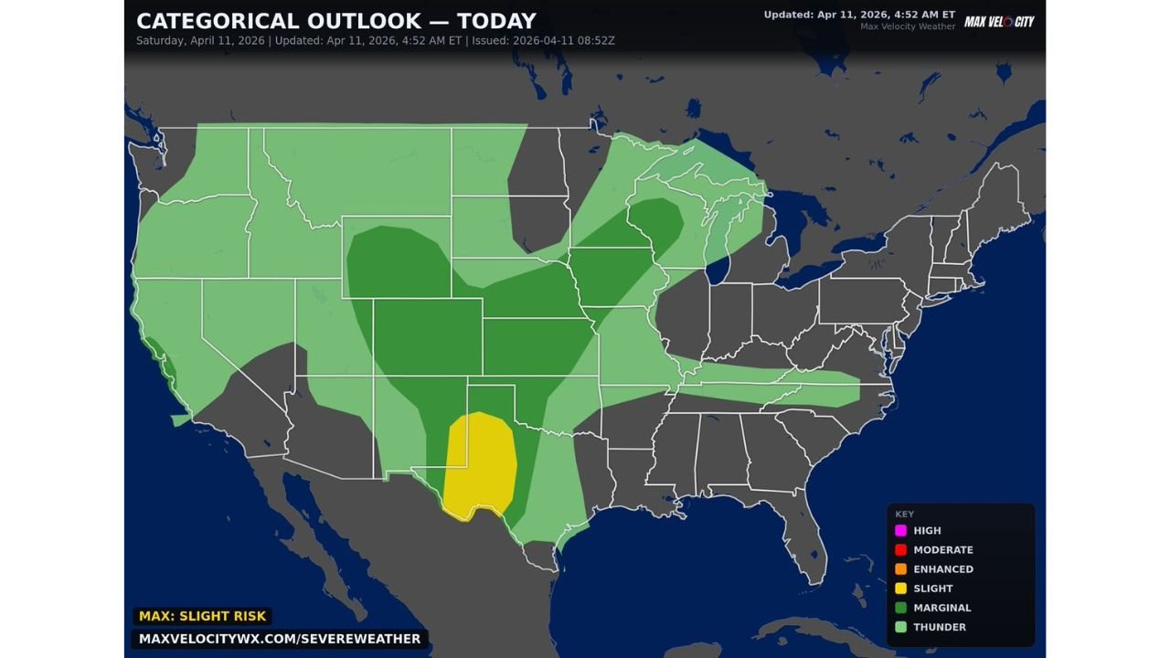
Categorical Outlook At A Glance
According to the Max Velocity Weather Categorical Outlook updated at 4:52 AM ET on April 11, 2026, the risk breakdown across the country today is as follows:
- Slight Risk — West Texas, centered over the Midland, Odessa, San Angelo, and Abilene region — highest severe weather potential today
- Marginal Risk — Broader surrounding area across the Plains and portions of the central and eastern United States
- General Thunder — Widespread thunderstorm potential across much of the country outside the primary risk zones
Stay Weather Aware Through Tonight
Residents across Midland, Odessa, San Angelo, Abilene, and all communities along and south of the I-20 corridor should take today’s severe weather threat seriously. Storms will be capable of producing large hail, damaging winds, and a brief tornado with little warning once they develop.
Key actions to take now:
- Have a severe weather shelter plan ready before storms arrive
- Keep your weather app notifications active for any warnings issued in your area
- Do not wait for a tornado warning to seek shelter if a severe thunderstorm warning is issued — conditions can escalate quickly
- Remain weather aware through tonight as storms are expected to persist into the evening hours before weakening overnight
Stay with CabarrusWeekly.com for continued coverage of today’s severe weather threat across West Texas and the Southern High Plains as this dangerous situation continues to develop.