Slow-Moving Coastal Low Near the Benchmark Could Deliver Widespread Snow to New York and New England Early Next Week
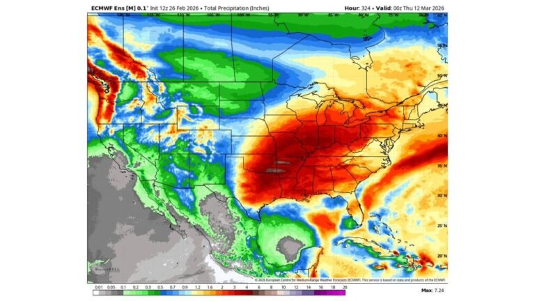
NEW YORK — Long-range model guidance is highlighting the potential for a slow-moving, deepening coastal low near the classic “benchmark” position early next week, raising the possibility of a widespread snow event from eastern New York through much of New England.
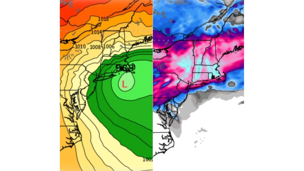
Forecast projections for Monday into Tuesday show a strengthening low-pressure system offshore, positioned southeast of Long Island — a historically favorable location for significant Northeast snowstorms.
Low Pressure Near the Benchmark
Surface pressure fields indicate a developing low centered just offshore of the Mid-Atlantic and southern New England coastline. Central pressure values drop into the upper 980s millibar range, signaling a strengthening system.
The low appears slow-moving, which is a key ingredient for prolonged snowfall. When storms stall near the benchmark (roughly 40°N/70°W), moisture wraps back into the cold air across interior New York and New England.
This setup increases the risk for sustained snow bands.
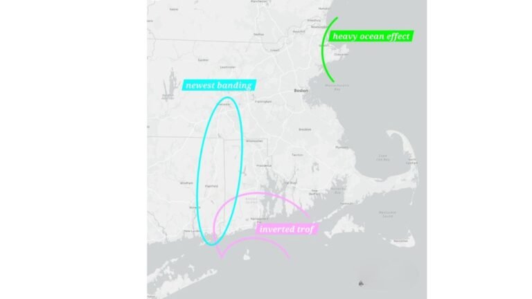
Snowfall Signal Across New England and Eastern New York
Snowfall projections show widespread accumulation potential across:
- Eastern New York
- Vermont
- New Hampshire
- Massachusetts
- Connecticut
- Rhode Island
- Much of Maine
Heavier shading on model snowfall output suggests the potential for significant totals across interior sections, with strong banding possible if the storm deepens as projected.
Coastal Massachusetts and Long Island also appear within the heavier precipitation shield, though exact rain/snow lines would depend on track and thermal structure.
Pressure Gradient and Wind Impacts
Tightly packed pressure contours north of the storm indicate strengthening winds across coastal New England. If the low deepens further, gusty northeast winds could accompany snowfall, particularly across coastal Massachusetts and Maine.
Blowing and drifting snow would become more likely if heavier bands develop.
Still 7–10 Days Out
While the model signal is notable, this event remains in the extended range. Storm track, intensity and temperature profiles could shift significantly over the coming days.
Small changes in positioning — even 50 to 100 miles — could dramatically alter snowfall totals and coastal mixing potential.
At this stage, the setup is one worth monitoring as winter attempts one more potential push before the seasonal transition toward spring.
Residents across New York and New England should watch for continued forecast updates as model guidance refines the storm’s track and intensity.
If this coastal system trends stronger in upcoming runs, it could become one of the more impactful late-season snow threats for the Northeast.
For the latest updates on this developing storm signal, continue following CabarrusWeekly.com as we track the next 10 days of winter weather potential.