South Dakota, Minnesota, Wisconsin and Michigan Bracing for Blizzard Warnings and 1–2+ Feet of Snow as Major Winter Storm Spreads Across the Great Lakes
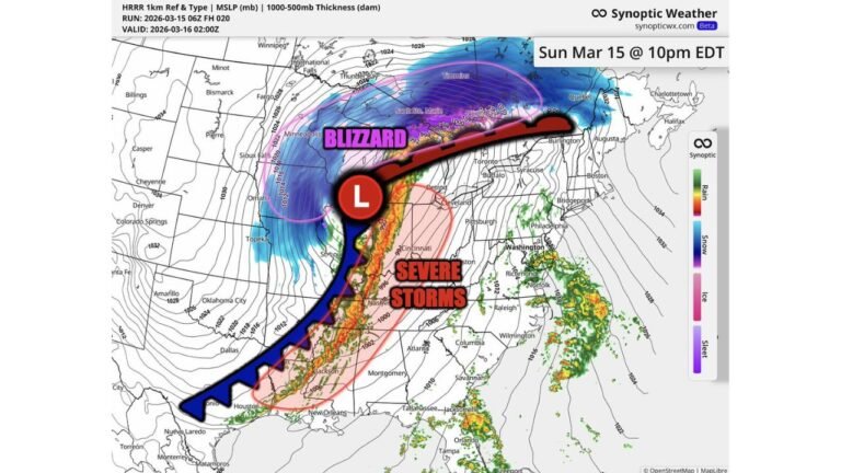
UNITED STATES — A powerful cross-country storm system is delivering a dangerous one-two punch: severe storms in the East and a significant winter outbreak from the Dakotas into the Great Lakes. Blizzard Warnings have been issued from South Dakota into Minnesota, while parts of Wisconsin and Michigan could see well over a foot of snow — with localized totals exceeding two feet.
Forecast data shows a broad swath of 12+ inches stretching from eastern South Dakota across much of Minnesota and into Wisconsin and Michigan through Tuesday morning.
Over a Foot from the Dakotas to the Great Lakes
The heaviest snow is forecast across:
- Eastern South Dakota
- Much of Minnesota
- Northern and central Wisconsin
- Michigan’s Upper Peninsula
Model blends indicate widespread 12–18 inches across central Minnesota into Wisconsin, with a concentrated axis of 20–28+ inches from northern/central Wisconsin into the Michigan Upper Peninsula.
Cities such as Minneapolis, Duluth, Wausau, Green Bay and Marquette are in or near the corridor of heaviest accumulation.
Northern Wisconsin to Upper Michigan: 2+ Feet Possible
The most intense snowfall zone appears focused from northern and central Wisconsin into the Upper Peninsula of Michigan. Ensemble projections show several locations in this band potentially exceeding two feet if persistent snow bands develop.
These totals would be sufficient to cause major travel disruptions, road closures and possible structural strain in isolated areas.
Blizzard Warnings from South Dakota into Minnesota
Blizzard Warnings have been issued from South Dakota into Minnesota, signaling the likelihood of heavy snow combined with strong winds.
Blizzard conditions are defined not only by snowfall totals but by sustained winds or gusts creating near-zero visibility. In open areas of the Dakotas and western Minnesota, blowing and drifting snow could make travel nearly impossible at times.
Ice Threat from Southern Minnesota into Michigan
In addition to heavy snow, a zone of icing is expected from southern Minnesota into parts of Wisconsin and Michigan.
Forecast guidance indicates pockets of measurable ice accumulation in this transition zone. Even light ice can significantly worsen travel conditions and increase the risk of power outages.
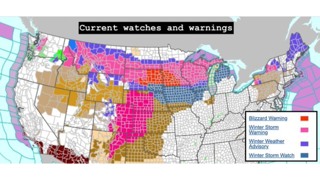
Widespread Winter Alerts Cover the Region
The current alert map shows:
- Blizzard Warnings (notably across parts of South Dakota and Minnesota)
- Winter Storm Warnings across large portions of Minnesota, Wisconsin and Michigan
- Winter Weather Advisories extending farther south and east
This broad coverage reflects the large footprint of the storm and the variety of hazards involved — from blizzard conditions to heavy snow and ice.
Dual-Season System
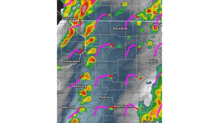
Notably, this winter outbreak is unfolding alongside a robust severe weather threat farther south and east. While the Southeast and Mid-Atlantic prepare for damaging winds and possible tornadoes, the Upper Midwest and Great Lakes are facing a high-impact snowstorm.
Such sharp seasonal contrasts highlight the strength and scale of this system.
Bottom Line
South Dakota, Minnesota, Wisconsin and Michigan are in the crosshairs of a significant winter storm capable of producing 12–24+ inches of snow, localized totals over two feet in northern Wisconsin and the Upper Peninsula, and blizzard conditions in parts of the Dakotas and Minnesota.
Residents across the Upper Midwest and Great Lakes should prepare for hazardous travel, possible power outages and rapidly changing conditions through Tuesday morning.
CabarrusWeekly.com will continue monitoring developments and provide updates as new data becomes available.