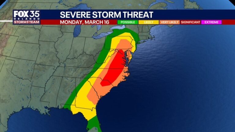
Southeast Texas Braces for Saturday Evening Severe Storm Line: Houston, Galveston, and Beaumont in Path of Damaging Winds and Isolated Tornado Risk
SOUTHEAST TEXAS — A line of strong thunderstorms is expected to push across the region Saturday evening, placing areas from Houston to Galveston and Beaumont under the threat of damaging wind gusts and a brief tornado. While scattered showers may develop earlier in the day, the most intense storms are forecast to arrive later in the evening hours.
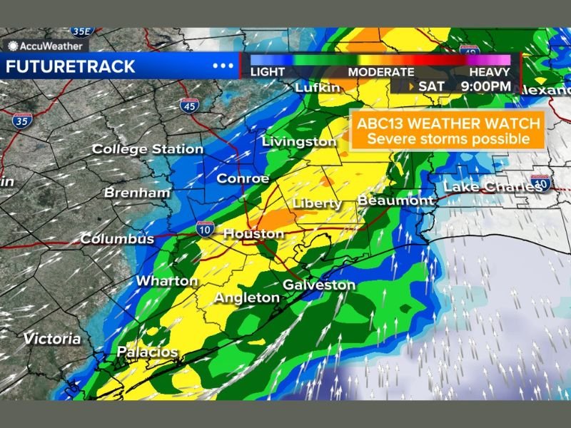
Line of Storms Targeting the I-10 Corridor
Future radar projections show a band of heavy rain and embedded thunderstorms developing southwest of Houston and lifting northeast through the Interstate 10 corridor.
Communities including Wharton, Angleton, Houston, Liberty, Conroe, Livingston, Beaumont, and Galveston appear positioned along the projected storm track. Rainfall intensity is expected to increase as the line organizes and moves eastward.
If the system tracks slightly farther north than anticipated, impacts across parts of Southeast Texas could be somewhat reduced. However, current projections keep the core of the activity centered near the greater Houston area and adjacent coastal communities.
Severe Wind and Brief Tornado Risk
Forecasters indicate the primary hazard with this line will be strong to severe wind gusts, capable of downing tree limbs and causing isolated power outages.
In addition, a brief tornado cannot be ruled out, particularly if storms tap into sufficient low-level wind shear during the evening hours. The tornado risk is not widespread, but residents should remain weather-aware. Lightning will be frequent within stronger cells, and isolated hail is possible in more intense storms.
Heavy Rain and Street Flooding Concerns
Widespread rain is expected with this system, and heavy downpours may lead to street flooding, especially in low-lying or poorly drained areas. Urban locations such as Houston and surrounding suburbs are particularly vulnerable when rainfall rates become intense over short periods.
Timing of Impacts
Passing showers are possible at any point during the day Saturday. However, the strongest thunderstorms are most likely during the evening, with peak impacts expected after sunset. Residents should monitor updated forecasts throughout the day, especially if planning evening travel or outdoor activities.
System at the Tail End but Still Potent
Southeast Texas is positioned near the southern tail of the broader weather system. While that placement could slightly limit the severity compared to areas farther north, it does not eliminate the potential for impactful storms. Even at the tail end of the system, sufficient instability and moisture remain in place to support severe weather.
Bottom Line
Saturday will bring a dynamic weather setup to Southeast Texas, with a line of strong storms expected during the evening hours. Damaging winds, heavy rain, lightning, and a brief tornado risk are all possible from Houston to the Upper Texas Coast. If you experience severe weather conditions in your area, share your reports and photos with us at CabarrusWeekly.com.