Southern New England Snow Threat Builds for Friday–Saturday as Blocking Pattern Locks in Cold Air Over Massachusetts, Connecticut and Rhode Island
SOUTHERN NEW ENGLAND — A potentially more organized winter setup is taking shape for Friday into early Saturday, as a blocking pattern to the north helps secure cold air across Massachusetts, Connecticut and Rhode Island while a developing coastal system brings moisture into the region.
Forecast guidance suggests this system could carry more moisture than the recent midweek disturbance, increasing the odds of measurable snowfall if thermal profiles hold.
Blocking to the North Supports Cold Air in Place
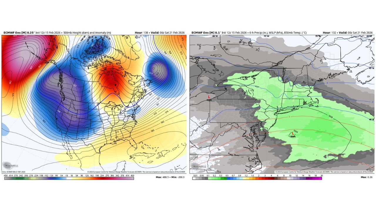
Upper-level ensemble guidance shows a pronounced ridge building into Alaska and western Canada, paired with a deep trough over the eastern United States. This configuration promotes cold air supply into the Northeast, particularly across interior and coastal Southern New England.
At 500mb, height anomalies indicate a supportive pattern for maintaining below-normal temperatures across the region heading into late week. That blocking influence reduces the likelihood of a rapid warm intrusion from the south, which often disrupts snow potential in marginal setups.
With colder air established, precipitation type becomes more favorable for snow rather than rain, especially inland.
Coastal Low Tracks South of New England
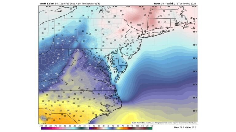
Surface projections show a developing low pressure center offshore, southeast of New Jersey and Long Island, with broad precipitation spreading northward into Southern New England.
Moisture fields indicate light to moderate precipitation extending into Connecticut, Rhode Island and eastern Massachusetts, with the potential for steadier bands depending on the exact storm track. The low appears positioned far enough south to limit immediate warm air intrusion along much of the I-95 corridor.
If the storm tracks slightly farther north, mixing could become an issue near the immediate coastline. However, current ensemble guidance favors cold air holding firm, especially north and west of Boston.
Moisture Appears More Robust Than Midweek System
Comparative model output shows this late-week system carries a broader and deeper moisture plume than the preceding midweek wave. While snowfall totals are still uncertain, the overall setup suggests a better opportunity for accumulating snow across portions of Southern New England.
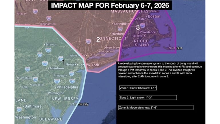
The heaviest precipitation signal currently favors parts of central and southern Massachusetts, northern Connecticut, and interior Rhode Island, though fine-scale placement will depend on mesoscale banding and storm evolution.
Given the presence of cold air at both the surface and aloft, the probability of primarily snow appears higher than in recent marginal events.
Timing and What to Watch
The window for precipitation appears to begin late Friday and continue into early Saturday morning. Exact start times and intensity will be refined as higher-resolution data becomes available.
Key forecast variables include the precise offshore track of the low pressure center and whether any coastal front develops that could sharpen temperature gradients near the shoreline.
For now, Southern New England residents should monitor updates closely, as this setup has the ingredients necessary for a more meaningful snowfall event than earlier in the week.
If snow begins to develop in your area Friday night, share your conditions and totals with us at CabarrusWeekly.com as this potential winter system approaches.