Southern New England Snowstorm Looks Earlier and Stronger on the South Edge as Massachusetts, Connecticut, Rhode Island and New Hampshire Track Higher Totals
SOUTHERN NEW ENGLAND — A fast-evolving winter storm forecast is becoming more defined for Tuesday into Wednesday, with updated guidance showing the southern edge of the system filling in and timing trending earlier than expected across parts of the region. The latest update also notes there have been no major changes to accumulation expectations, with the current forecast leaning closely toward the GFS-style solution.
Southern Edge “Fills In,” Raising Potential Toward the Higher-End Totals
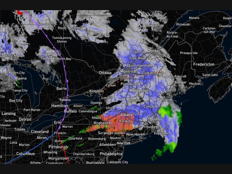
The newest signal shows more organized precipitation on the southern side of the storm, a change that often matters most for locations near the sharp gradient between lighter and heavier snow. With the southern edge strengthening, areas from Connecticut and Rhode Island into eastern Massachusetts could see totals trend closer to the higher end of prior expectations, especially where colder air holds longest.
Snow, Mix, and Coastal Rain Line Still in Play
This setup continues to show a classic precipitation-type layout. Widespread snow is favored inland across Vermont, New Hampshire, and interior Maine, where colder air is more secure. Farther south and closer to the coast, the storm still supports a transition zone where mixing is possible, particularly across portions of southern New York into western and central Massachusetts, depending on exact track and temperature profiles.
Along the immediate coastline, especially into southeastern Massachusetts, the signal suggests periods of rain or wet mix may remain in the picture, with heavier precipitation still possible even where snow totals are lower.
Tuesday-to-Wednesday Timeline: Earlier Start, Overnight Finish
Timing guidance shows a storm that ramps up Tuesday afternoon and evening across much of Southern New England, with snow and mixed precipitation spreading east and northeast through the night. The ending timeline is centered late night into early Wednesday, with lingering impacts likely into Wednesday morning in areas that hold onto steadier snowfall.
Forecast Confidence: Pattern Is Set, Fine Details Still Shifting
Model-to-model differences are still evident, but the overall trend is now more consistent on two key points: earlier arrival and a more robust southern edge. That combination is why higher totals remain on the table in parts of Massachusetts, Connecticut, Rhode Island, New Hampshire, Vermont, and Maine, even as the storm’s exact snow/mix line continues to wobble.
CabarrusWeekly.com will continue tracking changes to this storm as higher-resolution guidance refines snowfall totals and precipitation type. If you’re in Southern New England, share what you’re seeing where you live as the storm begins and let us know when snow starts in your town at CabarrusWeekly.com.