Storm Prediction Center Warns of Possible EF3+ Tornadoes This Evening Across Northern Illinois, Indiana and Southern Michigan
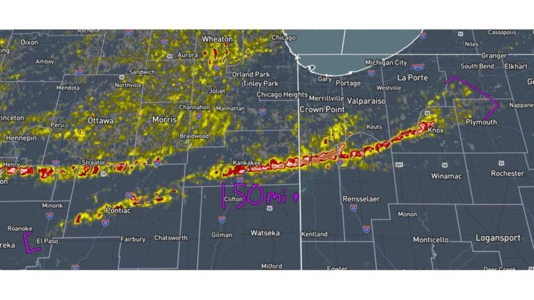
UNITED STATES — The Storm Prediction Center is now cautioning that intense tornadoes, including EF3+ strength, are possible this evening across northern Illinois, northern Indiana and southern Michigan as confidence grows in a dangerous warm-front setup.
Forecasters indicate that one or more supercells could track eastward along a lifting warm front, tapping into strong low-level wind shear and instability — a combination that can support powerful, long-track tornadoes.
Highest Concern: Northern Illinois Into Northern Indiana
The corridor of greatest concern stretches from portions of northern Illinois — including areas near Peoria and toward the Chicago metro — eastward into northern Indiana and southern Michigan.
Cities and regions near the highlighted zone include:
- Chicago, IL
- Rockford, IL
- Peoria, IL
- Fort Wayne, IN
- South Bend, IN
- Portions of southern Michigan
The outlook suggests that storms riding along the warm front may intensify rapidly if they remain surface-based in the unstable air mass.
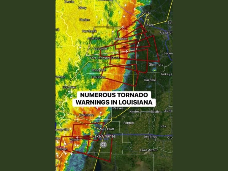
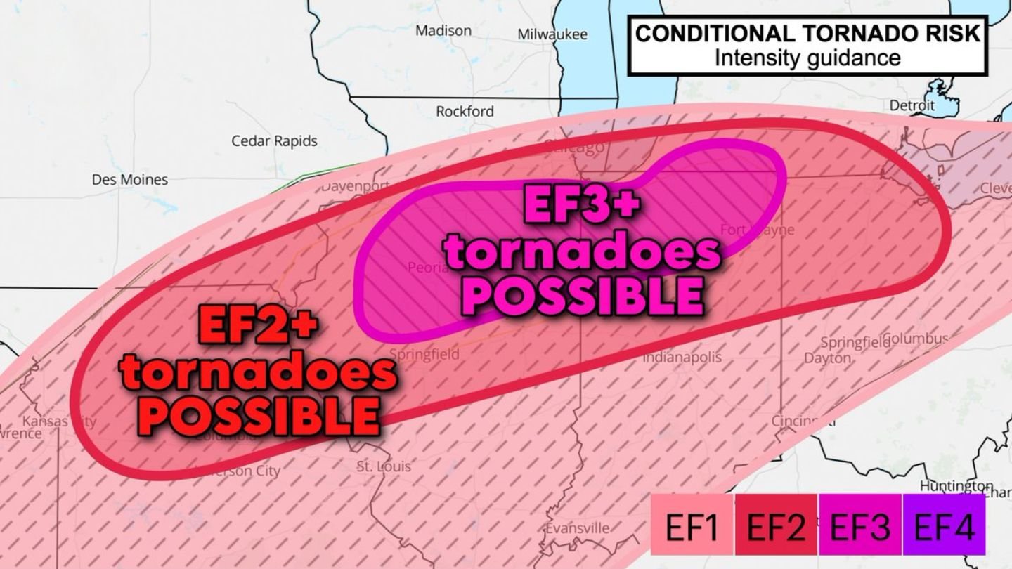
EF2+ to EF3+ Tornadoes Possible
Intensity guidance shows:
- EF2+ tornadoes possible across a broad swath
- A more focused area where EF3+ tornadoes are possible
This higher-end risk appears centered across parts of northern Illinois into northern Indiana, where overlapping instability and strong low-level spin could maximize storm rotation.
The phrase “conditional tornado risk” underscores that storm placement and boundary interaction will determine how extreme the threat becomes. However, confidence is increasing that the ingredients for significant tornadoes will be present.
Why the Warm Front Matters
The warm front is a key player in tonight’s setup.
If supercells:
- Form near the boundary
- Remain rooted in the warm, unstable air
- Track east along the front
they may “gobble up” enhanced low-level wind shear, significantly increasing tornado potential.
Warm fronts often locally enhance wind direction changes and low-level helicity, which can boost the intensity of rotating storms.
Evening Timing
The primary tornado threat is expected this evening, as storms mature and track eastward from Illinois into Indiana and southern Michigan.
While not every location will experience severe weather, areas within the highlighted corridor should prepare for the possibility of rapidly intensifying storms capable of producing strong to intense tornadoes.
Bottom Line
The Storm Prediction Center now warns that EF3+ tornadoes are possible this evening across northern Illinois, northern Indiana and southern Michigan. A warm front lifting eastward may provide the necessary ingredients for powerful, long-track supercells.
Residents in Chicago, Rockford, Peoria, Fort Wayne, South Bend and surrounding communities should closely monitor updates and be ready to act quickly if tornado warnings are issued. CabarrusWeekly.com will continue tracking this evolving high-end severe weather threat.