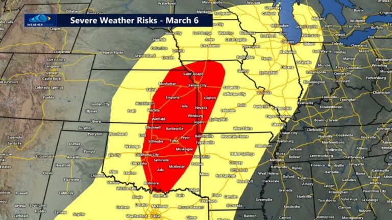
Strengthening Low-Level Jet and Dryline Setup Target Central Oklahoma and Southeast Kansas Friday Evening With Increasing Tornado and Large Hail Potential
OKLAHOMA & KANSAS — Forecast data continues to highlight a volatile setup across central Oklahoma and southeast Kansas heading into Friday evening, as a strengthening low-level jet, sharpening dryline and favorable surface winds combine to support severe storm development.
While some guidance suggests a potential downtrend in overall coverage, current high-resolution model data still supports concern for organized storms capable of producing large hail and possibly tornadoes.
Dryline Sharpening Across Central Oklahoma
Surface maps show a clear moisture gradient developing Friday afternoon, with:
- Higher dew points surging northward into central and eastern Oklahoma
- Much drier air positioned just west across western Oklahoma
This sharp contrast marks the dryline — a classic Plains severe weather trigger. Central Oklahoma appears to sit near or just east of this boundary during peak heating.
Southeast Kansas also lies within the corridor of richer low-level moisture.
Low-Level Jet Ramping Up After Dark
By Friday evening, model guidance shows the low-level jet (LLJ) strengthening significantly across:
- Central Oklahoma
- Northeast Oklahoma
- Southeast Kansas
Stronger winds at roughly 850 mb (around 5,000 feet) increase storm organization potential and enhance wind shear. This is particularly important after sunset, when surface-based instability can decrease but shear increases.
Storm-Relative Helicity Increasing
Storm-relative helicity values increase notably across:
- Central Oklahoma
- Eastern Oklahoma
- Southeast Kansas
Higher helicity values support rotating updrafts, especially if storms remain discrete rather than forming into a solid line.
The strongest helicity signal appears near the Oklahoma-Kansas border and into southeast Kansas, suggesting a corridor where supercells could maintain rotation.
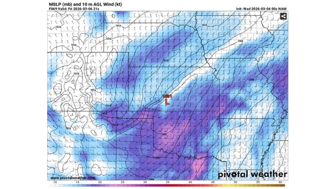
Surface Low and Wind Fields
Surface pressure maps show a developing low positioned across western or central Oklahoma by late afternoon and evening.
Surface winds ahead of the low are forecast to:
- Maintain a favorable directional component
- Enhance low-level shear
- Feed moisture northward into storm development zones
This combination supports the potential for organized storms near and just east of the surface low track.
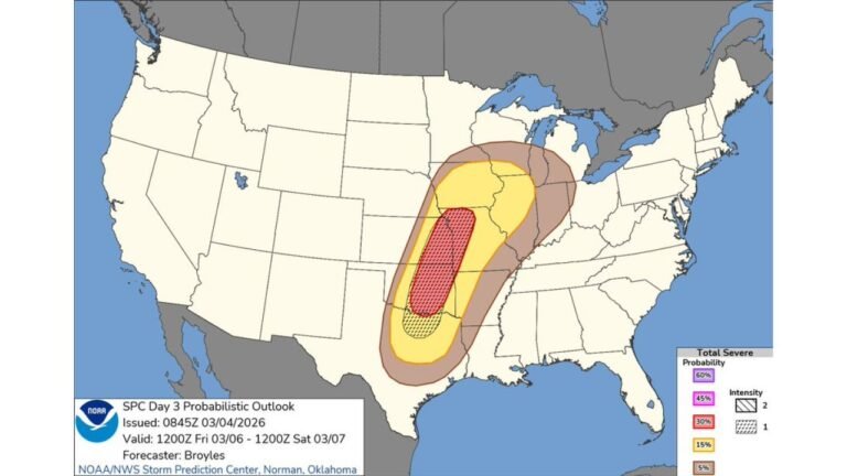
Primary Threats
If storms can initiate and remain semi-discrete along or just east of the dryline, the primary threats include:
- Large hail
- Damaging winds
- A few tornadoes
Storm coverage and exact timing remain sensitive to subtle shifts in the dryline position and strength of the cap, but the environmental ingredients remain supportive.
Bottom Line
Despite some chatter about a possible downtrend, current model data still supports a concerning severe weather setup Friday evening across central Oklahoma and southeast Kansas, particularly after dark as the low-level jet intensifies.
Residents in these areas should closely monitor updated forecasts as details become clearer.
CabarrusWeekly.com will continue tracking this developing Plains severe weather threat and provide updates as new guidance becomes available.