Texas, Austin, Dallas and Houston Face Warmer Than Normal End of March Before April Storm Pattern Shift
TEXAS — A warm and dry pattern is expected to dominate through the rest of March, but a noticeable shift in early April could bring rounds of showers and thunderstorms across the state, especially in central and eastern regions.
Warm and Dry Conditions Hold Across Texas
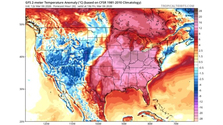
Cities including Austin, Dallas, Houston, and surrounding areas are expected to experience above-normal temperatures through the remainder of March. A strong high-pressure system positioned over the southern United States is keeping skies mostly clear and limiting rainfall.
This setup is allowing temperatures to stay consistently warm, with minimal rain chances and extended dry stretches. The pattern has been stable, meaning most areas will continue to see very little disruption from storms in the short term.
The lack of rainfall combined with warmer temperatures could begin to dry out soils further, particularly in areas that have already seen limited precipitation recently.
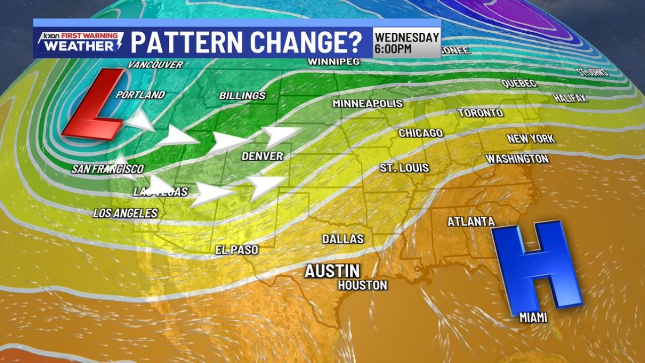
High Pressure Dominates the Southern U.S.
The dominant weather feature driving this pattern is a broad ridge of high pressure centered over the Southeast, including states like Georgia and Florida. This system is extending its influence westward into Texas.
As a result, much of the state remains under stable atmospheric conditions, which suppress cloud development and storm activity. This is why rainfall has been scarce and temperatures have remained elevated across the region.
This ridge is expected to hold strong through late March, maintaining the current warm and quiet weather pattern.
Western System Signals Pattern Change Ahead
A shift begins to take shape as a low-pressure system develops along the West Coast near California and Oregon. At the same time, the jet stream is expected to dip southward over the western United States.
This evolving setup will gradually push the high-pressure ridge eastward, allowing weather systems to move closer to Texas. As this transition unfolds, moisture from the Gulf of Mexico will begin to return.
This is a key signal that the current dry pattern will start to break down as April begins.
Early April Brings Increasing Storm Chances
As the pattern shifts, Texas is likely to see multiple rounds of showers and thunderstorms, particularly across central and eastern areas.
Cities such as Austin, Dallas, and Houston could experience increasing rain chances along with periods of heavier rainfall. The interaction between incoming disturbances and returning Gulf moisture will support a more active weather pattern.
This marks a transition toward typical spring conditions, where storm systems become more frequent and widespread.
Seasonal Shift Toward Active Spring Weather
The change from a dry, warm setup to a more unsettled pattern reflects a classic seasonal transition into spring. Late-winter stability will give way to more dynamic conditions with increased storm activity.
While the end of March will remain calm and warm, early April is expected to introduce greater variability in weather, including clouds, rain, and possible thunderstorms.
Residents should be prepared for rapid changes in conditions as this shift takes place.
Residents across Texas are encouraged to monitor local forecasts as this transition unfolds. Share what conditions you’re seeing in your area and stay updated with the latest reports on CabarrusWeekly.com.