Texas, New Mexico, Arkansas, Tennessee, Kentucky, Virginia, and the Appalachians Face Widespread Ice, Snow, and Dangerous Arctic Cold Through the Weekend
UNITED STATES — A rapidly intensifying Arctic outbreak is unfolding across a large portion of the country, setting the stage for widespread ice accumulation, snow, and extreme cold from Texas and New Mexico through the Tennessee Valley, Appalachians, and into the Mid-Atlantic as the weekend approaches. Multiple National Weather Service products confirm that this will be a high-impact winter event, particularly due to significant ice accretion and prolonged sub-freezing temperatures.
Arctic Air Surge and Storm Setup
A strong Arctic high-pressure system is forcing bitterly cold air southward, undercutting warmer air aloft. Satellite and temperature-change data show rapid cooling spreading east of the Rockies, with temperature drops of 20 to 40 degrees in less than 24 hours across parts of the Plains, Midwest, and East.
This setup is creating a classic freezing rain and sleet corridor, especially where low-level cold air is trapped beneath moist upper-level clouds, a pattern clearly visible in nighttime satellite imagery over Texas, the Southern Plains, and the Lower Mississippi Valley.
Ice Accumulation: A Major Threat
Forecast ice maps indicate a dangerous swath of ice accumulation stretching from:
- Central and East Texas
- Southern Oklahoma and Arkansas
- Northern Louisiana and Mississippi
- Tennessee and Kentucky
- West Virginia, Virginia, and parts of the Mid-Atlantic
In this corridor, ice accumulations of 0.25 to 0.75 inches are widespread, with localized totals exceeding 1 inch possible in the hardest-hit areas. This level of icing is more than enough to down trees and power lines, leading to long-duration power outages.
Ice impacts are expected to be the most disruptive part of this storm, surpassing snowfall in terms of damage and travel hazards.
Snowfall Focus: Mountains and Northern Zones
While ice dominates farther south, snowfall will be concentrated in colder regions, including:
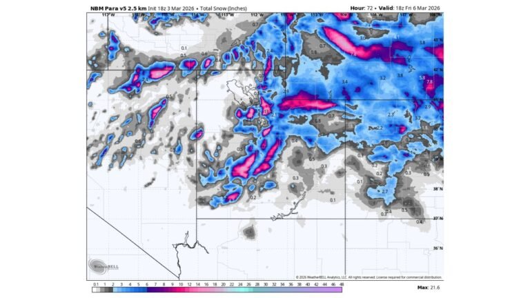
- Sacramento Mountains of New Mexico, where 4 to 8 inches of snow are expected, with higher totals above 9,000 feet
- Eastern Wyoming and areas east of the Continental Divide, where light snow under 1 inch will develop as the Arctic front pushes south
- Portions of the Central and Southern Appalachians, where snow may mix in as colder air deepens
Snow totals outside mountain regions will generally remain modest, but blowing snow and reduced visibility will still pose hazards due to strong cold-air advection.
Winter Storm Warnings, Advisories, and Watches
National Weather Service offices have upgraded Winter Storm Watches to Winter Storm Warnings and Winter Weather Advisories, especially across:
- Southeastern New Mexico
- West and Central Texas
- Otero Mesa and Hudspeth County
- Parts of Arkansas, Tennessee, and Kentucky
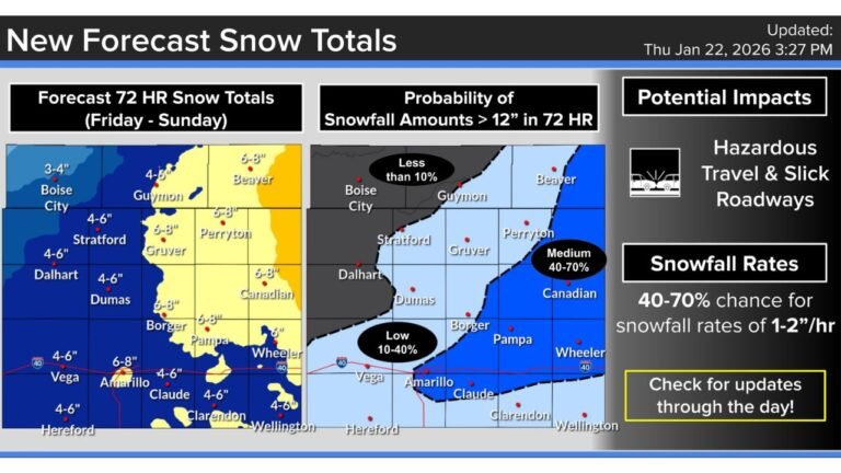
These alerts highlight hazardous travel conditions, icy roadways, and the potential for impassable roads, particularly from Friday through Sunday morning.
Extreme Cold and Life-Threatening Conditions
Behind the storm system, extreme cold settles in, with forecast lows of 10° to 20°F across West Texas and southeastern New Mexico, and wind chills plunging to -5° to 5°F in exposed areas.
This cold significantly increases the risk of hypothermia, especially during prolonged power outages. Warning signs include confusion, intense shivering, difficulty speaking, drowsiness, and stiff muscles, all of which require immediate action.
Power Outages and Infrastructure Impacts
Heavy ice accumulation combined with strong winds creates a high probability of widespread power outages that may last several days in some regions. Ice-laden trees and power lines are expected to fail under the weight, particularly in areas experiencing repeated waves of freezing rain.
Residents are urged to prepare emergency supply kits, secure alternative heat sources, and avoid unnecessary travel during peak icing periods.
What to Expect Next
Conditions are expected to deteriorate rapidly, with Saturday and Sunday shaping up as the most dangerous period for travel and infrastructure impacts. The slow-moving nature of the system means prolonged exposure to ice and cold, increasing the severity of impacts.
This is not a fast-hitting storm — it is a long-duration winter event, and preparation will be critical for safety.
Stay with Cabarrus Weekly for continued updates as this significant winter weather pattern evolves.


