Texas, Oklahoma and Kansas Enter First Major Severe Weather Setup of April as 15% Storm Risk Expands Into Weekend
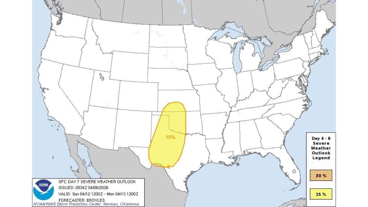
UNITED STATES — The first organized severe weather signal for April is now clearly emerging, with forecast data showing a 15% severe storm risk across parts of Texas, Oklahoma, and Kansas for both Saturday (April 11) and Sunday (April 12).
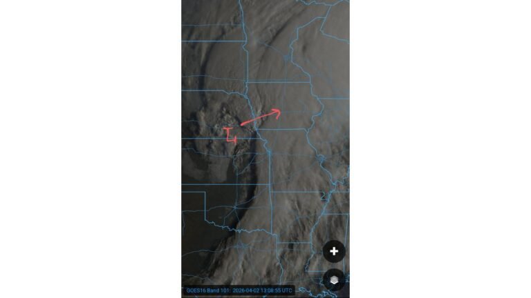
This marks the beginning of what could be a more active stretch of spring severe weather across the Southern Plains, following a relatively quieter period.
Where the 15% Severe Risk Is Focused
The highlighted risk area stretches across key parts of the Southern Plains, including:
- West and North Texas (including areas near Odessa, Abilene, and toward the Red River)
- Central and Western Oklahoma
- Southern Kansas
The risk zone appears consistent on both days, though it shifts slightly north and east on Sunday, signaling evolving storm dynamics.
A 15% risk at this range typically indicates growing confidence in scattered severe storms, including the potential for:
- Damaging wind gusts
- Large hail
- Isolated tornado development
Saturday Setup: Storms Begin to Organize
On Saturday (April 11), the severe weather threat begins to take shape across:
- Western Texas into Oklahoma
- Parts of the High Plains
At this stage, storms may develop in a more isolated to scattered fashion, but conditions will be supportive of stronger thunderstorms capable of severe impacts.
This day represents the initial phase of the pattern, where atmospheric ingredients begin to come together.
Sunday Setup: Risk Expands and Shifts
By Sunday (April 12), the setup becomes more organized:
- The risk area expands slightly northward into Kansas
- Storm coverage may become more widespread compared to Saturday
- The environment appears more favorable for organized severe clusters
This suggests Sunday could carry a higher overall impact potential, especially if storm systems consolidate and track across populated areas.
Why This Pattern Is Developing
The emerging severe weather setup is tied to a return of active spring dynamics across the Plains, including:
- Increasing moisture return from the Gulf of Mexico
- Strengthening upper-level energy moving in from the western U.S.
- A developing trough pattern that enhances storm organization
Together, these factors create a classic early-season severe weather environment across the Southern Plains.
Early Signal of a More Active Stretch Ahead
This two-day risk is not just an isolated event—it may be the first indication of a broader shift toward a more active mid-April pattern.
Forecast trends suggest:
- Multiple rounds of storms may follow beyond this weekend
- The Plains and Midwest could see repeated severe weather opportunities
- Confidence is increasing in a more sustained storm pattern
What Residents Should Watch For
While it is still several days out, residents across Texas, Oklahoma, and Kansas should begin monitoring updates for:
- Timing of storm development
- Potential upgrades in risk levels
- Specific threats such as hail, wind, or tornadoes
Even at this stage, a 15% outlook is a strong early signal that conditions are aligning for impactful weather.
Stay With Cabarrus Weekly for Ongoing Severe Weather Coverage
As this developing system gets closer, forecast details will continue to sharpen.
Stay with Cabarrus Weekly for the latest updates on storm timing, risk areas, and safety information as the Southern Plains prepare for the first significant severe weather setup of April.