Texas, Oklahoma, Arkansas, Tennessee and East Coast Face Major Winter Storm With Ice, Heavy Snow and Dangerous Arctic Cold
UNITED STATES — A high-impact winter storm threat is rapidly coming into focus for Friday through Saturday, with impacts expected to stretch from Texas, Oklahoma and Arkansas through the Tennessee Valley and into the Mid-Atlantic and East Coast. Forecast data shows a dangerous combination of Arctic air, deep moisture, and jet stream phasing, a setup that historically produces crippling ice storms, heavy snow bands, and prolonged bitter cold.
While not every location will experience the same type of winter weather, confidence is growing that most areas within the highlighted zone will see either snow or ice, with some locations facing extended travel disruptions and power outages.
Why Meteorologists Are Increasing Concern
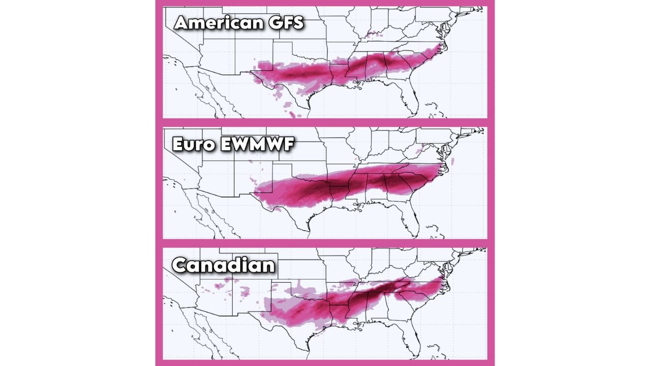
Upper-level pattern analysis shows a strong Arctic air supply surging south, driven by high-latitude blocking and a powerful ridge near the Bering Sea. At the same time, both the northern and southern jet streams are expected to phase, a classic signal for major winter storms across the central and eastern United States.
Forecast guidance indicates southern-stream energy emerging from Texas while northern energy dives southeast. When these two branches interact, storms often strengthen rapidly, increasing the risk for widespread winter precipitation instead of a simple rain event.
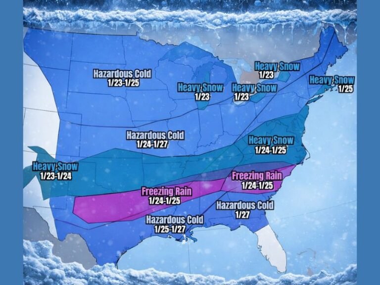
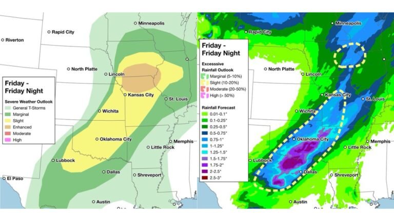
Ice Storm Risk From Texas to the Tennessee Valley
The greatest concern at this stage is the potential for a significant ice storm across Texas, Oklahoma, Arkansas, Louisiana, Mississippi, northern Alabama and Tennessee.
Multiple forecast models show warm air overriding shallow Arctic air near the surface, a setup that favors freezing rain rather than snow. In the most impacted zones, ice accretion between 0.5 and 1 inch is possible if trends hold.
Ice totals of this magnitude can lead to:
- Widespread power outages
- Downed trees and power lines
- Roads becoming impassable for days
- Delayed emergency response
Residents in the ice corridor are strongly encouraged to prepare by midweek, including stocking essentials, charging backup power, and checking on elderly or vulnerable family members.
Heavy Snow Potential North of the Ice Zone
North of the ice corridor, heavy snow is increasingly likely from parts of Oklahoma and Missouri into Kentucky, Ohio, Pennsylvania, Maryland and interior New Jersey.
As the storm intensifies, snowfall rates could become heavy where surface temperatures remain cold enough. Small track shifts will determine whether communities see heavy snow, sleet, or freezing rain, making continued forecast monitoring critical.
Dangerous Arctic Cold Spreads and Lingers
Behind the storm system, dangerous Arctic cold will surge south and east, compounding impacts even after precipitation ends. Forecast guidance highlights:
- Sub-zero wind chills across parts of the Midwest and Great Lakes
- Single-digit or below-zero temperatures spreading into the Ohio Valley and Northeast
- Elevated risk of hypothermia and frostbite
This cold pattern may linger into late January, especially problematic in areas affected by ice-related power outages.
What Forecasters Are Still Watching
Despite increasing confidence in a major winter event, several key uncertainties remain:
- Exact placement of the snow-ice-rain transition line
- Which states receive the highest ice accumulations
- Whether winter impacts extend into Sunday
Given the high-impact nature of this setup, forecast adjustments are expected over the coming days.
Bottom Line
This system has the potential to become one of the most disruptive winter storms of the season for parts of Texas, the Deep South and the East Coast. Ice appears to be the primary threat, with heavy snow and extreme cold adding to the overall danger.
Stay weather-aware, prepare early, and closely monitor updates as details become clearer.
How could this storm impact concerts, travel, or weekend plans in your area? Share your thoughts and stay connected with Cabarrusweekly.com.