Texas Oklahoma Kansas Missouri Illinois Could See Increasing Severe Weather Risk As Early April Pattern Shift Develops
UNITED STATES — After a relatively quiet stretch of late March weather, new forecast data suggests a significant pattern change is on the way that could bring a more active and potentially severe setup across parts of the Central and Eastern United States heading into early April.
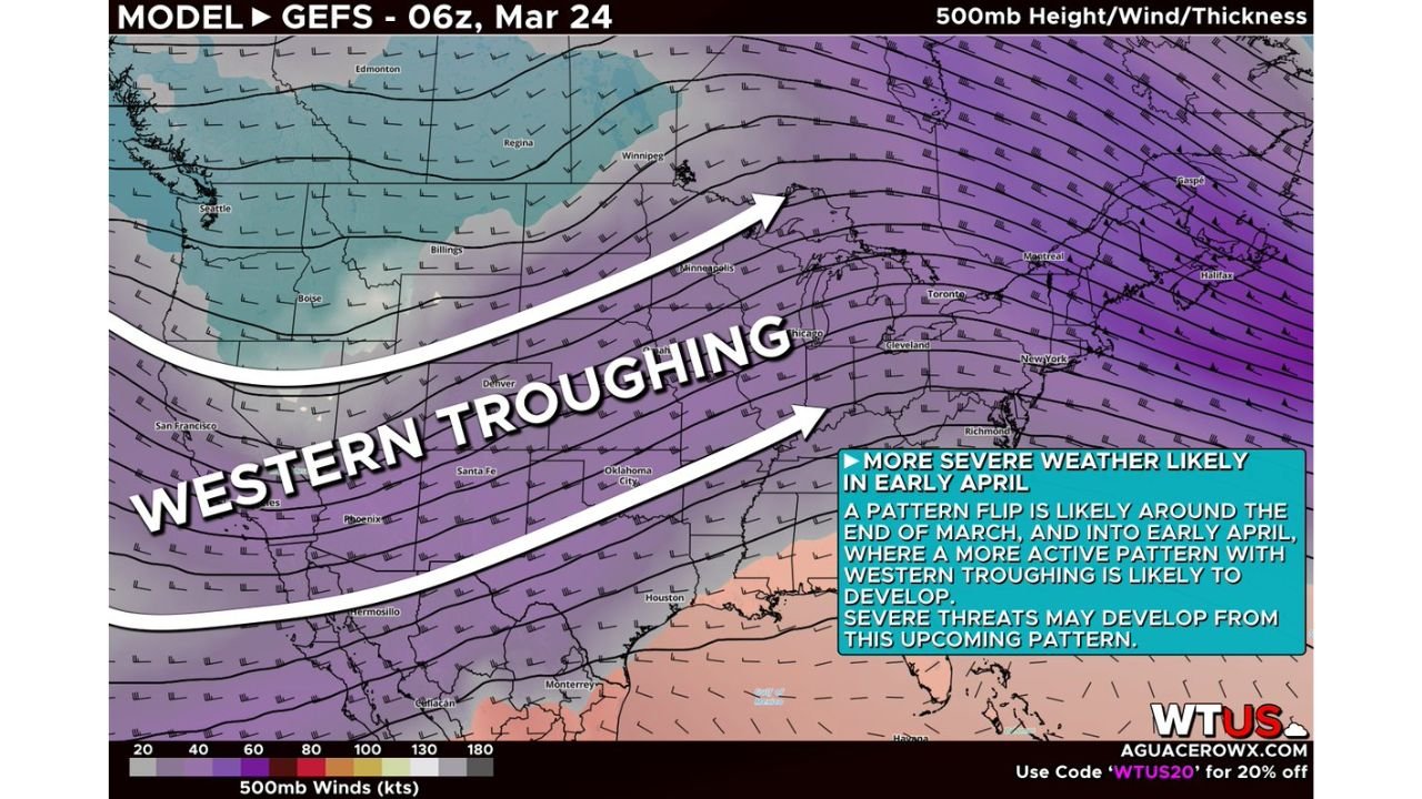
Western Troughing Signals Major Pattern Change
Long-range ensemble guidance shows strong agreement that western troughing will begin to take shape, replacing the recent stable pattern.
This shift involves:
- A breakdown of the Western U.S. ridge
- A dip in the jet stream across the West and Central U.S.
- Increasing storm energy moving eastward
As this trough develops, it will allow colder air to push south and interact with warmer, moisture-rich air returning from the Gulf.
Central States Positioned For Storm Development
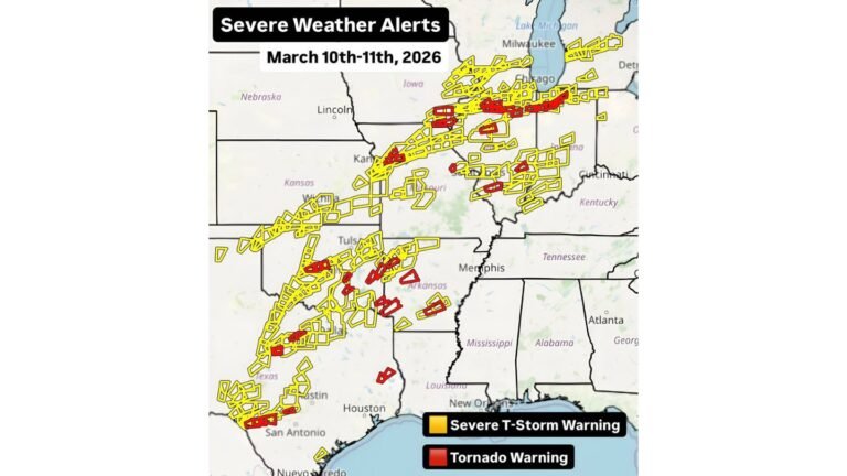
The evolving setup places several key states in a favorable zone for storm development, including:
- Texas
- Oklahoma
- Kansas
- Missouri
- Illinois
These regions often sit at the intersection of warm, moist air and incoming upper-level energy, making them particularly vulnerable during pattern transitions like this.
Early April Could Bring Multiple Severe Weather Opportunities
Rather than a single storm system, this pattern suggests multiple rounds of potential severe weather could develop.
Key ingredients expected to increase include:
- Stronger jet stream winds enhancing storm organization
- Rising moisture levels across the Plains and Midwest
- Instability building over time, especially during warmer days
This combination typically supports threats such as:
- Large hail
- Damaging winds
- Possible tornado development
However, exact timing and locations remain uncertain at this stage.
Confidence Growing But Details Still Unclear
Forecast models show consistent signals of this pattern flip, increasing confidence that a more active stretch is coming.
At the same time:
- Specific storm days are not yet locked in
- Exact impact zones will shift as systems develop
- Severity levels will depend on how individual setups evolve
This is a broad-scale signal, not a pinpoint forecast.
Why This Pattern Matters
This type of transition is common during the spring severe weather season, when:
- Cold air from the north clashes with warm Gulf air
- The jet stream becomes more active
- Storm systems become more frequent and organized
Historically, setups like this have led to notable severe weather outbreaks across the Plains and Midwest.
Final Word
While late March has remained relatively calm, the atmosphere appears to be resetting into a more active spring pattern, with Texas, Oklahoma, Kansas, Missouri, and Illinois all potentially in the path of increased severe weather chances in early April.
Residents across these states should stay aware in the coming days as forecasts become more detailed and specific.
Stay with CabarrusWeekly.com for continued updates as this developing early April severe weather pattern takes shape across the United States.