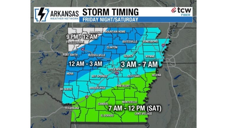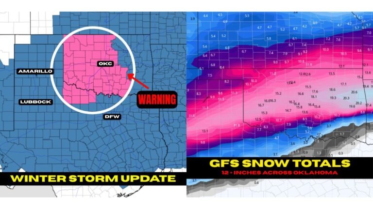
Utah Snowpack Could Get a Much-Needed Boost as ECMWF Shows Stormy Pattern Returning to the Western U.S. by Feb. 16
CABARRUS COUNTY, NORTH CAROLINA — A notable pattern change is being signaled in the West, with guidance showing stormier weather returning and potentially delivering a much-needed precipitation boost to areas including Utah, where the graphic notes a record-low snowpack has made this a painful season for skiers and snow-lovers.
What the forecast graphic is showing
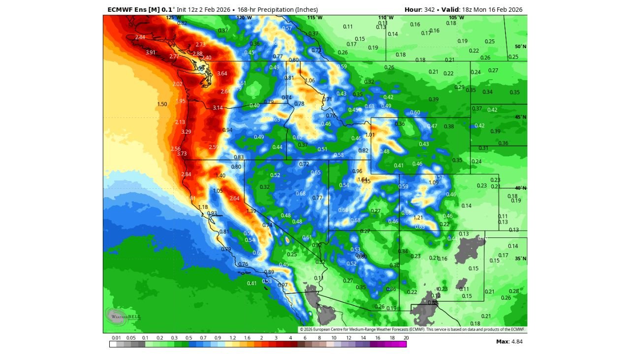
The provided map is an ECMWF ensemble precipitation projection (168-hour total precipitation, in inches), valid 18z Monday, Feb. 16, 2026. In plain terms, it’s a look at where the model thinks the next week of moisture could stack up as the West turns more active.
The signal is not subtle: a broad swath of the Western U.S. shifts into wetter colors, with the most intense precipitation concentrated along and near the Pacific Coast and into the mountain belts of the interior West.
Where the heaviest precipitation is focused
Based on the color field and values shown, the biggest totals are aimed at the West Coast, especially:
- Northern and Central California along the coastal ranges
- Portions of Oregon and Washington near the coast and into the Cascades
- The Sierra Nevada region, where mountain-enhanced precipitation typically translates into meaningful snowfall when temperatures cooperate
The map’s highest shading and clustered larger numbers hug the coast, which is a classic signature of Pacific storm energy returning and pushing inland.
Utah and the Intermountain West are in the wetter lane
The key local storyline from the caption is Utah: after a season described as painful due to record-low snowpack, the incoming storm track shown on the map suggests Utah and surrounding interior areas could finally tap into sustained moisture.
The map shows a broad, wetter footprint expanding across the interior West, including areas around:
- Utah
- Parts of Nevada and Idaho
- Portions of Colorado
- Nearby high terrain extending into the Four Corners region
It’s important to be clear about what this represents: the graphic is total precipitation, not snowfall. But in mountain-focused states like Utah, a stormier pattern often means at least a portion of that moisture can fall as snow at elevation—especially in mid-February.
Too little, too late — or the start of a turnaround?
The caption’s question is the one many snow-dependent communities ask every winter: is this a late-season tease, or the beginning of a real second-half shift?
This is the kind of setup that can go either way. A single wet week helps, but for a true snowpack recovery, the West typically needs multiple storms in sequence and cold-enough air to keep precipitation falling as snow in the mountains rather than rain. Still, if the storm door truly reopens, it can change the season’s trajectory fast—especially in higher terrain.
Why Cabarrus County readers should care about a West pattern flip
Even though this map is focused on the Western U.S., big pattern changes out West can sometimes connect to downstream changes later in the month across the central and eastern U.S. That doesn’t automatically mean storms for North Carolina, but it does signal that the overall weather pattern may be shifting away from stagnant, which is often when the Southeast begins seeing more active systems in the extended outlook.
Bottom line
The data you shared points to a clear headline: a stormier Western U.S. pattern is being advertised by mid-February, with heavy coastal precipitation and a wetter push inland that could finally help Utah’s struggling snowpack if enough of that moisture falls as snow in the mountains.
If you’re tracking this pattern because you have family out West, travel plans, or you’re watching for a broader U.S. weather shift, tell us what you’re seeing and where—join the conversation at CabarrusWeekly.com.