Virginia, Maryland and North Carolina Under Historic Day 4 30% Severe Risk — First Time Since 2016 for the Mid-Atlantic
UNITED STATES — A rare and historically significant severe weather outlook has been issued for portions of Virginia, Maryland and North Carolina, as the Storm Prediction Center maintains a Day 4 30% severe risk for Monday, March 16.
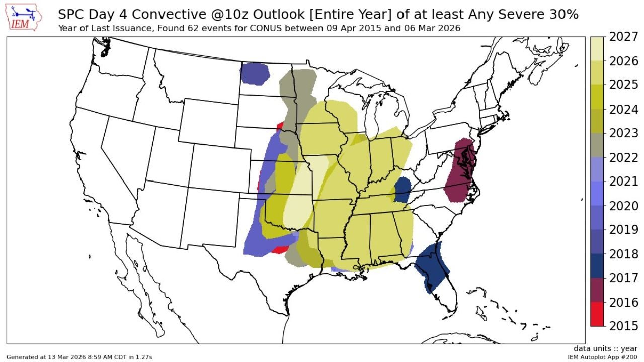
According to historical data, this marks only the first — and second ever — time a Day 4 30% severe probability has been issued for the Mid-Atlantic region. The last occurrence was June 5, 2016.
Why This Outlook Is So Rare
Day 4 outlooks typically carry lower probabilities due to forecast uncertainty several days in advance. A 30% severe risk at this range indicates unusually strong confidence in a potentially impactful severe weather event.
Historical records show that since at least 2015, only 62 Day 4 “30% any severe” outlooks have been issued across the entire continental United States. Very few of those have targeted the Mid-Atlantic.
The only previous Mid-Atlantic instance — June 5, 2016 — ultimately produced a scattered wind event across the region. While damaging, it did not evolve into a widespread catastrophic outbreak.
The fact that forecasters are once again issuing a 30% risk days ahead suggests atmospheric signals are aligning in a concerning way.
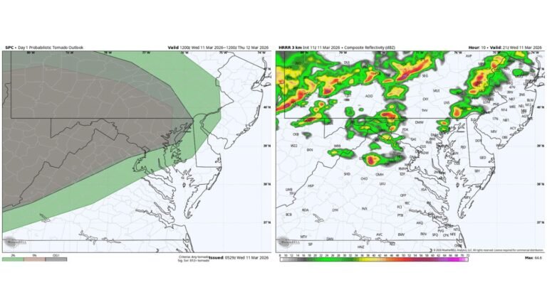
Areas Included in the 30% Risk
The core 30% severe zone covers portions of:
- Eastern North Carolina
- Eastern and central Virginia
- Southern Maryland
Major cities in or near the highlighted area include:
- Raleigh, North Carolina
- Richmond, Virginia
- Virginia Beach, Virginia
- Washington, D.C. metro
- Baltimore, Maryland
Surrounding this zone is a broader 15% severe probability extending farther into the Carolinas and Mid-Atlantic.
What Threats Are Expected?
Forecast discussions indicate:
- Significant damaging straight-line winds
- The potential for a few severe tornadoes
Meteorologists are closely watching the potential for a powerful squall line capable of producing widespread 60–75+ mph wind gusts. Embedded tornadoes within the line are possible, especially if storms can tap into strong upper-level wind energy.
There is also concern that isolated supercells may form ahead of the main line, increasing tornado potential in localized areas.
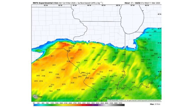
Why Confidence Is Higher Than Usual
Several key atmospheric ingredients are expected to align:
- Strong jet stream energy overhead
- Robust wind shear supporting storm rotation
- Adequate instability across the Mid-Atlantic
When these elements combine, storms can organize quickly and intensify.
Issuing a 30% probability this far out signals that forecast models are in strong agreement about the overall setup.
What Residents Should Do
With several days still remaining before the event, now is the time to:
- Review severe weather safety plans
- Ensure access to weather alerts and warnings
- Identify safe shelter locations in homes or workplaces
- Monitor forecast updates through the weekend
Even if exact timing shifts, the elevated risk level underscores the need for awareness.
Bottom Line
Virginia, Maryland and North Carolina are under a historically rare Day 4 30% severe weather risk for Monday, March 16 — only the second such outlook ever issued for the Mid-Atlantic region.
While the last similar setup in 2016 resulted in a scattered wind event, the current forecast signals the potential for significant damaging winds and a few tornadoes.
CabarrusWeekly.com will continue to track developments and provide updated timing and impact details as new forecast data becomes available.