Widespread Damaging Wind Event and Multiple Tornadoes Underway Across Louisiana and Mississippi, Gusts Up to 80 MPH Possible Tonight
LOUISIANA AND MISSISSIPPI — A widespread severe weather outbreak is unfolding tonight across large portions of Louisiana and Mississippi, where a powerful squall line is producing damaging winds, multiple tornadoes, and wind gusts that could reach 80 mph in isolated areas.
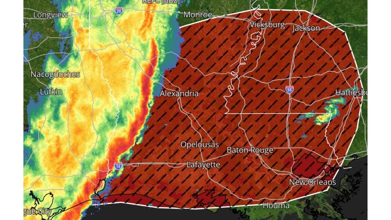
Meteorologists warn that if you are within the highlighted red risk zone, you are either currently being impacted or will likely be affected as the line continues moving east.
Red Highlighted Area Under Significant Severe Threat
The highest concern extends across Alexandria, Lafayette, Baton Rouge, Opelousas, and New Orleans in Louisiana, and into Jackson, Vicksburg, and Hattiesburg in Mississippi.
Within this region, forecasters are calling for a widespread severe damaging wind event, with numerous reports of strong wind gusts already ongoing along the leading edge of the squall line.
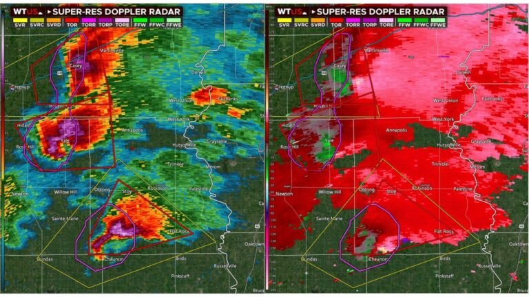
The radar imagery shows an intense, solid line of storms stretching north to south, capable of producing embedded circulations.
Multiple Tornadoes Possible, One Could Be Strong
In addition to damaging straight-line winds, meteorologists indicate multiple tornadoes are possible, and at least one strong tornado cannot be ruled out.
The storm mode suggests a mature squall line with embedded rotating cells. These quick spin-ups can develop rapidly, sometimes with minimal lead time, especially within high-shear environments.
Communities across central and southern Mississippi, as well as southern Louisiana, should remain prepared for rapidly changing conditions.
Wind Gusts 60 to 80 MPH a Major Concern
While tornadoes are a serious threat, the broader and more widespread danger may come from powerful straight-line wind gusts of 60 mph, with localized gusts possibly reaching 80 mph.
Winds of this magnitude can:
Down trees and power lines
Cause structural damage to roofs and siding
Lead to scattered power outages
The combination of saturated soils and strong gusts increases the likelihood of tree damage.
Storm Line Moving East Tonight
The squall line is advancing eastward, meaning areas currently under the red zone will continue to see impacts through the evening and overnight hours.
Behind the line, drier air will eventually filter in, but conditions ahead of it remain unstable and supportive of severe weather.
Residents should have multiple ways to receive warnings, especially overnight when storms may approach while people are sleeping.
If severe weather impacts your community tonight, share updates and conditions with us at CabarrusWeekly.com as our weather team continues monitoring this dangerous situation.