Widespread Severe Weather Threat Friday From Texas Through Oklahoma, Kansas and Missouri With Risk of EF2+ Tornadoes, 74+ MPH Winds and 2-Inch Hail
UNITED STATES — A large and potentially dangerous severe weather event is expected Friday, March 6, stretching from Texas through Oklahoma, Kansas and into Missouri, with strong tornadoes, damaging winds and significant hail all possible.
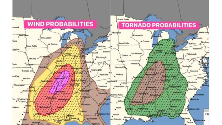
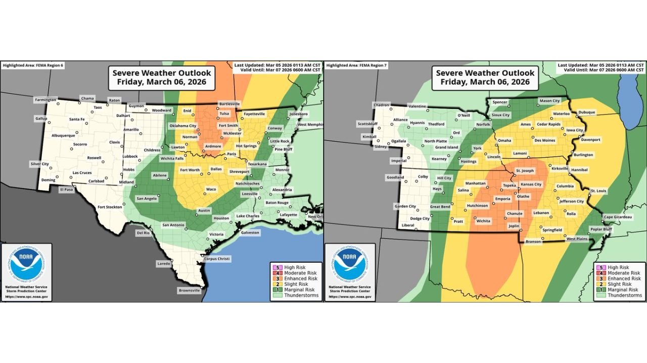
Storm Prediction Center graphics show a broad severe risk area covering much of the Southern Plains and Mid-Mississippi Valley.
Broad Severe Corridor Across the Plains
The general severe weather outlook includes:
- North and Central Texas
- Much of Oklahoma
- Eastern Kansas
- Western and Central Missouri
- Portions of Arkansas and southern Iowa
An Enhanced Risk area (Level 3 of 5) is centered from central and eastern Oklahoma into eastern Kansas and western Missouri, indicating a higher likelihood of organized severe storms.
Surrounding this zone is a larger Slight Risk area extending into:
- North Texas
- Western Arkansas
- Central Missouri
- Parts of Iowa
Tornado Outlook Highlights Strong Potential
The Tornado Outlook shows a concentrated corridor from:
- North Texas
- Through central and eastern Oklahoma
- Into eastern Kansas
- And across western and central Missouri
Within this area, black dashed (hatched) regions indicate Intensity Level 1, meaning stronger tornadoes are possible if storms evolve favorably.
That includes the potential for:
- EF2 or stronger tornadoes
- Long-lived supercells
- Tornadoes capable of producing significant damage
The most favorable environment for tornado development appears across:
- Eastern Oklahoma
- Eastern Kansas
- Western Missouri
Cities near or within this corridor include:
- Oklahoma City
- Tulsa
- Wichita
- Kansas City
- Topeka
- Springfield
- Joplin
Damaging Winds and Large Hail Also Possible
Beyond the tornado threat, Friday’s setup supports:
- Wind gusts of 74+ mph
- Hail 2 inches in diameter or larger
Large hail and destructive winds may occur both with discrete supercells and any developing storm clusters.
A Key Uncertainty
One uncertainty involves early-day storms. Morning convection could:
- Limit atmospheric instability in some areas
- Reduce storm intensity locally
However, if storms remain discrete during the afternoon and early evening, the environment would support a more robust severe threat, including the possibility of a couple of strong tornadoes.
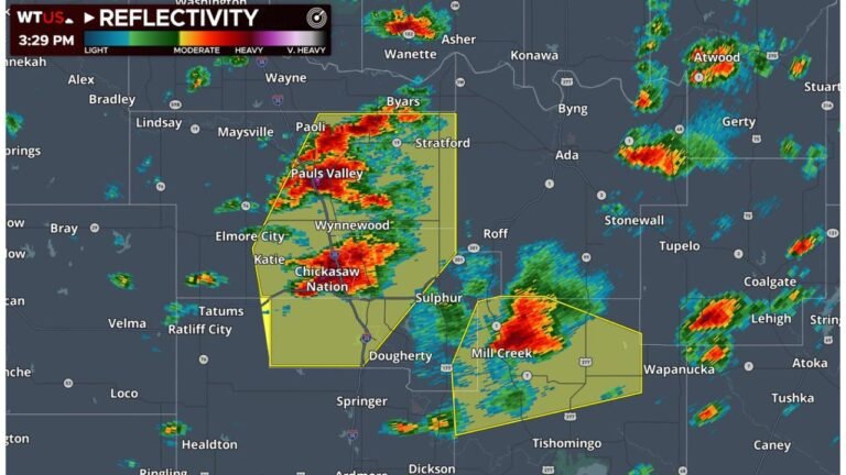
Severe Weather Already Ongoing
Severe weather is also expected today in portions of the broader risk area, adding to concerns as the atmosphere becomes increasingly primed heading into Friday.
What Residents Should Do
Communities across:
- Texas
- Oklahoma
- Kansas
- Missouri
- Arkansas
should ensure they have:
- Multiple ways to receive warnings
- A safety plan in place
- Awareness of peak storm timing Friday afternoon and evening
With a wide geographic area involved and multiple severe hazards on the table, this event has the potential to become a significant early-season outbreak across the central United States.
CabarrusWeekly.com will continue monitoring this developing situation and provide updates as new forecast information becomes available.