Wyoming, Colorado, Nebraska, South Dakota, and Kansas Face Critical Fire Weather Threat as Extreme Conditions Spread Across the High Plains
UNITED STATES — A dangerous fire weather setup is unfolding across the High Plains, with critical to extreme fire conditions expected across Wyoming, Colorado, Nebraska, South Dakota, and Kansas through Saturday.
Critical Fire Weather Expands Across the High Plains
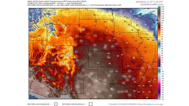
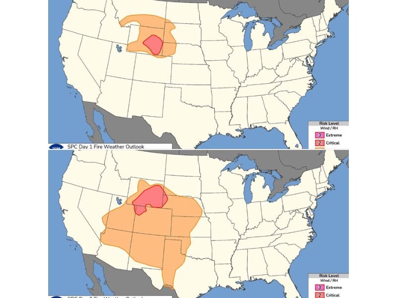
Forecast maps indicate a core area of extreme fire danger centered over eastern Wyoming, northeastern Colorado, and western Nebraska, with surrounding regions under a broader critical risk zone.
This includes parts of South Dakota and Kansas, where conditions are also favorable for rapid fire spread. The expansion of risk from Day 1 into Day 2 highlights a growing and evolving threat across multiple states.
Why Conditions Are So Dangerous
The primary drivers behind this setup are very low relative humidity levels combined with strong downslope winds coming off the Rockies.
These winds not only dry out vegetation further but also increase the speed at which any fire can spread. With humidity values dropping significantly, even a small spark could quickly turn into a fast-moving wildfire.
The alignment of dry air, gusty winds, and warm temperatures creates near-perfect conditions for extreme fire behavior.
Day-by-Day Breakdown of the Risk
On Friday, the most intense conditions are expected across eastern Wyoming and nearby portions of Colorado and Nebraska, where the extreme risk zone is concentrated.
By Saturday, the threat expands significantly, covering a much larger portion of the central and northern High Plains. This includes a broader area stretching into Kansas, South Dakota, and deeper into Nebraska and Colorado, indicating worsening conditions.
The expansion suggests that fire weather concerns will not only persist but intensify geographically, impacting more communities.
Temporary Relief Before Another Round
Conditions are expected to briefly improve on Sunday, offering a short window of relief. However, this break is not expected to last long.
Forecast guidance suggests that poor fire weather conditions will return early next week, meaning the overall pattern remains active and concerning for wildfire potential across the region.
What This Means for Residents
Residents and land managers across these states should be extremely cautious. Activities that could generate sparks—such as outdoor burning or equipment use—could become dangerous under these conditions.
With rapid fire spread possible, response times can be critical, and fires may quickly grow beyond initial containment efforts.
Final Outlook
This is a high-impact fire weather event for the High Plains, with multiple states under critical and extreme risk levels over consecutive days.
The combination of atmospheric factors makes this one of the more dangerous setups seen so far this season, particularly across Wyoming, Colorado, Nebraska, South Dakota, and Kansas.
Residents are urged to stay alert and follow local fire restrictions as conditions evolve. Stay with CabarrusWeekly.com for continuing coverage, and share updates from your area as this fire threat develops.