Severe Weather Threat Expands Across Mississippi, Alabama and Georgia: Conditional Risk for Very Large Hail and Isolated Tornadoes Tuesday Afternoon
DEEP SOUTH — Severe weather is set to return Tuesday across portions of Mississippi, Alabama, and western Georgia, with forecasters highlighting a conditional but potentially impactful afternoon and early evening threat.
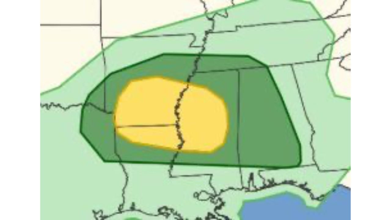
The latest outlook places a focused area of concern from central and southern Mississippi eastward through central Alabama and into parts of western Georgia. Cities near the center of the risk zone include:
- Jackson, Mississippi
- Meridian, Mississippi
- Birmingham, Alabama
- Tuscaloosa, Alabama
- Montgomery, Alabama
- Columbus, Georgia
A Conditional but Concerning Setup
Forecasters describe this as a conditional risk, meaning storm development is not guaranteed everywhere inside the highlighted zone. However, if storms are able to form and organize, they could quickly become severe.
The primary threats include:
- Very large hail
- Damaging wind gusts
- A couple of tornadoes
The most favorable timing appears to be during the afternoon into the early evening hours, when daytime heating and atmospheric instability are at their peak.
Where Storms Are Most Likely
The core of the severe weather risk stretches across:
- Central Mississippi
- Much of central Alabama
- Western portions of Georgia
Northern areas of Alabama and southern Tennessee appear to be on the northern fringe of the threat, while southern Louisiana and the Florida Panhandle are expected to remain largely outside the primary severe zone for this event.
Why This Setup Matters
This system is being driven by increasing instability and wind shear across the Deep South. When these ingredients overlap, storms that develop can rotate — increasing the risk for large hail and isolated tornadoes.
However, storm coverage will depend heavily on whether the atmosphere can overcome any limiting factors such as cloud cover or lack of a strong trigger mechanism.
If storms remain isolated and discrete rather than forming into a solid line, the tornado potential would be higher.
Timing and What to Watch
Storm development is most likely from mid-afternoon through the early evening. Residents across Mississippi, Alabama, and western Georgia should:
- Monitor updated forecasts
- Have multiple ways to receive warnings
- Be prepared to act quickly if warnings are issued
Because this is a conditional setup, confidence in exact storm placement remains moderate, but the environment will support severe weather where storms do form.
Bottom Line
Severe weather is expected to return to the Deep South Tuesday, with central Mississippi, Alabama, and western Georgia in the zone for very large hail and isolated tornadoes. While storm development is not guaranteed everywhere, any storms that do form could intensify quickly during the afternoon and early evening.
CabarrusWeekly.com will continue monitoring this developing situation and provide updates as confidence increases.