Arkansas, Tennessee, Mississippi, Alabama, Kentucky and Indiana Brace for Dangerous Severe Weather Outbreak With Tornadoes and Widespread Damaging Winds
UNITED STATES — A significant severe weather outbreak is developing across parts of the Mid-South and Ohio Valley, where storms are expected to produce damaging winds, tornadoes, and hail across multiple states including Arkansas, Tennessee, Mississippi, Alabama, Kentucky, and Indiana.
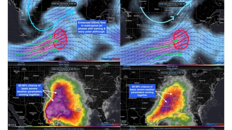
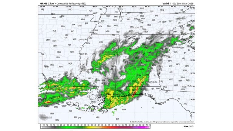
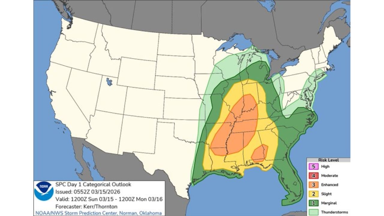
Storm outlook maps show a broad corridor of severe weather risk stretching from the Lower Mississippi Valley through the Tennessee Valley and into portions of the Ohio Valley, with the highest concentration of severe storms expected later in the day.
Strong Storm System Targeting the Mid-South and Ohio Valley
Severe weather outlook maps indicate a large area of enhanced severe storm risk centered across Arkansas, western Tennessee, northern Mississippi, and northern Alabama.
Cities within this corridor include Little Rock, Memphis, Jackson, Tupelo, Huntsville, and Nashville, where thunderstorms may intensify as the system moves northeast.
Additional risk areas extend northward into Kentucky and southern Indiana, including cities such as Louisville and Evansville, where severe storms may continue into the evening.
Damaging Winds Expected to Be the Primary Hazard
Storm probability maps highlight a large zone of high damaging wind potential stretching from Louisiana and Mississippi northward through Tennessee and into Kentucky and Indiana.
Within this area, thunderstorms may organize into a fast-moving squall line capable of producing widespread damaging winds, with the strongest gusts capable of causing tree damage, structural impacts, and power outages.
The most intense wind corridor appears centered from Mississippi through western Tennessee and into Kentucky, where storm intensity could be strongest.
Tornado Threat Includes Potential for Embedded Tornadoes
In addition to damaging winds, storms within the main squall line may produce embedded tornadoes across parts of the Mid-South and Tennessee Valley.
The tornado outlook highlights areas across Mississippi, Alabama, Tennessee, and western Kentucky where rotating storms could develop.
These tornadoes may form quickly within the line of storms, which can make them difficult to detect and can occur with little warning.
Large Hail Possible Across Southern Portions of the Storm System
Large hail is also possible with stronger storms, particularly across southern portions of the severe weather zone, including parts of Louisiana, southern Mississippi, and southern Alabama.
Hail-producing storms may develop ahead of the main storm line where atmospheric conditions allow stronger updrafts.
While hail is not expected to be the dominant hazard, it may still occur with the most intense storms across the southern portion of the system.
Severe Weather Expected to Expand East Through the Day
As the storm system continues moving east and northeast, the severe weather risk may gradually expand into parts of the Southeast and Mid-Atlantic later in the event.
Communities across the Mid-South and Ohio Valley could see rapidly changing weather conditions as the storm complex moves through the region.
The combination of damaging winds, tornado potential, and isolated hail makes this a multi-hazard severe weather event affecting several states across the central and eastern United States.
Stay with CabarrusWeekly.com for continuing updates as severe storms develop across Arkansas, Tennessee, Mississippi, Alabama, Kentucky, and Indiana throughout the day.