Pennsylvania, Maryland, New Jersey and New York Brace for Sunday Night Severe Storms After 80°F Warm Surge Ahead of Cold Front
MID-ATLANTIC — A developing weather system is expected to bring a late-day severe storm threat Sunday across Pennsylvania, Maryland, New Jersey, and New York, following an unusually warm afternoon with temperatures nearing 80 degrees.
Warm Surge Sets the Stage for Evening Storms
Ahead of the incoming cold front, much of the region will experience unseasonably warm temperatures approaching 80°F, creating the instability needed for storm development later in the day.
This warm air mass combined with increasing moisture will act as fuel, while the approaching front provides the trigger for thunderstorms.
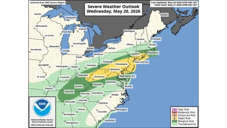
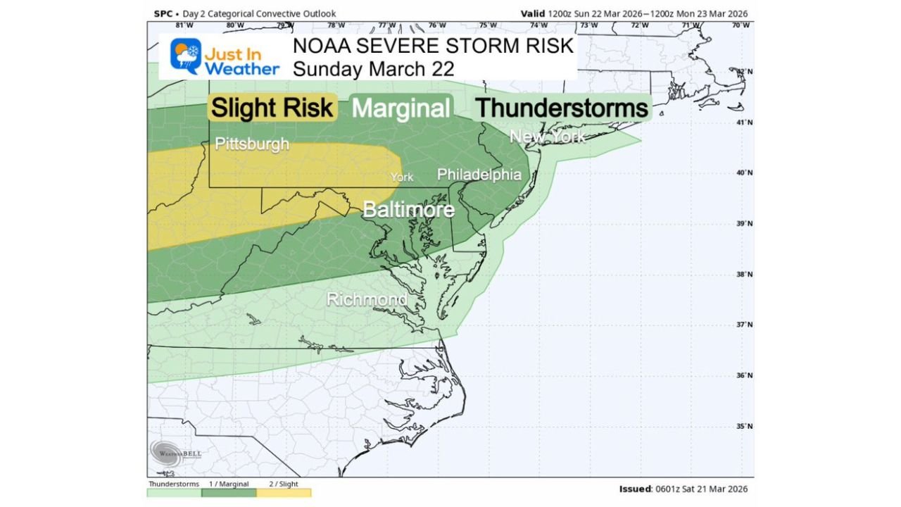
NOAA Highlights Slight Risk Across Interior Zones
Parts of western and central Pennsylvania into northern Maryland fall under a Level 2 out of 5 Slight Risk, meaning scattered severe storms are possible.
Surrounding regions including Philadelphia, Baltimore, and New York City remain under a marginal risk, where storms are still expected but may be less intense.
Storm Timing Focused After 7 PM
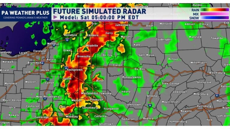
High-resolution guidance shows storms developing after 7 PM, first across western Pennsylvania and eastern Ohio, then tracking east.
By late evening, storms are expected to move into central and eastern Pennsylvania, New Jersey, Maryland, and eventually toward New York City, increasing nighttime travel risks.
Main Threats Include Damaging Winds and Hail
Storms are expected to organize into lines or clusters, increasing the risk of strong to locally damaging wind gusts.
Some cells may still produce hail and brief rotation early, but the primary hazard shifts toward wind as storms merge.
What This Means for Surrounding Areas
While the core threat remains north, nearby regions may still see increasing clouds and scattered showers, especially later Sunday into Monday.
The overall pattern reflects a classic warm-then-storm spring setup, where rapid temperature increases are followed by a frontal boundary and storm development.
Stay with CabarrusWeekly.com for continued updates as this system develops. If storms impact your area, share your conditions with the CabarrusWeekly.com community.