Illinois, Indiana and Wisconsin Face Evening Supercell Storm Threat With Damaging Winds Pushing Into Central Indiana
ILLINOIS — A dangerous evening weather setup is developing across parts of the Midwest, where supercell storms are expected to form over Illinois before pushing east into Indiana with damaging winds and heavy rain.
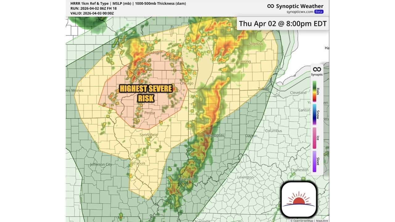
Highest Severe Risk Centered Over Central Illinois
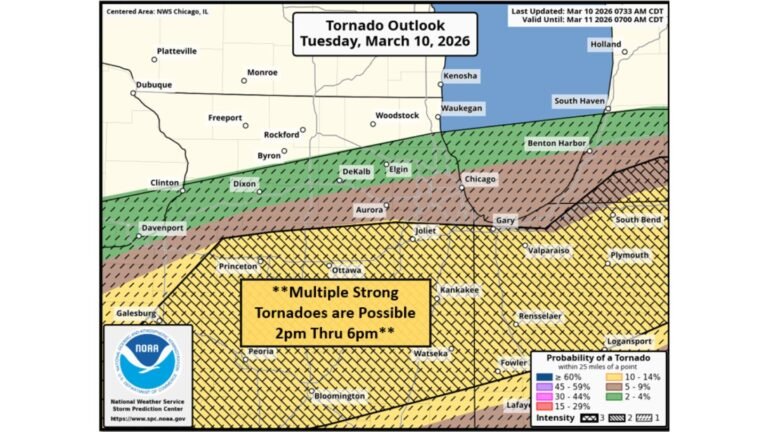
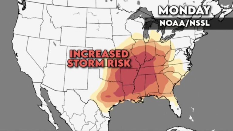
The most intense storm activity is expected across central Illinois, including areas near Peoria and Springfield. This region falls within the highest severe risk zone, where atmospheric conditions strongly support supercell development capable of producing damaging winds and isolated tornadoes.
Storms are likely to rapidly intensify during the evening as instability and wind shear combine, creating an environment favorable for rotating thunderstorms. Residents in this area should be especially alert as storm strength could increase quickly within a short time frame.
Storm Line Evolves While Moving Into Indiana
As storms track eastward, they are expected to organize into a line moving into Indiana, including the Indianapolis region. While the system may weaken slightly compared to its peak in Illinois, it will still carry a significant threat of strong to damaging wind gusts and intense rainfall.
Central Indiana is expected to experience a decaying but still impactful line of storms, where the tornado threat lowers but straight-line winds and brief heavy downpours remain the primary concern.
Scattered Strong Storms Extend Into Wisconsin and Michigan
Farther north, parts of southern Wisconsin and areas into Michigan, including regions near Madison and Lansing, will see scattered thunderstorms. While not in the highest risk zone, these areas can still experience isolated strong storms with gusty winds, lightning, and brief heavy rain.
Localized conditions may allow some storms to briefly intensify, especially where instability remains sufficient for stronger updrafts.
Evening Timing Brings Peak Impact Window
The most active severe weather period is expected during the evening hours, roughly between 6 PM and 10 PM EDT, with storms continuing eastward overnight. Illinois will experience impacts first, followed by Indiana later in the evening.
Travel conditions may deteriorate quickly during this time, with reduced visibility, heavy rain, and sudden wind gusts affecting roadways.
Main Threats Include Wind Damage and Isolated Tornado Risk
This weather setup supports multiple hazards across the region. The primary concerns include damaging wind gusts potentially exceeding 60 mph, isolated tornado potential in central Illinois, and frequent lightning within stronger storm cells.
Heavy rainfall may also lead to brief water accumulation on roads, particularly where storms repeatedly move over the same areas.
What Residents Should Watch For Tonight
Residents across Illinois and Indiana should remain weather-aware through the evening hours as storms develop and move through. Even outside the highest risk zone, conditions can still produce strong and disruptive thunderstorms capable of causing localized impacts.
This pattern reflects a typical Midwest severe weather evolution where discrete supercells transition into a moving storm line, spreading risk across multiple states.
Stay with CabarrusWeekly.com for continued updates and share what you’re seeing in your area as these storms move through tonight.