From Pleasant Sunday to Summer-Like Heat: Baltimore, Central Virginia, and Inland Maryland Brace for a Jump Into the 80s and Possible 90s This Week as Drought Conditions Deepen
BALTIMORE, MARYLAND — Sunday April 12 is starting out as a pleasant, sunny, and seasonal day across the Baltimore and Washington D.C. region — but that calm will not last long. A dramatic jump toward summer-like heat is on the way, and by the middle of the week, parts of Central Virginia and inland Maryland could be flirting with 90 degrees. Meanwhile, a precipitation deficit of 3.66 inches for the year with no organized rain in sight is setting the stage for worsening drought and increased brush-fire danger.
A Tale of Two Weather Worlds This Sunday Morning
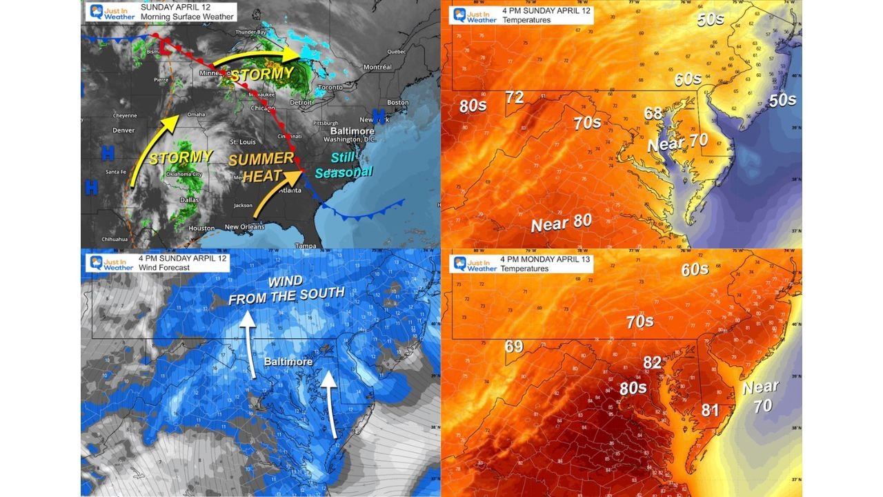
The morning surface weather map for Sunday April 12 tells a stark story depending on where you live. To the west and northwest, stormy conditions are already underway — active weather is firing across the Plains from Dallas and Oklahoma City north through St. Louis, Chicago, Milwaukee, and into Minnesota. A separate stormy corridor is pushing from the Upper Midwest toward the Great Lakes and Toronto.
Meanwhile, Baltimore, Washington D.C., and the surrounding region are sitting in an entirely different atmosphere — still seasonal, still quiet, and still comfortable. A southerly wind flow is already beginning to establish itself across the region, and that is the key ingredient that will drive the dramatic warmup arriving this week.
Sunday Afternoon: Winds Shift South, Warmth Begins to Build
By 4 PM Sunday April 12, winds across the Baltimore region are flowing from the south, pulling warmer air northward into the mid-Atlantic. Afternoon temperatures reflect the beginning of the transition:
| Area | Sunday April 12 — 4 PM Temperature |
|---|---|
| Southern Maryland and areas near 80 | Near 80°F |
| Baltimore and surrounding region | Near 70°F / 68°F |
| Western Maryland and inland areas | Low to mid 70s |
| Eastern Shore and coastal areas | Mid to upper 50s |
| Northern coastal areas | 50s |
The temperature gradient is sharp — inland and southern areas are already running significantly warmer than coastal locations, which are being held back by cooler marine air. That gap will widen dramatically as the week progresses.
Monday: The Jump to Summer Heat Begins in Earnest
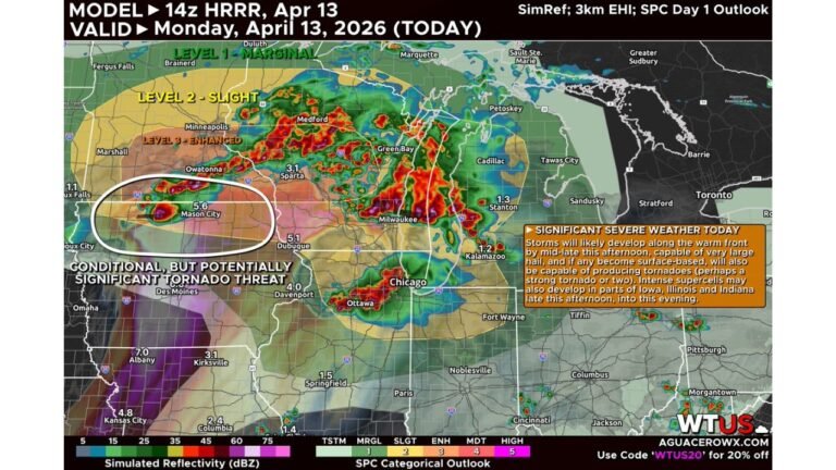
By 4 PM Monday April 13, the warmup kicks into a higher gear. The seasonal feel of Sunday gives way to something that looks and feels much more like summer across the region.
| Area | Monday April 13 — 4 PM Temperature |
|---|---|
| Southern areas and Virginia | Low to mid 80s, upper 80s possible |
| Baltimore and central Maryland | 82°F — solidly in the 80s |
| Western Maryland | Upper 70s to low 80s |
| Coastal and Eastern Shore | Near 70 to low 80s |
| Northern and interior areas | 70s |
Baltimore hits 82 degrees on Monday afternoon — a significant jump from the seasonal readings of Sunday. Southern portions of the region push well into the mid and upper 80s, with some areas already approaching 85 degrees.
Wednesday and Thursday: Peak Heat — and Possible 90s
Monday’s warmth is just the opening act. The peak of this heat event arrives Wednesday and Thursday, when temperatures across the region are expected to reach their highest point of the stretch.
Some forecast models are still pushing temperatures into the 90s, and forecasters note that scenario is most likely across Central Virginia and inland Maryland — specifically the Frederick to Hagerstown corridor. These inland locations, sheltered from marine influence and exposed to maximum heating, are the prime candidates for the highest readings of the week.
This is being called a jump to summer — temperatures that would not be out of place in late June or July arriving in the second week of April.
No Rain Coming — and the Drought Is Getting Worse
While the heat grabs the headlines, the precipitation situation deserves equal attention. There is no organized rain in sight for the Baltimore and mid-Atlantic region, and the numbers behind that statement are concerning.
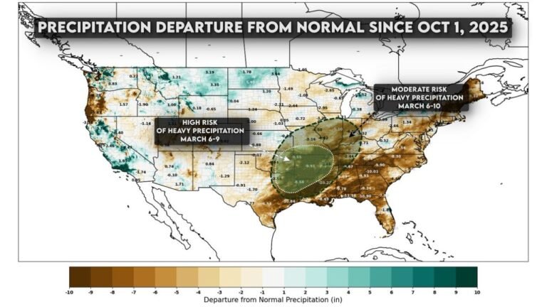
The region is already running a precipitation deficit of 3.66 inches for the year. With the growing season now underway and temperatures about to surge into the 80s and potentially 90s, that deficit is going to become increasingly painful on multiple fronts:
- Farmers entering the growing season are facing dry soil conditions at a critical time
- Brush-fire danger will increase significantly as warm temperatures and dry conditions combine with low humidity
- Drought stress will become more prominent and more visible across the landscape with each passing dry day
The reality of those dry conditions, as forecasters note, will become more prominent with no rain, rising heat, and the growing season underway simultaneously.
The Week at a Glance for Baltimore and the Mid-Atlantic
| Day | Expected Conditions |
|---|---|
| Sunday April 12 | Pleasant, sunny, seasonal — near 70 in Baltimore |
| Monday April 13 | Jump to 80s begins — Baltimore near 82°F |
| Tuesday April 14 | Continued warming across the region |
| Wednesday April 15 | Peak heat — possible 90s in Central Virginia and Frederick to Hagerstown MD |
| Thursday April 16 | Peak heat continues — warmest stretch of the year so far |
| Beyond | No organized rain in sight, drought conditions deepen |
Bottom Line: Enjoy Sunday, Prepare for What Comes Next
Sunday April 12 offers one last pleasant, comfortable day before the pattern transforms. Starting Monday, a rapid jump toward summer-like heat takes over the Baltimore, Washington D.C., Central Virginia, and inland Maryland region. Wednesday and Thursday represent the peak, with 90-degree readings possible from Frederick to Hagerstown and through Central Virginia.
Behind the heat, the drought story is the one that lingers longest. With a 3.66-inch precipitation deficit already built up and no rain on the way, the combination of record-challenging warmth and ongoing dryness will have real consequences for farmers, fire risk, and water resources across the region in the days and weeks ahead.
Stay with CabarrusWeekly.com for daily temperature updates, drought tracking, and the latest forecast as Baltimore and the mid-Atlantic head into the warmest stretch of 2026 so far.