Texas, Oklahoma, Kansas, Missouri, Iowa and Wisconsin Brace for Friday Severe Weather Outbreak With Tornadoes, Giant Hail and Widespread Damaging Winds
UNITED STATES — A potentially dangerous and widespread severe weather outbreak is expected on Friday, stretching from Texas through Oklahoma, Kansas, Missouri, Iowa, and into Wisconsin, as an active storm pattern continues to intensify across the central United States.
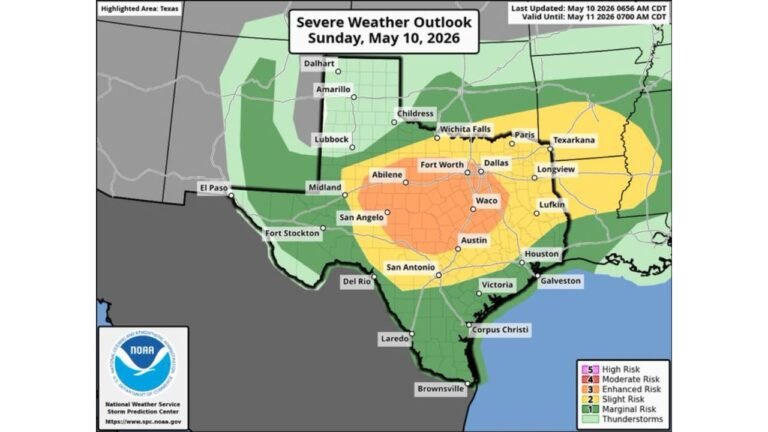
Forecasters are highlighting a broad corridor of severe weather risk, with multiple hazards expected including very large hail, damaging winds, and several tornadoes.
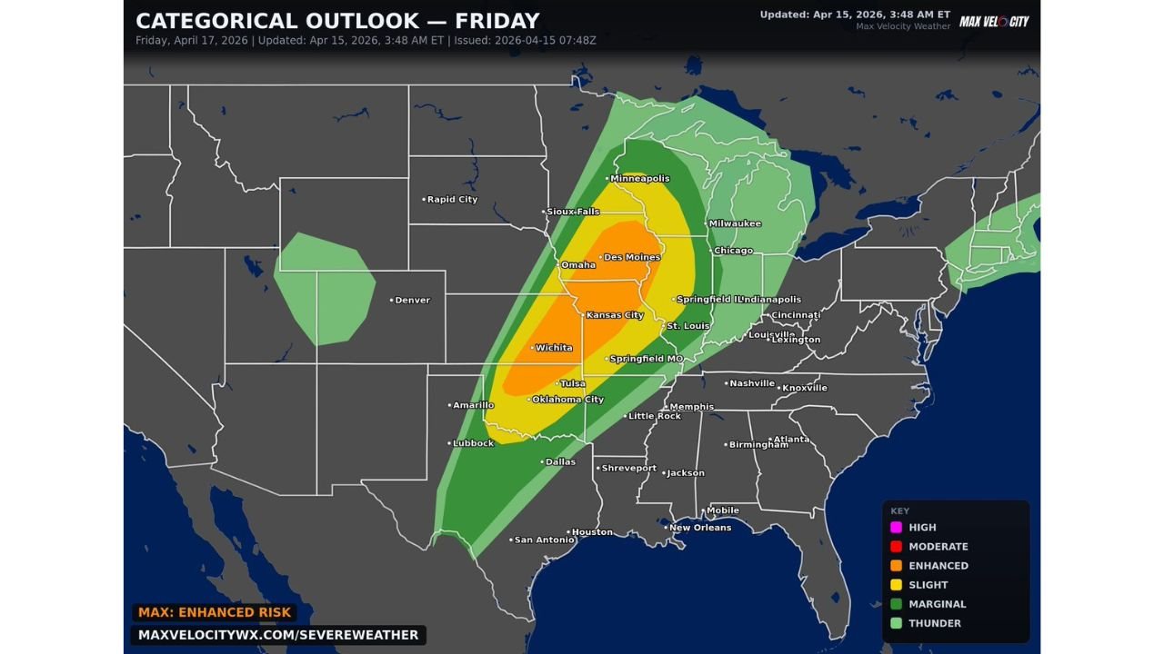
Large Severe Weather Corridor Expands From Texas to the Upper Midwest
The latest outlook shows a long, continuous zone of storm development extending from:
- North Texas and Oklahoma City region
- Through Kansas including Wichita and Kansas City
- Into Missouri including Springfield and St. Louis
- Across Iowa including Des Moines
- Reaching as far north as Minnesota and Wisconsin
This setup indicates a multi-state outbreak scenario, where storms could impact a wide geographic area throughout the day and evening.
Enhanced Risk Zone Signals Higher Impact Potential
The most intense part of the system is centered within an Enhanced Risk (Level 3) zone, covering:
- Central and eastern Kansas
- Much of Missouri
- Parts of Iowa and northern Oklahoma
Within this region, atmospheric conditions are expected to strongly support:
- Organized supercells capable of producing very large hail
- Clusters or lines of storms producing widespread damaging winds
- A few tornadoes, some of which could be strong if storms remain discrete
Storm Evolution Expected Throughout Friday
The severe weather is expected to evolve in phases:
Afternoon:
- Storms begin developing across the Plains
- Initial supercells form with large hail and tornado potential
Evening:
- Storms grow into clusters and lines
- Threat transitions to damaging straight-line winds across multiple states
Night:
- Severe storms continue pushing northeast toward the Upper Midwest and Great Lakes
This progression increases the risk of long-track storm impacts across several states in a short time window.
Why This Setup Is Significant
This outbreak is being driven by:
- A strong upper-level system moving across the Plains
- High moisture levels streaming northward from the Gulf
- Strong wind shear supporting storm rotation
- Warm, unstable air fueling storm intensity
These ingredients together create a classic severe weather outbreak pattern, capable of producing multiple rounds of severe storms.
Areas That Should Prepare Now
Residents across the following areas should stay especially alert:
- Dallas–Fort Worth and North Texas
- Oklahoma City and Tulsa
- Wichita and Kansas City
- Springfield and St. Louis
- Des Moines and surrounding Iowa communities
- Milwaukee and southern Wisconsin
Travelers and residents in these regions should be ready for rapid weather changes, possible warnings, and evening storm impacts.
Bottom Line
A significant multi-state severe weather outbreak is expected Friday, impacting a large portion of the Plains and Midwest from Texas to Wisconsin. With tornadoes, very large hail, and widespread damaging winds all possible, this is a situation that demands close attention.
This active pattern is not ending soon, meaning additional rounds of severe weather may follow in the coming days. Stay weather-aware and prepared as conditions evolve.