Texas to Michigan and New York in Line for Today’s Severe Storm Threat With Tornadoes and Very Large Hail Possible Across Multiple States
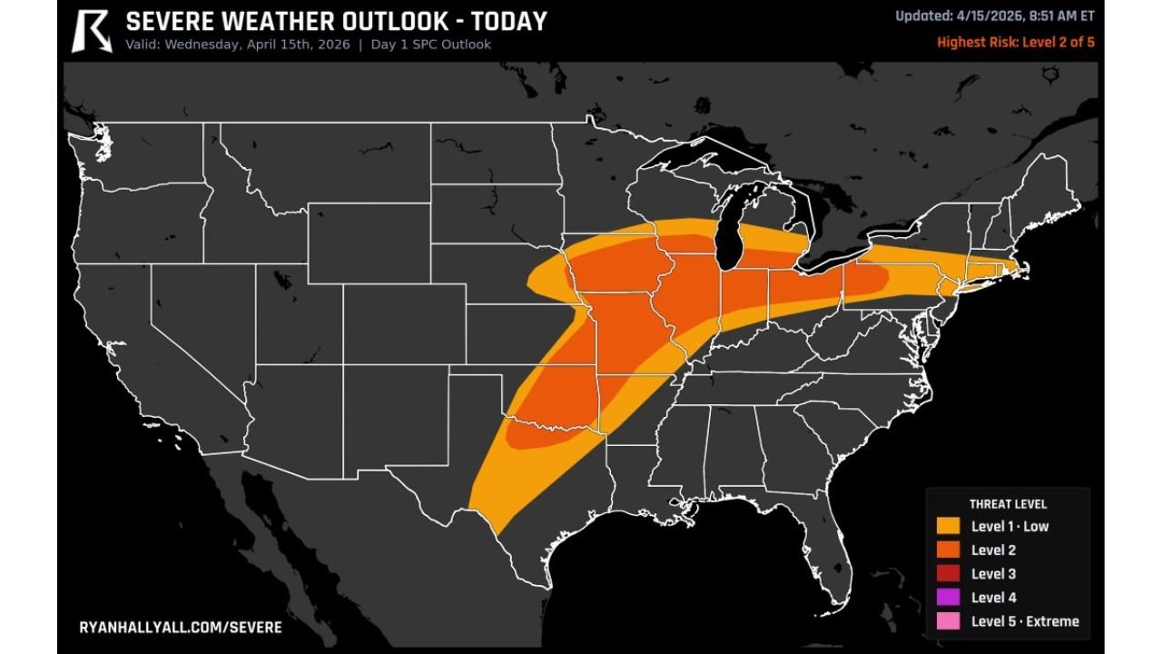
UNITED STATES — A broad and active severe weather setup is unfolding today across the central and eastern United States, with scattered but potentially intense thunderstorms expected to develop from Texas and Oklahoma through the Midwest and into parts of the Northeast.
Storms developing this afternoon and evening could produce very large hail, damaging winds, and a few tornadoes, especially within the more concentrated risk zones stretching northward.
Expansive Risk Area Covers Plains to Great Lakes and Northeast
The latest outlook highlights a wide swath of severe weather potential, extending from:
- North Texas and Oklahoma
- Through Arkansas, Missouri, and Illinois
- Into Indiana, Michigan, and Ohio
- Reaching parts of Pennsylvania and New York
This setup signals a multi-region severe weather day, where storms will be scattered but capable of intensifying quickly in favorable conditions.
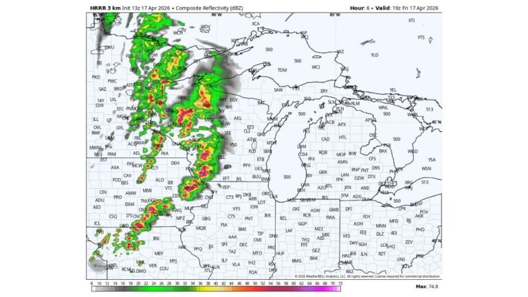
Stronger Storm Corridor Focused Over Midwest Into Great Lakes
The most organized severe weather threat is expected across:
- Missouri and Illinois
- Indiana and southern Michigan
- Parts of Ohio and surrounding states
This region is under a Level 2 risk, where storms could become more structured and capable of producing:
- Very large hail with early supercells
- Damaging wind gusts as storms cluster
- A few tornadoes, especially during peak heating hours
Cities like St. Louis, Chicago, Indianapolis, Detroit, and Cleveland fall within or near this higher-impact corridor.
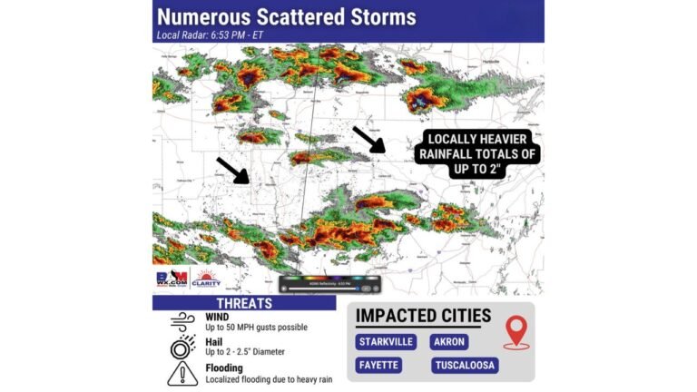
Southern Plains Also Watching Afternoon Storm Development
Farther south, storms are expected to initiate across:
- North Texas
- Oklahoma
- Parts of Arkansas
While coverage here may be more scattered, any storm that forms could quickly become severe, producing:
- Large hail early in development
- Localized damaging winds
- Isolated tornado potential
Timing and Storm Evolution Through the Day
Afternoon:
- Initial storms develop across Texas, Oklahoma, and Missouri
- Discrete supercells begin forming
Evening:
- Storms expand northeast into Illinois, Indiana, and Michigan
- Peak severe threat with hail and tornado risk
Night:
- Storms continue into the Great Lakes and parts of the Northeast
- Wind damage risk increases as storms organize
Why Today’s Setup Matters
This setup is being driven by:
- A strong upper-level system moving through the Plains
- Increasing moisture across the Mississippi Valley
- Favorable wind shear supporting rotating storms
- Warm temperatures fueling instability
Even though the overall risk level is moderate, the large geographic coverage increases the chance of multiple severe storm reports across different regions.
Areas That Should Stay Alert
Residents in the following regions should closely monitor weather updates:
- Dallas–Fort Worth and Oklahoma City
- Little Rock and Memphis
- St. Louis and Chicago
- Indianapolis, Detroit, and Cleveland
- Parts of western Pennsylvania and New York
Bottom Line
Scattered severe storms are expected today across a large portion of the central and eastern U.S., with the potential for very large hail, damaging winds, and a few tornadoes. While storms may not be continuous, any storm that develops could become dangerous quickly.
Stay weather-aware through the afternoon and evening as this widespread severe weather setup unfolds.