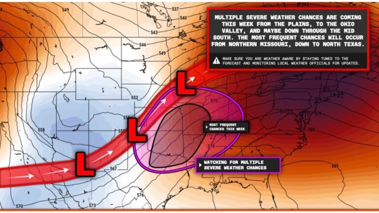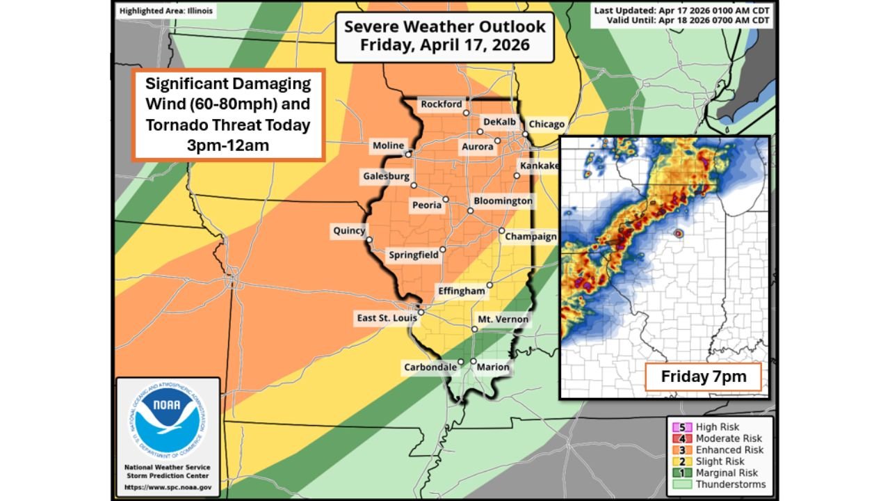
Illinois Faces 60 to 80 MPH Damaging Winds and Tornado Threat Friday From 3 PM Through Midnight
CHICAGO, ILLINOIS — A dangerous severe weather outbreak is unfolding across Illinois this Friday, with 60 to 80 MPH damaging wind gusts and several tornadoes likely from the afternoon through midnight as a fast-moving cold front sweeps east across Iowa and Illinois.
Storms Fire as Early as 2 PM Across Iowa Before Pushing Into Illinois
Thunderstorms are expected to develop as soon as 2 to 3 PM across central and eastern Iowa, initially producing very large hail before transitioning into tornado-producing supercells as they mature and push east. By 3 to 4 PM, the threat crosses into Illinois and ramps up quickly.
Timing by Region Across the Affected Area
| Region | Threat Window |
|---|---|
| Eastern Iowa | 3 PM to 10 PM |
| Northwest Illinois and Wisconsin | 3 PM to 10 PM |
| Northern Illinois / Chicagoland | 4 PM to Midnight |
| Northwest Indiana | 8 PM to 2 AM |
Northwest Illinois Faces the Greatest Tornado Danger
The tornado threat is highest across northwest Illinois, particularly along and west of I-39. As storms mature and move east through the evening, the threat character shifts — transitioning from tornadoes and large hail into widespread significant damaging winds with embedded tornadoes pushing into Chicago and northwest Indiana overnight. Storms exit Illinois after midnight.
Every Part of Illinois Is in the Damaging Wind Zone
The NWS Storm Prediction Center outlook confirms a significant damaging wind threat is in place for everyone across Illinois — from Rockford and Moline in the north to Carbondale and Marion in the south. No part of the state is out of range. Residents should secure outdoor items, charge devices, and know their shelter location before 3 PM.
Stay with CabarrusWeekly.com for live severe weather updates across Illinois, Iowa, and northwest Indiana.