Wisconsin, Iowa and Illinois Face Significant Tornado Threat Friday With Level 3 Risk Zone
MADISON, WISCONSIN — A major tornado setup is taking shape across the upper Midwest this Friday, with Wisconsin, Iowa, and Illinois all under elevated tornado risk and the highest danger concentrated in a corridor stretching from southern Wisconsin into the Quad Cities region.
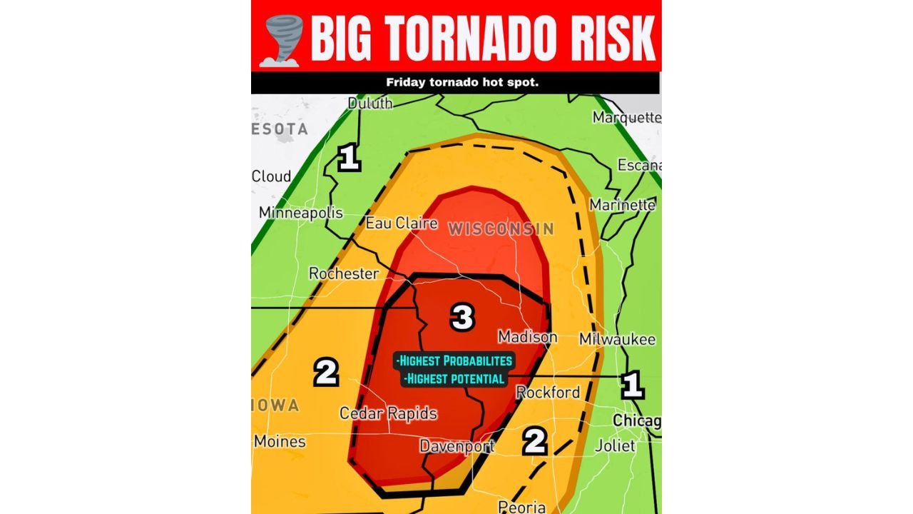
Level 3 Tornado Zone Covers Southern Wisconsin Into the Quad Cities
The storm prediction outlook places southern Wisconsin at the center of a Level 3 out of 5 tornado risk, the highest tier on today’s map. The zone is outlined with a bold black boundary, which signals the highest probability of significant tornadoes if storms develop as expected. Cities including Madison and Davenport fall within or near this most dangerous corridor.
How the Risk Zones Break Down Across the Region
| Risk Level | Zone Color | Key Areas |
|---|---|---|
| Level 3 (Highest) | Red with black outline | Southern Wisconsin, Davenport area |
| Level 2 | Orange | Eastern Iowa, Cedar Rapids, northern Illinois, Rockford |
| Level 1 | Green | Minneapolis area, Chicago, Joliet, Peoria |
The black-outlined area within the Level 3 zone represents where conditions are most favorable for strong, long-track tornadoes — not just brief spin-ups.
Who Is Most at Risk Friday
Iowa communities including Cedar Rapids and Davenport sit within or adjacent to the Level 2 to Level 3 overlap zone. Illinois residents near Rockford face a Level 2 threat, while Chicago and Joliet are on the outer Level 1 fringe. Residents across all three states should treat this as an active threat day and have a shelter plan ready before storms arrive.
What to Do Before Storms Arrive
Know your shelter location now. Do not wait for warnings to be issued. Significant tornadoes can produce little lead time in fast-moving storm environments. Monitor local alerts throughout the afternoon and evening hours.
Stay with CabarrusWeekly.com for live tornado threat updates across Wisconsin, Iowa, and Illinois.