West Virginia and Virginia Bear the Brunt of Severe Thunderstorm Outbreak Stretching From Indiana to Maryland on May 27
WEST VIRGINIA AND VIRGINIA — A severe thunderstorm outbreak is underway across a broad corridor stretching from Indiana to Maryland as of 3:00 PM ET on Wednesday, May 27, 2026. High winds and large hail are the primary threats, with West Virginia and Virginia identified as the prime zones for the most intense storm activity. An isolated tornado or two cannot be ruled out across the region through the remainder of the day.
The Threat Zone: Indiana to Maryland
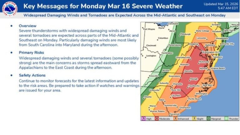
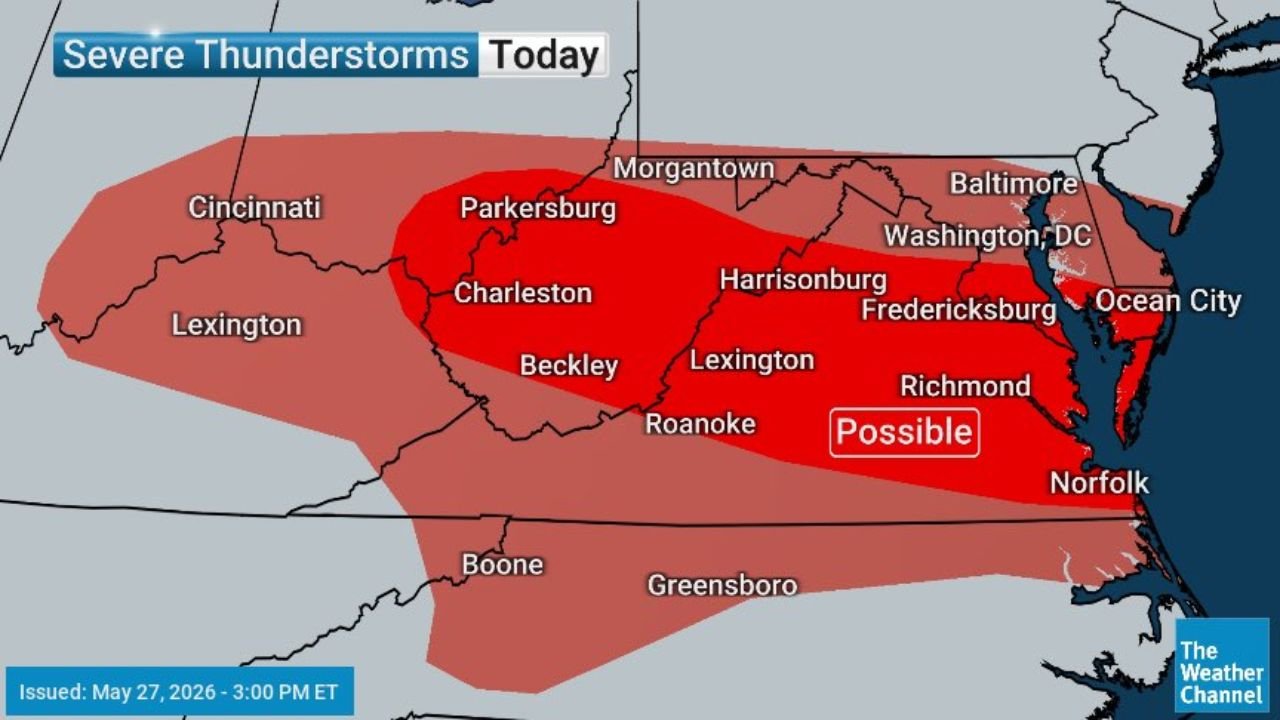
The severe thunderstorm map issued at 3:00 PM ET shows a large risk area covering multiple states across the mid-Atlantic and Appalachian region. The threat zone spans:
- West Virginia including Charleston, Parkersburg, Beckley and Morgantown
- Virginia including Roanoke, Harrisonburg, Lexington, Fredericksburg and Richmond
- Maryland including areas near Washington D.C., Baltimore and Ocean City
- Portions of Indiana and Ohio on the western edge of the corridor near Cincinnati
The deepest red core on the map, labeled “Possible”, is concentrated across central and eastern Virginia, covering the Richmond, Roanoke and Norfolk corridor.
Primary Hazards Today
The main threats with these storms are:
- High winds capable of downing trees and power lines
- Large hail across the prime zones in West Virginia and Virginia
- Isolated tornado possible, described as an outside chance across the region
Cities Most at Risk Right Now
Residents in the following communities should remain weather-aware through the rest of the afternoon and evening:
- Charleston and Parkersburg, West Virginia
- Roanoke, Harrisonburg, Lexington and Richmond, Virginia
- Fredericksburg and Norfolk, Virginia
- Washington D.C. and Baltimore, Maryland
- Ocean City, Maryland
What to Do If Storms Approach
- Move indoors immediately at the first sign of darkening skies or gusty winds
- Stay away from windows during active storm passage
- Unplug sensitive electronics ahead of approaching storms
- Have a shelter location identified in case a tornado warning is issued for your area
Stay with CabarrusWeekly.com for continuing updates as this severe thunderstorm threat moves through the mid-Atlantic through Wednesday evening.