3 Days of Severe Storms Sweep From the Northern Plains to Oklahoma and Arkansas Wednesday Through Friday This Week
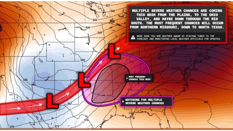
CENTRAL PLAINS — A relentless multi-day severe weather sequence is unfolding across the central United States this week, with three consecutive days of organized severe storm threats outlined for Wednesday April 22, Thursday April 23, and Friday April 24 — driving southeastward from the northern Plains through Kansas and Oklahoma and into the ArkLaTex corridor.
Wednesday — Red Zone Alert From North Platte to Wichita and Amarillo
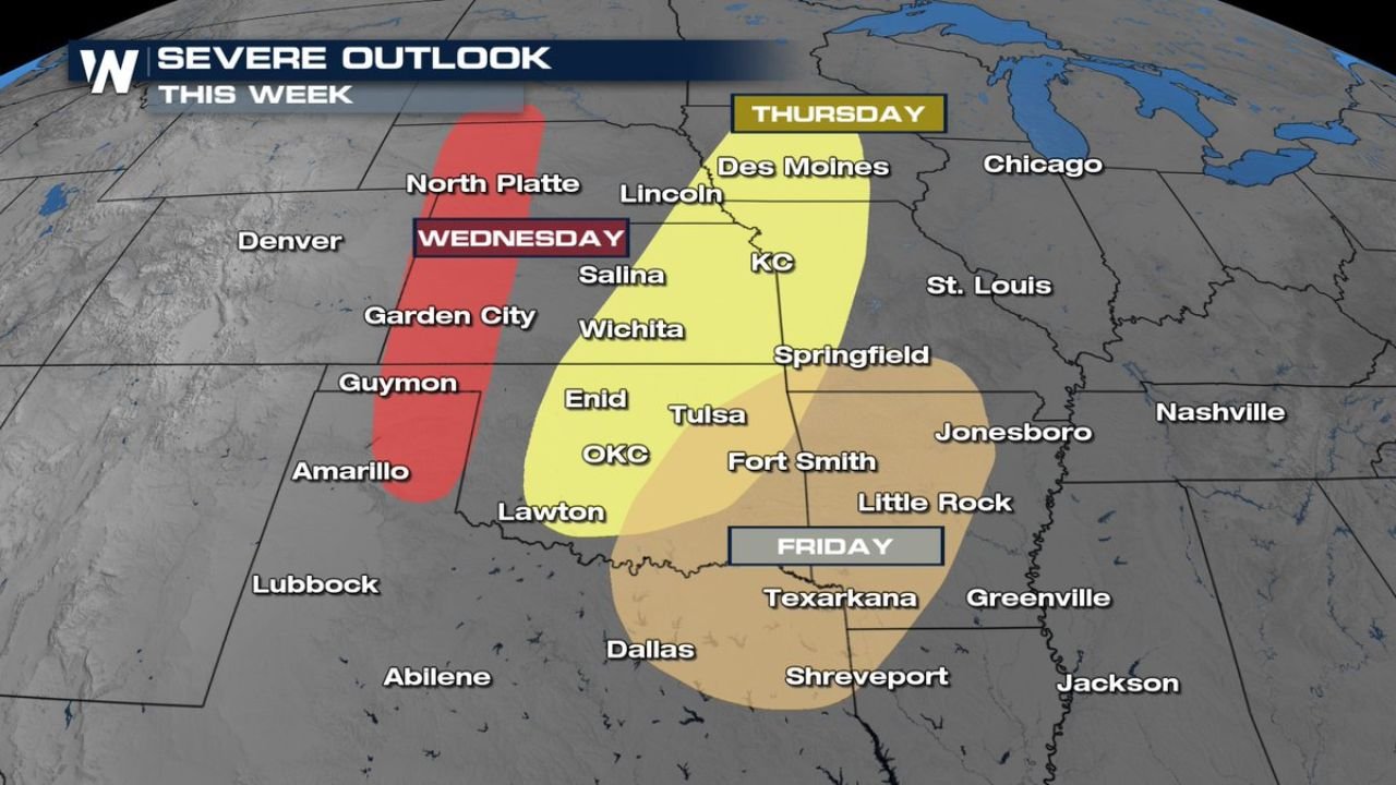
Wednesday carries the most urgent immediate threat, with a red-shaded enhanced risk zone stretching from North Platte and Garden City southward through Salina, Wichita, Guymon, and toward Amarillo. This elevated risk designation signals organized and significant severe weather is expected Wednesday afternoon and evening along the developing dryline corridor across central Kansas and the Oklahoma Panhandle.
Thursday — Largest Risk Zone Covers Des Moines to OKC and Fort Smith
Thursday’s risk area expands dramatically, with the yellow severe outlook zone — the broadest footprint of the three-day sequence — stretching from Des Moines and Lincoln southward through Kansas City, Wichita, Enid, Tulsa, Oklahoma City, Lawton, and Fort Smith. All severe hazard types remain possible Thursday as stronger atmospheric forcing and better moisture combine across the central Plains and lower Midwest.
Friday — Threat Slides Into ArkLaTex and Mid-South
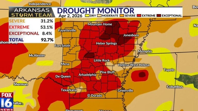
By Friday, the severe weather corridor shifts further southeastward into the ArkLaTex region and Mid-South, with the risk zone covering Texarkana, Shreveport, Little Rock, Greenville, and Jackson. Friday’s area is slightly smaller but still carries significant severe storm potential as the system continues tracking east.
| Day | Risk Level | Primary Cities Threatened |
|---|---|---|
| Wednesday Apr 22 | Enhanced — Red zone | North Platte, Salina, Wichita, Amarillo |
| Thursday Apr 23 | Slight to Enhanced | Des Moines, KC, Wichita, OKC, Fort Smith |
| Friday Apr 24 | Marginal to Slight | Texarkana, Shreveport, Little Rock, Jackson |
Northern Plains to Central Plains — A Continuous Severe Weather Conveyor
The three-day outlook represents a continuous southeastward progression of the severe weather threat as the driving storm system tracks across the region. Each day’s risk zone overlaps with the previous day’s southern fringe, creating an almost unbroken corridor of severe storm potential from Nebraska and Kansas all the way to the Louisiana border across the three-day period.
Residents from North Platte and Wichita through Oklahoma City and all the way to Shreveport should remain on high alert every day from Wednesday through Friday and have severe weather plans finalized before Wednesday afternoon arrives.
Stay with CabarrusWeekly.com for live severe weather outlook updates across the Plains, Oklahoma, and the ArkLaTex through Friday April 24.