Texas, Oklahoma, Arkansas and Tennessee Face Supercells With Very Large Hail, Damaging Winds and Tornadoes Possible Tuesday Afternoon and Evening From Dallas to Memphis
TEXAS, OKLAHOMA, ARKANSAS AND TENNESSEE — A Slight Risk severe weather outbreak is taking shape for Tuesday, May 5, 2026, with supercells capable of producing very large hail, damaging winds and a couple of tornadoes threatening a corridor stretching from Dallas, Texas to Memphis, Tennessee during the afternoon and evening hours.
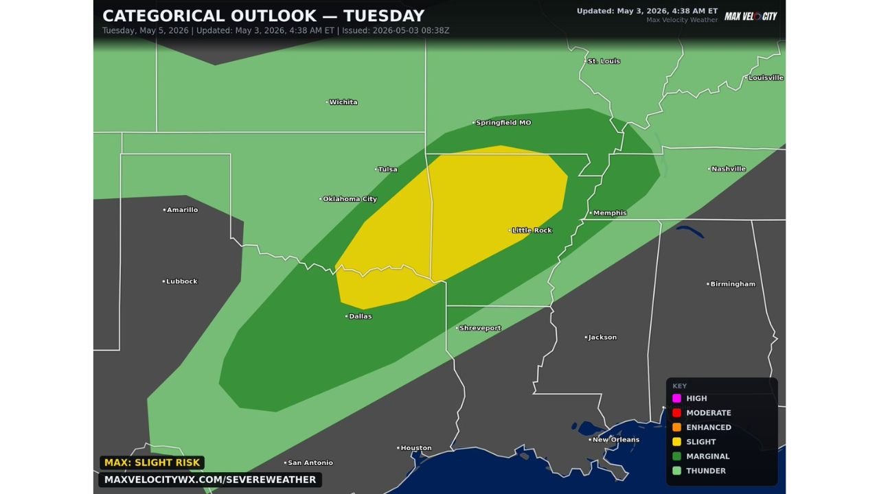
Slight Risk Zone Covers Dallas Through Little Rock to Memphis
The categorical outlook places a Slight Risk zone centered over a corridor running from north Texas and Oklahoma City northeast through Tulsa, Little Rock and up to Memphis. The yellow Slight Risk oval on the outlook map tightly outlines the area where supercell development is most expected Tuesday afternoon.
A broader Marginal Risk surrounds the core zone, extending the general storm threat to Springfield MO, Nashville, Jackson, Shreveport and Houston. A wide Thunder risk zone covers the full surrounding region.
Hazards Inside the Slight Risk Zone Tuesday
- Hail — very large hail possible with supercell development
- Wind — damaging wind gusts
- Tornado — a couple of tornadoes possible
Timing — Afternoon Into Evening is the Primary Window
The threat is focused on Tuesday afternoon and evening. Supercell storms are expected to develop and track northeast through the risk corridor during those hours. Residents inside the Slight Risk zone should have their severe weather plan in place before Tuesday afternoon arrives.
Cities sitting within or near the Slight Risk zone include Dallas, Oklahoma City, Tulsa, Little Rock, Memphis and Shreveport.
Stay with CabarrusWeekly.com for live Tuesday severe weather updates across Texas, Oklahoma, Arkansas and Tennessee.