Orlando Florida Hit by Weakly Rotating Supercell Thunderstorm With Quarter Size Hail as Forecasters Watch for Possible Rotation Intensification
ORLANDO, FLORIDA — A weakly rotating supercell thunderstorm is moving through Orlando, Florida with quarter-sized hail as the primary hazard, while forecasters are actively monitoring the storm in case rotation intensifies to a more dangerous level.
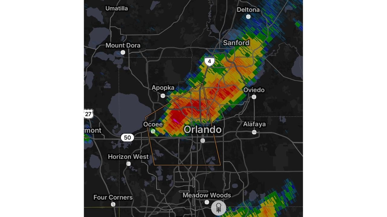
Supercell Tracking Directly Over Orlando With Warning Polygon in Place
Radar shows the supercell’s most intense core centered directly over Orlando, with a severe thunderstorm warning polygon outlined across the city and extending northeast toward Sanford and Oviedo. The storm is tracking along the Interstate 4 corridor with the highest reflectivity values — shown in deep red on radar — positioned over Ocoee and central Orlando.
Surrounding communities in the warning area include Apopka, Oviedo, Alafaya and Sanford to the northeast.
Quarter Size Hail Is the Main Threat Right Now
The primary confirmed hazard with this storm is quarter-sized hail. Damage to vehicles, outdoor property and vegetation is possible across the warning area as the storm moves through.
Rotation Being Monitored Closely
While the supercell is currently classified as weakly rotating, forecasters are watching the storm closely in the event that rotation increases. A pink couplet signature is visible on radar near the Ocoee and Orlando core, indicating some rotational velocity is present within the storm at this time.
Residents across Orlando, Sanford, Apopka and Oviedo should seek shelter immediately and stay away from windows until this storm passes.
Stay with CabarrusWeekly.com for live updates on this developing storm over Orlando and Central Florida.