East Texas, Mississippi and Alabama Face Level 2 Severe Storm Risk Wednesday With Damaging Wind Gusts, Large Hail and Tornadoes Possible as Cold Front Moves Through Afternoon Into Overnight
EAST TEXAS — Scattered severe storms are expected across East Texas, Mississippi and Alabama on Wednesday, May 6, 2026, as a cold front pushes through the region during the afternoon and overnight hours. The highest risk reaches Level 2 of 5 across the core zone, with damaging wind gusts, large hail and a few tornadoes all possible.
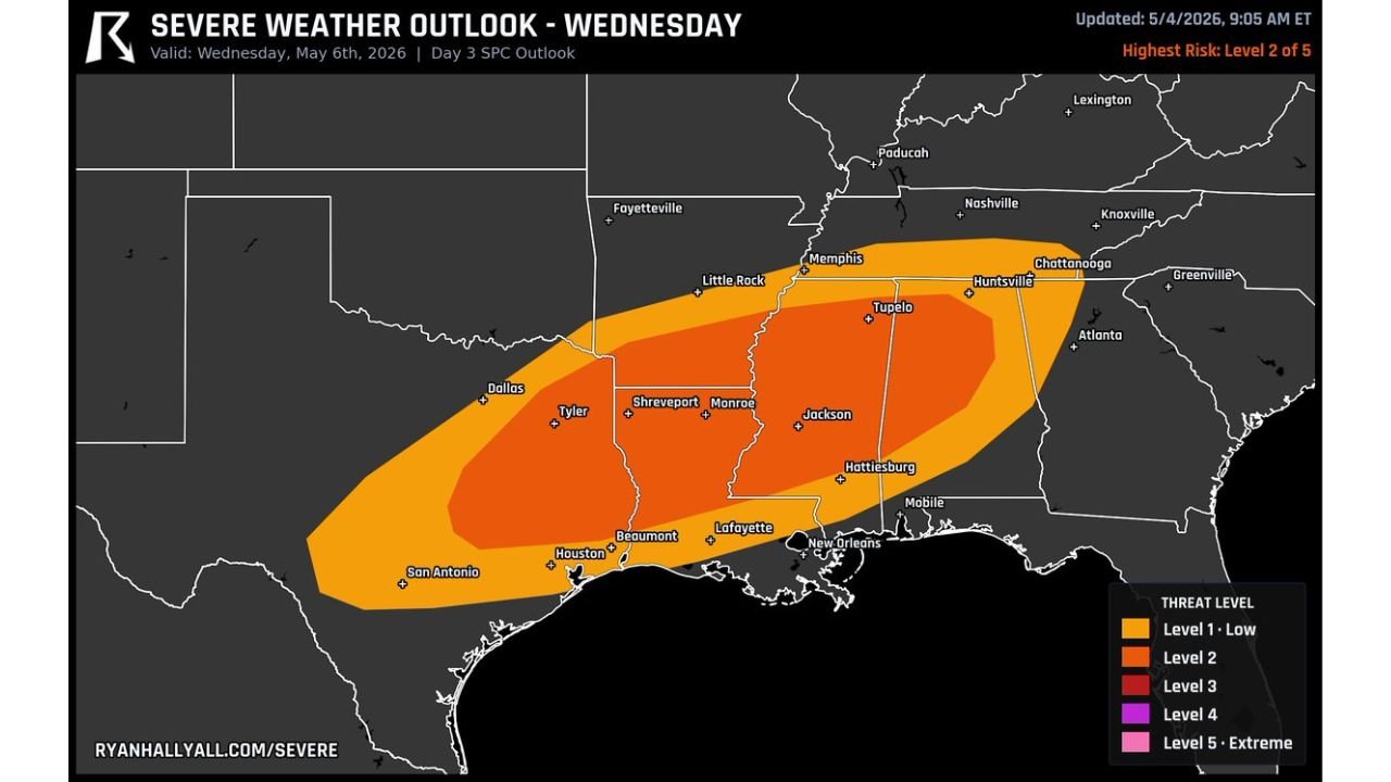
Level 2 Core Zone Covers a Wide Corridor From Texas to Alabama
The Day 3 SPC outlook valid Wednesday, May 6 places the Level 2 risk across a broad corridor stretching from East Texas and Houston northeast through Shreveport, Monroe, Jackson, Tupelo and into Huntsville and northern Alabama. A wider Level 1 Low risk surrounds the core area extending coverage from San Antonio and Dallas through Memphis, Mobile and New Orleans.
Hazards Expected Wednesday Afternoon Into Overnight
- Wind — damaging wind gusts
- Hail — large hail possible across the risk zone
- Tornado — a few tornadoes possible
Cities Inside the Risk Zone Wednesday
| Risk Level | Cities |
|---|---|
| Level 2 | Tyler, Shreveport, Monroe, Jackson, Tupelo, Huntsville, Hattiesburg |
| Level 1 | Dallas, Houston, Beaumont, Lafayette, New Orleans, Memphis, Mobile, Chattanooga |
Timing — Afternoon Through Overnight
The cold front driving this event will push through during Wednesday afternoon and continue into the overnight hours. Residents across East Texas, Louisiana, Mississippi and Alabama should have weather alerts active well before Wednesday afternoon and maintain awareness through the overnight period.
Stay with CabarrusWeekly.com for live Wednesday severe weather updates across East Texas, Mississippi and Alabama.