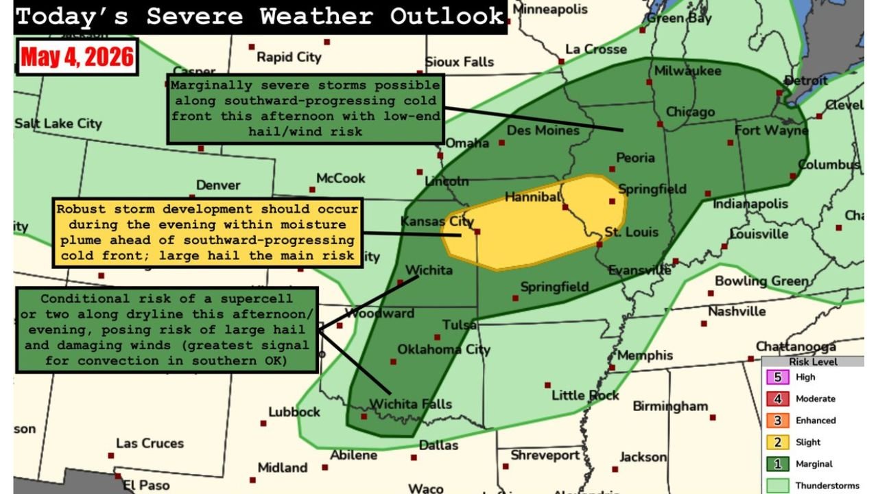
Kansas, Illinois, Missouri and Southern Oklahoma Face Large Hail and Damaging Winds Monday With Slight Risk Evening Storms and Conditional Supercell Threat Along the Dryline
KANSAS — Severe weather is returning across a wide corridor from the Great Lakes to the Southern Plains on Monday, May 4, 2026, as moisture advances north ahead of a southward-progressing cold front. Large hail and damaging winds are the main threats across the entirety of the risk area today, with the most intense activity expected during the evening hours across the Slight Risk zone from eastern Kansas into central Illinois.
Three Distinct Threat Areas Active Today
The outlook for Monday identifies three separate zones of concern:
Zone 1 — Marginal Risk, Midwest and Great Lakes this afternoon A few marginally severe storms are possible along the cold front across the Midwest and Great Lakes region this afternoon, with a low-end hail and wind risk across areas including Des Moines, Chicago, Fort Wayne, Columbus and Indianapolis.
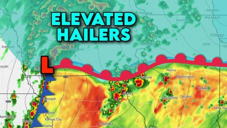
Zone 2 — Slight Risk Level 2, Eastern Kansas into Central Illinois this evening Robust storm development is expected during the evening hours within the moisture plume ahead of the cold front. The Slight Risk zone covers Kansas City, St. Louis, Hannibal, Springfield and Evansville. Large hail is the main risk in this zone.
Zone 3 — Conditional Dryline Risk, Southeast Kansas to Far North Texas this afternoon into early evening A conditional risk for a supercell or two exists along the dryline from southeast Kansas through Woodward, Tulsa and Oklahoma City down toward Wichita Falls. The greatest signal for convective development is across southern Oklahoma. Large hail and damaging winds are possible if storms develop.
Hazards Across the Full Risk Area Today
- Hail — large hail is the primary threat across all zones
- Wind — damaging wind gusts possible across the full corridor
- Supercell — conditional risk along the dryline in southern Oklahoma and north Texas
Risk Zone Summary
| Zone | Area | Timing | Max Risk |
|---|---|---|---|
| Marginal | Great Lakes and Midwest | This afternoon | Level 1 |
| Slight | Eastern Kansas to central Illinois | This evening | Level 2 |
| Conditional dryline | Southeast Kansas to north Texas | Afternoon into early evening | Supercell possible |
Residents across Kansas, Missouri, Illinois and southern Oklahoma should keep weather alerts active throughout Monday afternoon and into the evening hours.
Stay with CabarrusWeekly.com for live Monday severe weather updates across the Great Lakes, Midwest and Southern Plains.