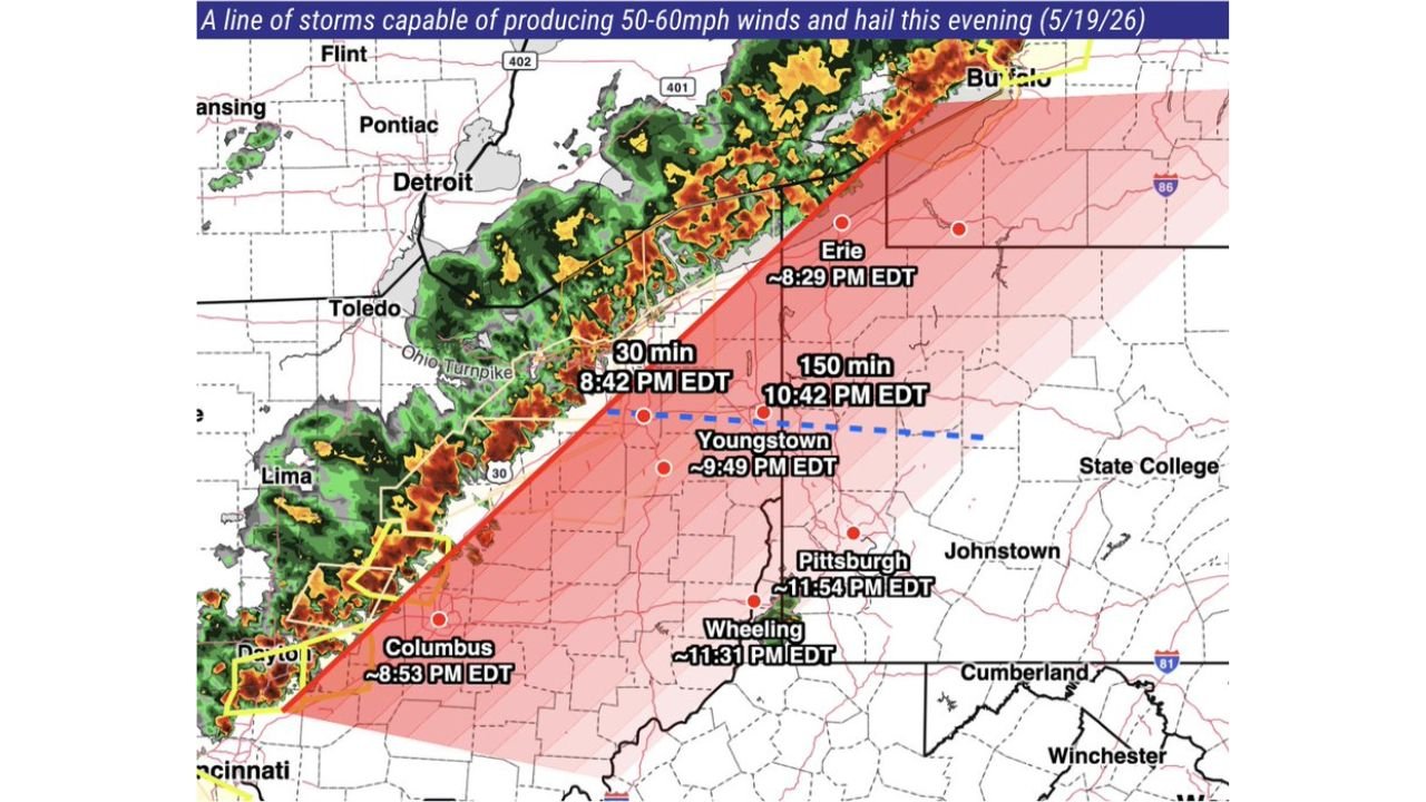
Severe Storm Line With 50 to 60 MPH Winds and Hail Targeting Ohio Pennsylvania and West Virginia Including Columbus by 8:53 PM Erie by 8:29 PM Youngstown by 9:49 PM and Pittsburgh by 11:54 PM Tuesday
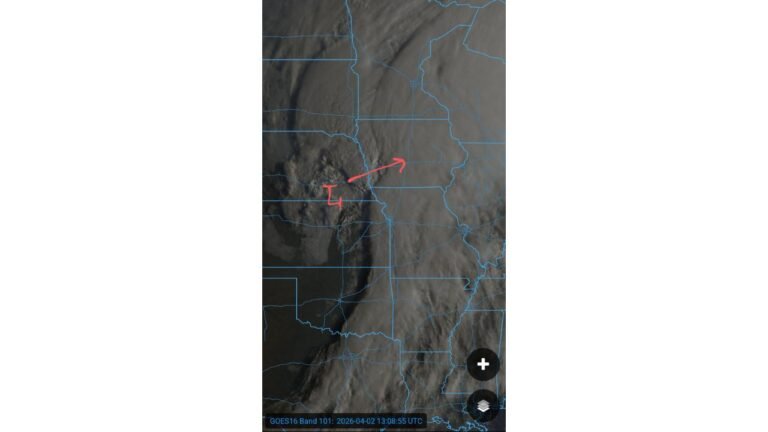
OHIO — A fast-moving line of strong to severe thunderstorms is pushing eastward across Ohio and into Pennsylvania and West Virginia this Tuesday evening, May 19, 2026, carrying the threat of 50 to 60 mph damaging wind gusts and hail. Forecasters have tracked the line and issued specific arrival time estimates for communities directly in its path.
Exact Storm Arrival Times for Your City
Residents in the following cities need to take shelter before these times arrive:
| City | Estimated Storm Arrival |
|---|---|
| Erie, Pennsylvania | Approximately 8:29 PM EDT |
| Columbus, Ohio | Approximately 8:53 PM EDT |
| Youngstown, Ohio | Approximately 9:49 PM EDT |
| Wheeling, West Virginia | Approximately 11:31 PM EDT |
| Pittsburgh, Pennsylvania | Approximately 11:54 PM EDT |
The Two Threats Coming With This Storm Line
Every cell within this storm line is capable of producing:
- Damaging wind gusts of 50 to 60 mph
- Hail capable of damaging vehicles and property
Wind damage is the primary concern with this type of fast-moving organized line. Gusts at 50 to 60 mph are strong enough to down trees, snap branches, damage roofs, and knock out power across the affected corridor.
The Full Path of This Storm Line
The storm corridor is tracking along a southwest to northeast path, pushing through the Ohio Turnpike corridor and pressing into western and central Pennsylvania and northern West Virginia. Additional communities along this track between the listed cities, including Toledo, Lima, Dayton, Youngstown, Johnstown, and State College, should also be on alert throughout the evening.
What to Do Before Your Arrival Time Hits
Do not wait until you hear thunder to act. If your city is on this list, move indoors now, secure any loose outdoor items, and stay away from windows. Power outages are possible as wind gusts push through the area. Have flashlights and chargers ready before storms arrive.
Stay with CabarrusWeekly.com for live storm tracking updates as this line continues pushing east tonight.