Moderate Snow Band Targets Illinois, Indiana, Iowa and Missouri as Models Trend Heavier Totals South of I-80
MIDWEST — Forecasters are closely monitoring a developing winter system expected to bring accumulating snow Sunday evening into Monday morning across portions of Iowa, Missouri, Illinois, and Indiana, with the heaviest snowfall currently projected across central Illinois and areas south of Interstate 80.
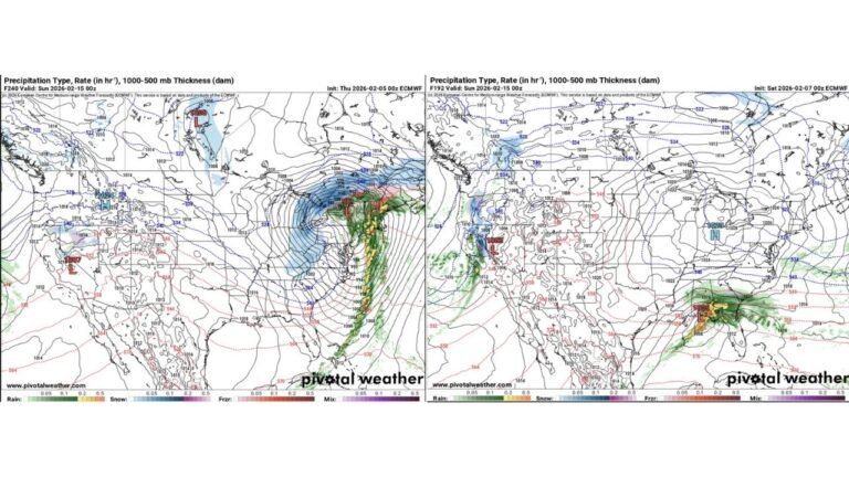
Latest model ensembles show a defined swath of moderate snowfall stretching from eastern Iowa and northern Missouri through central Illinois and into Indiana.
Snow Trends Shift North After Earlier Southward Drift
Over the past several days, forecast guidance had nudged the snow band farther south. However, overnight model runs have adjusted the corridor back northward, now including portions of northern Illinois within the accumulating snow zone.
Despite that northward adjustment, the strongest signal for heavier totals remains focused across:
- Central Illinois
- South of I-80 in northern Illinois
- Parts of Indiana
- Eastern Iowa and northern Missouri
Forecasters stress that while details may still change, confidence is increasing in a measurable snowfall event across the region.
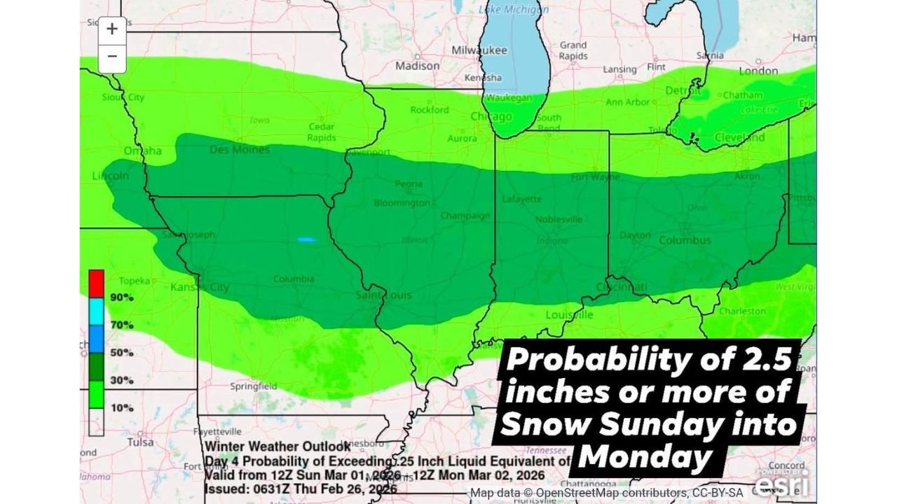
2–5 Inches Possible in Central Illinois
Current projections indicate central Illinois could see 2 to 5 inches of snowfall, with moderate probabilities of exceeding 2.5 inches across a broad area.
The National Weather Service outlook shows:
- Higher probabilities (around 50–70%) for 2.5 inches or more from eastern Iowa through central Illinois into Indiana
- Lower but notable probabilities extending north toward the Chicago metro and southern Wisconsin
- Snow chances tapering farther south into Kentucky and southern Missouri
Northern Illinois Impact Hinges on I-80 Line
Across northern Illinois, the heaviest snowfall is expected along and south of Interstate 80.
Areas north of I-80, including parts of the Chicago metro region, could still see around an inch or more, depending on final storm track and thermal profiles.
Small shifts in the system’s path could significantly alter where the heaviest snow band ultimately sets up.
Timing: Sunday Evening Into Monday Morning
The accumulating snow is expected to develop Sunday evening, continuing overnight and into early Monday.
Impacts may include:
- Slippery road conditions during the Monday morning commute
- Reduced visibility in heavier bands
- Snow-covered secondary roads
Because the event remains several days out, refinements in totals and exact placement are expected as new model data arrives.
What to Watch Next
Key forecast factors to monitor include:
- North–south adjustments in the storm track
- Temperature profiles determining snow ratios
- Banding features that could locally enhance totals
Forecasters will continue issuing updated snowfall probability maps as the event approaches.
Residents across Illinois, Indiana, Iowa, and Missouri should review travel plans and stay alert for updates as the system evolves.
Stay with CabarrusWeekly.com for continued weather coverage as new guidance comes in.