Texas and Oklahoma in the Crosshairs Wednesday: 15% Severe Risk Centers on Dallas–Fort Worth, Wichita Falls and Ardmore Corridor
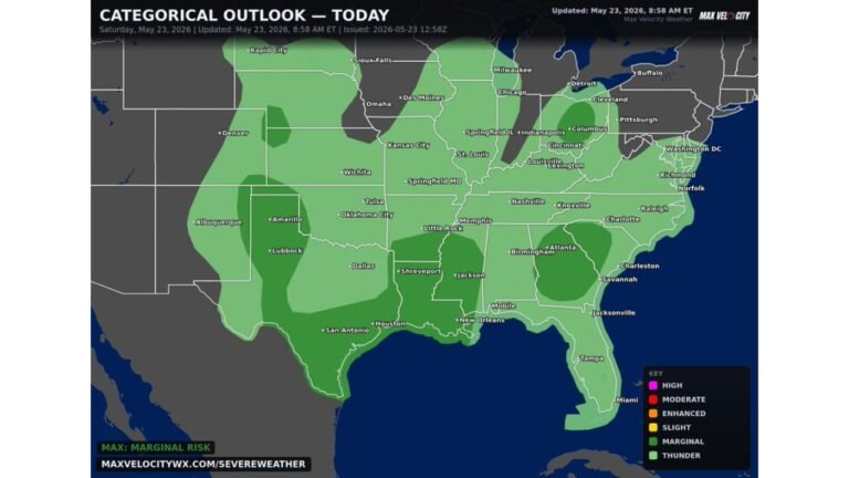
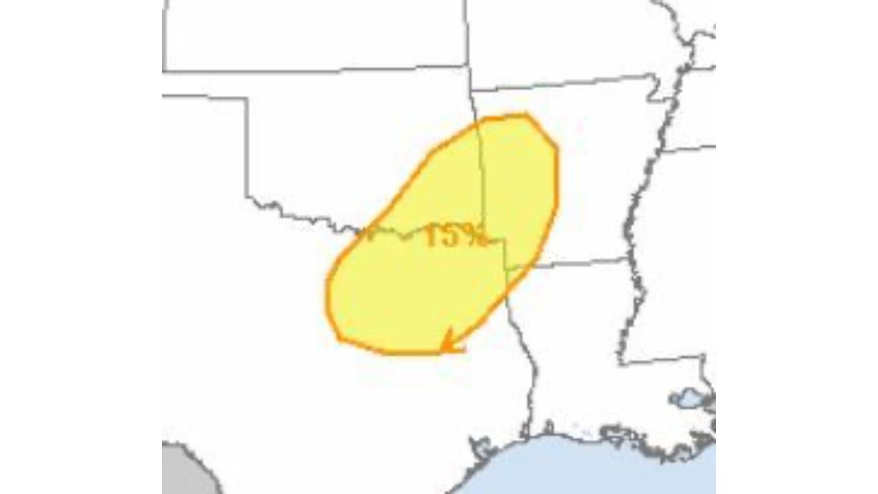
TEXAS & OKLAHOMA — A developing severe weather setup could bring strong to locally severe thunderstorms across parts of the Southern Plains on Wednesday, with the greatest risk currently centered from north Texas into southern Oklahoma.
Forecast guidance highlights a 15% severe probability area stretching across the Red River region, placing several major metro areas in the zone of concern.
Where the Greatest Risk Is Located
The highlighted risk area includes:
• Dallas
• Fort Worth
• Wichita Falls
• Ardmore
Storm development is expected during the afternoon and evening hours, when daytime heating combines with increasing wind energy aloft.
While forecast adjustments are still possible over the next couple of days, this corridor currently appears most favored for stronger storm organization.
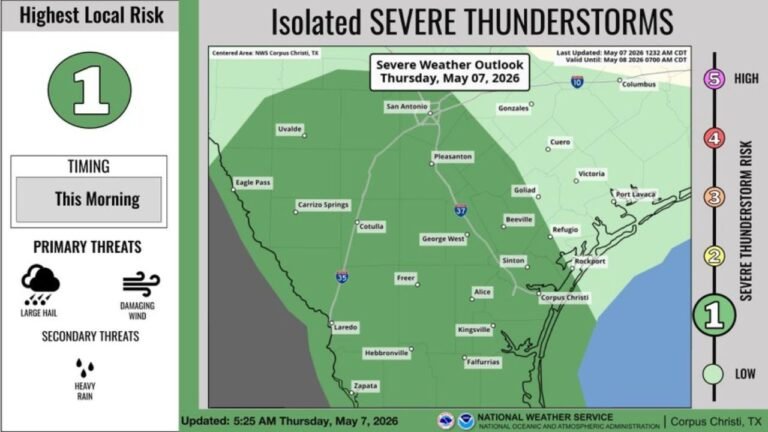
Primary Threats: Wind and Hail
If thunderstorms become organized, the main hazards may include:
• Damaging wind gusts
• Large hail
• Brief heavy rainfall
Large hail is possible in stronger updrafts, particularly if storms develop semi-discrete structures before consolidating into clusters.
Tornado Risk: Low but Not Zero
The tornado threat currently appears limited. However:
• Any storm that remains isolated
• Or interacts with localized boundaries
could briefly increase rotation potential.
At this stage, tornado risk is considered lower than wind and hail threats, but residents should remain weather aware.
Timing and Storm Evolution
Current projections suggest:
• Storm initiation during mid to late afternoon
• Peak intensity into the evening
• Gradual weakening overnight
The exact timing will depend on how quickly instability builds and how the upper-level system evolves.
What This Means for North Carolina
While this event is unfolding well west of the Carolinas, early March is a transition period when severe weather patterns begin expanding eastward.
For Cabarrus County and surrounding North Carolina communities, this setup serves as a reminder that severe weather season is gradually ramping up across the southern United States.
We will continue monitoring storm trends and provide updates if similar dynamics begin shifting toward the Southeast.
Residents in the Dallas–Fort Worth area, Wichita Falls, and Ardmore should stay alert for possible watches or warnings Wednesday afternoon and evening.
For continuing updates and regional weather coverage, stay with CabarrusWeekly.com.