North Carolina Faces 40-Degree Temperature Swing From 20s to 60s Before Rain, Cold Air and Possible Freezing Mix Early Next Week
NORTH CAROLINA — Residents across North Carolina are in for a dramatic stretch of weather swings, with temperatures jumping from the 20s in the morning to the 60s by afternoon — followed by rain, colder air, and even the possibility of a brief freezing mix early next week.
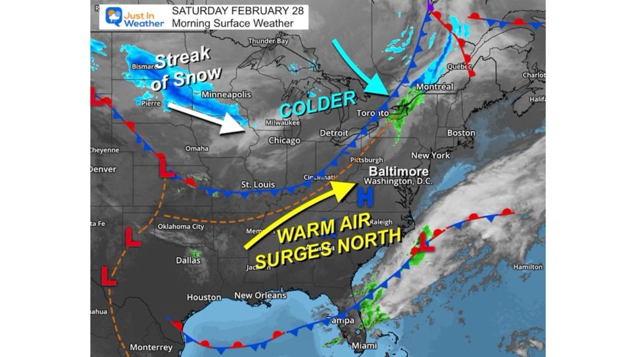
Forecast maps show a strong warm air surge pushing northward ahead of an approaching system, setting up rapid temperature changes across the region.
Saturday: From Winter Chill to Spring-Like Warmth
Saturday morning begins cold, with many inland areas starting in the 20s and low 30s.
By afternoon:
• Piedmont communities may reach the lower to mid 60s
• Southern North Carolina could push into the mid 60s
• Coastal areas remain cooler, mainly 50s
This sharp temperature swing is being driven by strong southerly flow transporting warmer air northward.
Sunday: Showers and a Cooler Turn
By Sunday, a frontal boundary approaches from the west.
Expected impacts:
• Periods of rain developing
• Cooler air filtering into northern sections
• A brief rain/snow mix possible north of North Carolina
While widespread snow is not expected locally, areas north of the state — including parts of Pennsylvania and New York — could see slushy accumulations.
Fog may also expand at times as moisture increases.
Monday: Colder and Drier
Behind Sunday’s system:
• Temperatures cool noticeably
• Dry conditions return
• Any lingering winter precipitation risk fades
High pressure settles in temporarily, providing a short break in active weather.
Tuesday: Early Morning Mix Possible Before Warming
Forecast guidance indicates another system may approach Tuesday morning.
Key details:
• A brief window for freezing rain cannot be ruled out in colder inland pockets
• Ground temperatures remain relatively warm, limiting widespread impact
• Most areas transition to plain rain by afternoon as temperatures rise
The setup suggests any icing issues would be localized and short-lived, but early morning commuters should stay alert.
Late Week: Another Warm Surge
As the pattern shifts again:
• Temperatures may rebound into the upper 60s
• Some locations could approach the low 70s
• Spring-like warmth returns heading into next weekend
This back-and-forth pattern highlights the volatility common during late winter transitions.
What This Means for Cabarrus County
For Cabarrus County specifically:
• Expect large daily temperature swings
• Prepare for rain at times Sunday and Tuesday
• Monitor early morning conditions Tuesday for any brief slick spots
While this is not a major winter storm scenario locally, the rapid temperature fluctuations and multiple system passages will keep the forecast active.
Cabarrus Weekly will continue monitoring updated model guidance and provide local impact updates as conditions evolve.