Maryland and Virginia Face Conditional Tornado Risk as Western Storm Development Could Push Damaging Winds and Possible Tornadoes Into Baltimore Metro This Evening
UNITED STATES — Maryland and northern Virginia are under a conditional severe weather threat today, with forecasters closely watching storm development west of the Baltimore–Washington corridor that could later move east and bring damaging winds — and possibly a tornado — into the metro area this evening.
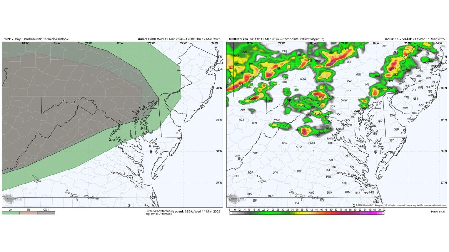
While the overall tornado probabilities remain relatively low across central Maryland, the broader severe setup suggests that if storms can organize upstream, the environment near Baltimore would be supportive of stronger impacts.
Tornado Outlook: Focus West of the I-95 Corridor
The Day 1 tornado outlook highlights:
- Western Maryland
- Eastern West Virginia
- Portions of central and western Virginia
The higher tornado probabilities are centered west of Baltimore, indicating that any meaningful severe threat for the metro would depend on storms forming in these western zones first.
Baltimore, Annapolis, and much of central Maryland remain on the eastern edge of the risk area — meaning storm survival and organization during eastward movement will be key.
The “Trigger” Question Around Baltimore
One major uncertainty remains: whether sufficient lift or forcing will develop near Baltimore itself to initiate storms locally.
Current high-resolution guidance suggests:
- Scattered storm development west of the Blue Ridge
- Stronger activity over western Maryland and eastern West Virginia
- Storm clusters capable of moving east into the Baltimore–Washington region during the late afternoon or evening
If storms fail to develop robustly to the west, the metro may see limited impacts. But if organized cells mature upstream, they could maintain intensity as they move toward I-95.
Damaging Winds the Primary Threat — Tornado Risk Secondary
Should storms hold together, the main concern around Baltimore and surrounding communities would be:
- Damaging straight-line winds
- Brief, embedded tornado potential
- Intense lightning and heavy downpours
Wind shear profiles across Maryland and northern Virginia appear sufficient to support rotation if storms become discrete or semi-organized before forming a larger line.
Timing: Late Afternoon Into Evening
The window of greatest concern appears to be:
- Mid to late afternoon in western Maryland
- Early to mid-evening for the Baltimore metro
Residents should monitor radar trends west of the city during the afternoon hours, as storm intensity there will likely determine downstream impacts.
Areas to Watch Closely
Communities to monitor include:
- Hagerstown
- Frederick
- Westminster
- Baltimore
- Columbia
- Washington, D.C.
If strong cells are observed west of these areas by mid-afternoon, the risk for damaging winds and isolated tornado potential will increase.
Bottom Line
Maryland and northern Virginia face a conditional severe weather threat today. Storms must first develop west of the Baltimore metro and then hold together as they track east. If that occurs, the environment near Baltimore could support damaging winds and even a brief tornado this evening.
Residents should stay weather aware and monitor conditions to the west throughout the afternoon.
CabarrusWeekly.com will continue tracking storm development and provide updates if the threat escalates.