Washington D.C., Baltimore and Surrounding Areas See Scattered Showers This Afternoon With Steadier Rain and Thunder Possible Into the Evening
WASHINGTON D.C. — Scattered showers are developing across the Washington D.C., Baltimore, and surrounding region as of 2:20 PM, with a few briefly heavy downpours popping up across the area. Times of steadier rain and thunder are possible as the afternoon progresses into the evening hours, with isolated severe activity remaining something to watch.
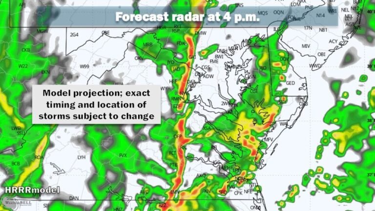
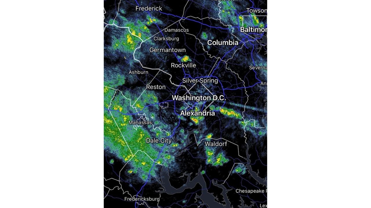
What Radar Shows at 2:20 PM
Radar at 2:20 PM shows scattered shower activity already developing and moving through the region. The heaviest cells are visible near Alexandria, Columbia, Towson, Baltimore, and Frederick, with additional activity pushing through Germantown, Rockville, Silver Spring, Ashburn, Reston, Manassas, and Dale City.
The Washington D.C. metro corridor from Manassas and Reston in the west through Alexandria, Silver Spring, and into Columbia and Baltimore is seeing the most active shower coverage at this time.
The Timing and Threat for the Rest of the Day
The afternoon and evening breakdown:
- Now through late afternoon: Scattered showers, a few briefly heavy, continuing to develop across the region
- Late afternoon into evening: Times of steadier rain and thunder possible
- Isolated severe activity cannot be ruled out and will be monitored
The primary hazards with any stronger storms that develop will include heavy downpours, lightning, and gusty winds. The situation will continue to be monitored for any isolated severe development through the evening hours.
Cities to Watch Through Tonight
Residents across the following areas should remain weather aware through this evening: Washington D.C., Baltimore, Columbia, Towson, Alexandria, Silver Spring, Rockville, Germantown, Frederick, Ashburn, Reston, Manassas, Dale City, Waldorf, Fredericksburg, and Chesapeake.
Stay with CabarrusWeekly.com for continuing updates as this afternoon and evening storm threat develops across the D.C. and Baltimore metro region.