Arkansas, Oklahoma, Missouri and Mississippi Valley Face Rising Severe Storm Risk Into Early April While North Carolina Watches Pattern Shift
UNITED STATES — A developing weather pattern across the country is signaling a potential increase in severe storm activity heading into late March and the first week of April, with the greatest concern centered over eastern Oklahoma, Arkansas, southern Missouri, and parts of the Mississippi Valley.
While conditions across North Carolina and much of the Southeast remain relatively quiet for now, the broader national setup is beginning to shift in a way that could support more active and potentially dangerous weather in the weeks ahead.
Central U.S. Emerging as Focus Area for Severe Weather
Current projections highlight a growing zone of concern stretching across:
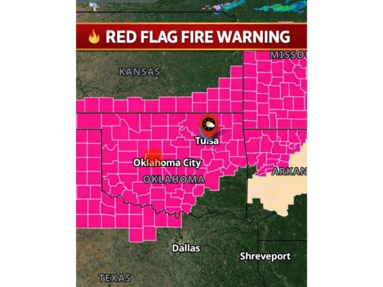
- Eastern Oklahoma
- Arkansas
- Missouri Ozarks
- Western Tennessee and Mississippi Valley regions
These areas are expected to sit in a favorable position for storm development as atmospheric conditions evolve toward early April.
The pattern suggests that multiple rounds of storm systems could track through this corridor, increasing the likelihood of severe weather episodes over time rather than a single isolated event.
Pattern Setup Signals Increasing Instability
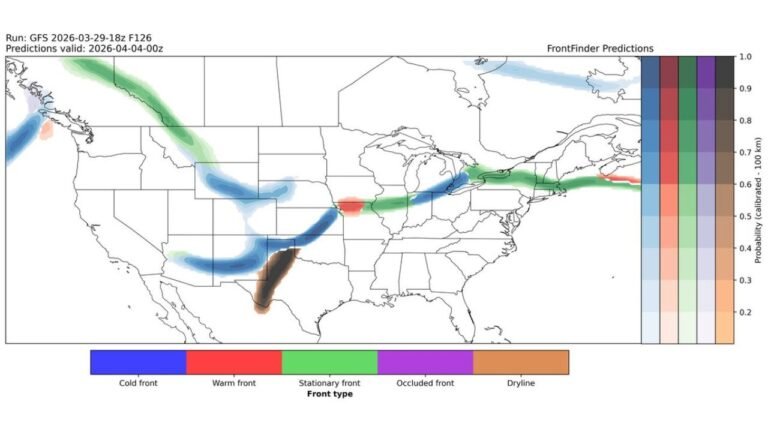
The anticipated increase in storm activity is tied to a larger-scale shift in the jet stream pattern across North America.
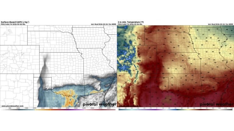
A trough developing in the western United States is expected to allow cooler air to move into the Rockies. At the same time, warmer and more humid air will build northward from the Gulf of Mexico into the central and southern U.S.
This contrast between air masses creates a classic setup for storm development, particularly across the Mid-South and central Plains.
As disturbances move eastward from the Rockies, they may interact with this warm, unstable air, leading to organized thunderstorms capable of producing severe weather.
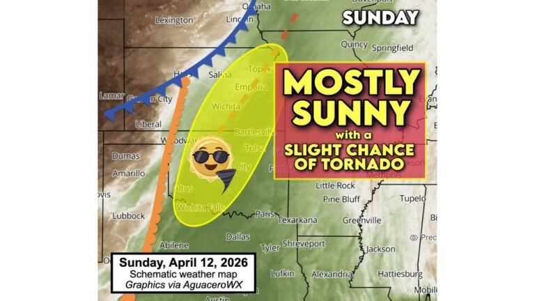
Late March Into Early April Marks Transition to Peak Season
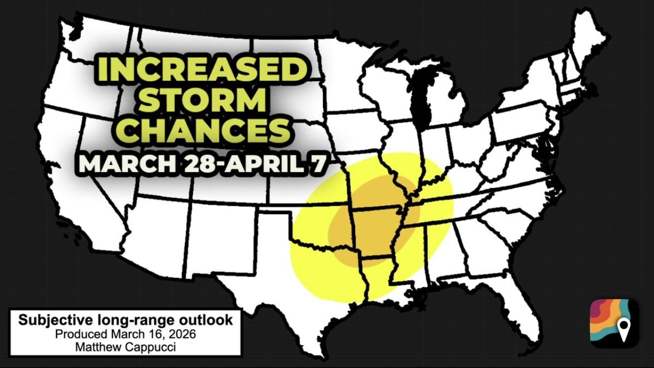
The timeframe from March 28 through April 7 is being closely watched as a window where storm chances could increase more noticeably.
This period also aligns with the beginning of peak severe weather season across the central United States, when ingredients such as moisture, instability, and wind shear become more consistently available.
In addition to severe storms, the overall pattern is expected to support a wetter-than-average stretch, with repeated rainfall events possible across the same regions.
What This Means for North Carolina and Surrounding Areas
For now, North Carolina, South Carolina, and much of the East Coast remain outside the primary risk zone, with no immediate widespread severe threat indicated in this outlook period.
However, changes in the national pattern mean the Southeast will need to monitor how storm systems evolve and track eastward as April approaches.
Even if the highest risk remains to the west, spillover impacts such as rain, isolated storms, or shifting temperature patterns could still affect parts of the Carolinas.
Early Signals, But Growing Confidence in Active Pattern
While exact storm timing and intensity remain uncertain this far in advance, the broader setup points toward an above-average likelihood of severe weather across key central U.S. states.
Forecast guidance continues to emphasize that this is an early outlook based on large-scale trends, but confidence is increasing that the pattern will support more frequent storm development as the calendar turns into April.
Residents across the central U.S. are encouraged to stay aware of updates as the situation becomes clearer in the coming days.
Stay with CabarrusWeekly.com for continued coverage of severe weather trends and what they could mean for North Carolina and beyond.