Illinois Indiana Ohio Under Severe Storm Threat Thursday Afternoon With Hail Wind And Possible Tornado Risk
ILLINOIS — A developing severe weather setup is expected to bring strong storms across parts of the Midwest on Thursday, March 26, with a focused risk corridor stretching from Illinois through Indiana into Ohio.
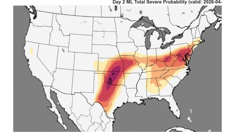
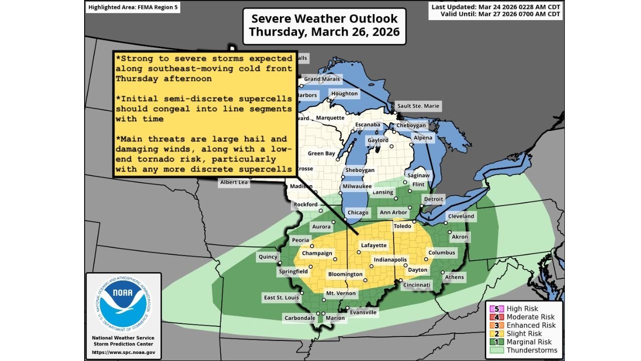
Forecast data shows a Slight Risk (Level 2 of 5) has been outlined across this region, signaling an increasing likelihood of organized storms capable of producing hazardous conditions.
Storms Expected To Develop Along Advancing Cold Front
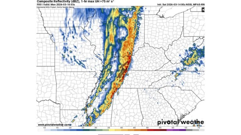
The setup centers around a southeast-moving cold front, which is expected to act as the trigger for storm development Thursday afternoon into the evening.
As this front pushes across the Midwest, conditions will become favorable for storm initiation and rapid strengthening, especially during peak daytime heating hours.
Early storm development may begin as semi-discrete supercells, which are capable of producing more intense, localized impacts before evolving into a more organized line of storms later in the day.
Main Threats Include Large Hail And Damaging Winds
The primary concerns with this system are:
- Large hail, potentially strong enough to cause damage to vehicles and property
- Damaging wind gusts, which could lead to downed trees and power outages
The risk zone includes key population centers such as:
- Chicago, Illinois
- Indianapolis, Indiana
- Columbus and Cincinnati, Ohio
As storms grow upscale into line segments, the wind threat may become more widespread, especially into the evening hours.
Low-End Tornado Risk Cannot Be Ruled Out
While not the dominant threat, a low-end tornado risk is also present, particularly if storms remain more discrete during the early stages.
Any isolated supercell that avoids merging into a line could briefly produce a tornado, though this risk is considered secondary compared to hail and wind.
Storm Evolution Will Be Key To Impact Severity
One of the biggest factors in how severe this event becomes will be storm mode evolution:
- Discrete storms early → higher chance of isolated severe impacts (hail, tornado)
- Line of storms later → broader damaging wind threat
This transition is expected as storms interact and organize along the advancing front.
Timing And Preparedness Outlook
- Thursday Afternoon: Storms begin developing across Illinois
- Late Afternoon to Evening: Stronger storms move into Indiana and Ohio
- Evening/Night: Storms may form a more organized line, expanding wind risk
Residents across Illinois, Indiana, and Ohio should stay alert for rapidly changing conditions, especially during the late afternoon and evening hours.
Final Word
This is a classic early spring severe weather setup, with all the key ingredients coming together across the Midwest.
While the overall risk level is not extreme, the combination of large hail, damaging winds, and a possible isolated tornado means this system should be taken seriously.
Stay with CabarrusWeekly.com for continued updates as this Thursday severe weather threat develops across Illinois, Indiana, and Ohio.