Today, 10 States From Arizona to Canada Have Zero Upper Air Data as Texas Faces Elevated Severe Weather Risk
UNITED STATES — A significant upper air data gap is raising serious concerns this Sunday, May 10, 2026, as 10 states stretching from Arizona and New Mexico north to Canada reported zero upper air observations at the 12Z analysis time — precisely when an elevated severe weather risk is unfolding across much of Texas.
What the Data Gap Means
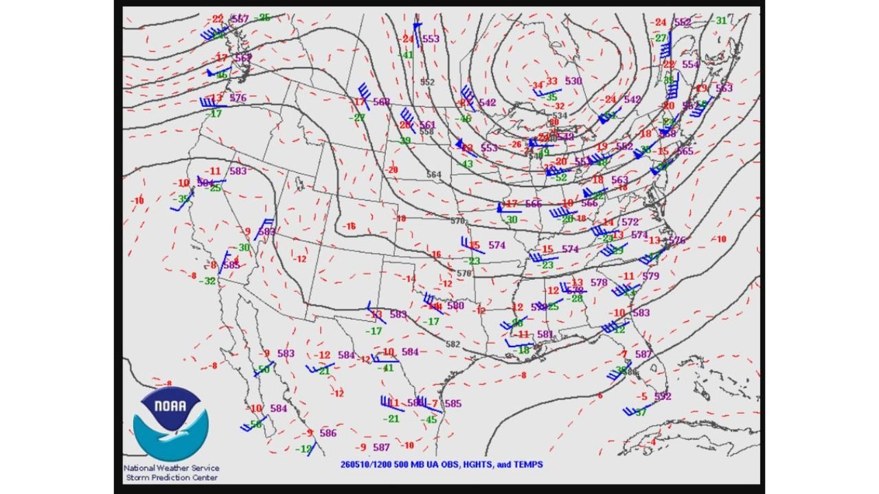
Upper air data is critical for forecasters to accurately assess atmospheric conditions, storm potential, and severe weather timing. The 500 MB upper air observation map issued by the NOAA Storm Prediction Center shows a vast blank zone across the western and central United States, covering a corridor of 10 states with no data whatsoever.
This gap is occurring at one of the worst possible times — with active severe weather ongoing across Texas and forecasters needing every available data point to issue accurate watches and warnings.
A Striking Comparison
At the same 12Z observation time on May 10, the Mexican Servicio Meteorologico Nacional was producing a far more robust upper air dataset than the United States across its own territory — a direct and concerning contrast highlighted alongside the NOAA chart.
Why This Matters for Texas Today
With an elevated severe weather risk across much of Texas today, gaps in upper air data directly impact:
- Accuracy of storm forecast timing
- Watch and warning lead times
- Assessment of tornado and wind potential
Forecasters working today’s Texas severe weather event are doing so with a critically incomplete picture of the upper atmosphere.
Stay with CabarrusWeekly.com for continued coverage of today’s Texas severe weather and the latest forecast updates.