Missouri Illinois Indiana Severe Storm Setup Thursday Shows Hail As Main Threat With Limited Tornado Risk
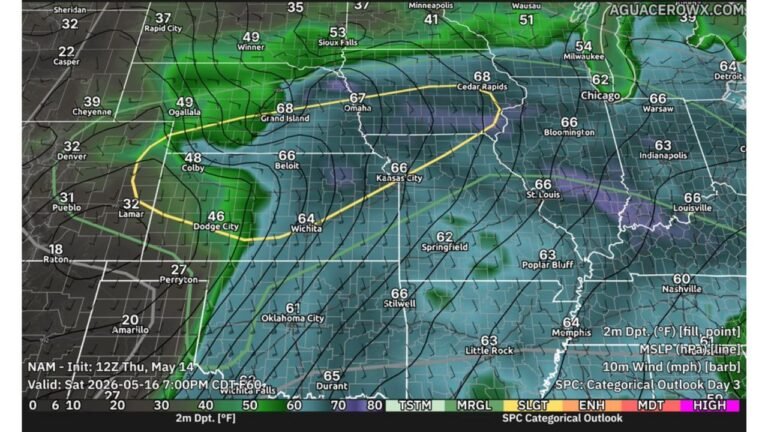
MISSOURI — A developing storm system is expected to bring a round of severe weather potential on Thursday, but current data suggests this setup may be more focused on hail rather than tornadoes.
Forecast guidance indicates a moderate but not extreme severe weather environment, with ingredients in place for organized storms, especially across parts of Missouri, Illinois, and Indiana.
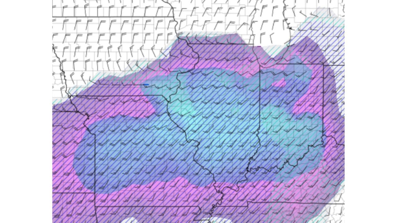
Storm Environment Supports Supercells But With Limits
The atmospheric setup includes several important features:
- A low-level jet (LLJ) enhancing moisture transport
- An elevated mixed layer (EML) supporting instability
- Strong bulk wind shear, favorable for storm organization
These ingredients could allow for supercell thunderstorm development, particularly if storms remain surface-based rather than elevated.
However, the overall setup is being described as somewhat “mid-level”, meaning it has supportive dynamics but lacks the extreme parameters typically associated with major tornado outbreaks.
Hail Emerges As The Primary Concern
Based on current projections, large hail is expected to be the dominant hazard with this system.
Areas most at risk include:
- Eastern Missouri
- Central and southern Illinois
- Western and central Indiana
Storms forming in this corridor could produce:
- Large to potentially very large hailstones
- Brief but intense severe cores
- Localized damage to vehicles, roofs, and crops
Tornado Threat Appears Limited
While wind shear is present, the tornado risk appears relatively low compared to other severe setups.
Key limiting factors include:
- Storms potentially becoming elevated
- Lack of stronger low-level instability in some areas
- Less favorable near-surface conditions
That said, an isolated tornado cannot be completely ruled out, especially if a storm becomes more rooted at the surface.
Storm Development Will Be Key Factor
One of the biggest uncertainties in this setup is whether storms can initiate and sustain themselves effectively.
If storms:
- Develop early and remain isolated → higher severe potential
- Stay elevated or struggle to organize → lower overall impact
This makes the event highly conditional, meaning small changes in timing or structure could significantly affect outcomes.
Regional Overview Of Risk Zone
The core severe corridor stretches across:
- Missouri
- Illinois
- Indiana
Surrounding regions may see storms, but the highest hail-focused threat appears concentrated within this central zone.
Final Word
Thursday’s setup across Missouri, Illinois, and Indiana is shaping up to be a hail-driven severe weather event, with conditions supportive of organized storms but limited tornado potential at this time.
Residents should remain alert, especially during the afternoon and evening hours, as any storm that strengthens could quickly produce damaging hail.
Stay with CabarrusWeekly.com for continued updates as this developing Thursday storm system becomes clearer.