Colorado Foothills and Front Range Face Sneaky Snow Accumulation Tonight With 1 to 4 Inches Above 7000 Feet and Possible 6 Inches Above 8000 Feet Along I-25 Corridor Through Wednesday Morning
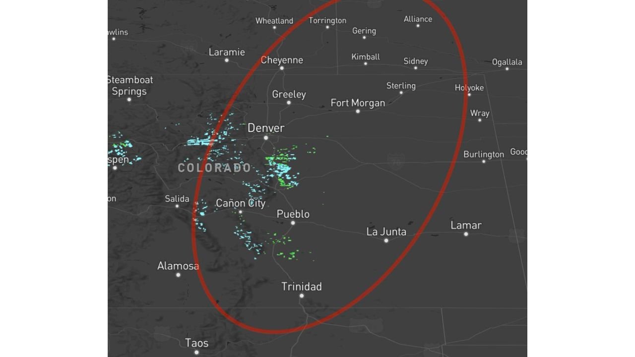
COLORADO — Rain and snow showers are redeveloping across Colorado this afternoon and evening as a shortwave trough pushes in from the west, targeting the foothills, Front Range, I-25 corridor, and eastern plains through tonight and into Wednesday morning. While not a blockbuster snow event for all elevations, forecasters are flagging the potential for sneaky and meaningful snowfall accumulations above 6,000 and 7,000 feet that should not catch residents off guard.
Where the Rain and Snow Will Focus Tonight
The primary coverage zone for tonight’s precipitation stretches along and east of the Continental Divide, covering the foothills, Front Range, I-25 corridor, and eastern plains of Colorado. This includes the Denver metro area and communities stretching from Cheyenne in the north through Pueblo and Trinidad in the south. Rain and snow activity will persist through tonight and into Wednesday morning.
The Snow Accumulation Breakdown by Elevation
The sneaky part of this forecast is what happens at higher elevations tonight. Snowfall accumulations are expected to increase significantly with altitude:
| Elevation | Expected Snow Accumulation |
|---|---|
| Above 6,000 feet | Trace to 2 inches |
| Above 7,000 feet | 1 to 4 inches |
| Above 8,000 feet | Localized 6 inches or more possible |
The sweet spot for accumulating snow is forecast at 7,000 feet and above, with the highest totals favoring 8,000 feet and above in the mountains.
The Specific Areas Watching Most Closely Tonight
The locations with the greatest snow accumulation potential this evening into Wednesday morning include:
- Foothills west of I-25
- Rampart Range
- Park and Teller County
- Northern El Paso County
- Portions of the Palmer Divide
- Sangre de Cristo Mountains
- Wet Mountains
What Comes After Tonight
Wednesday brings scattered showers and thunderstorms across the region as conditions evolve. Then on Thursday, a more potent and energetic storm system in the form of a closed low pressure system slides down the spine of the Rockies. Closed low systems carry more atmospheric energy, meaning Thursday’s scattered showers and thunderstorms could be strong.
Memorial Day Weekend Is Not Looking Dry
The active weather pattern shows no signs of shutting down heading into the Memorial Day holiday weekend. Residents making outdoor plans for the long weekend should build flexibility into their schedules, as rain chances remain in the forecast with no guarantees of dry conditions. After a prolonged dry stretch, this is welcome news for Colorado’s drought-stricken areas.
Stay with CabarrusWeekly.com for ongoing updates on Colorado’s active weather pattern through the holiday weekend.